Login
Register


PGV
Pitt-Greenville Airport
Official FAA Data Effective 2026-02-19 0901Z
Chart Supplement

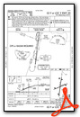
KPGV Airport Diagram

VFR Chart of KPGV
Sectional Charts at SkyVector.com
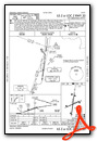
IFR Chart of KPGV
Enroute Charts at SkyVector.com
Location Information for KPGV
Coordinates: N35°38.14' / W77°23.04'Located 02 miles N of Greenville, North Carolina on 872 acres of land. View all Airports in North Carolina.
Surveyed Elevation is 26 feet MSL.
Operations Data
|
|
Airport Communications
| AWOS-3: | 128.425 Tel. 252-758-6485 |
|---|---|
| CTAF: | 122.800 |
| UNICOM: | 122.800 |
| AWOS-3 at OCW (16.8 E): | 120.175 252-975-6133 |
| AWOS-3P at MCZ (17.1 NE): | 118.65 252-802-4261 |
| AWOS-3P at ETC (19.6 N): | 119.575 252-641-1640 |
- CLEARANCE DELIVERY PRVDD BY RALEIGH RADIO ON FREQ 122.2 (PITT-GREENVILLE RCO).
- APCH/DEP SVC PRVDD BY WASHINGTON ARTCC (ZDC) ON 123.85/279.65 (NEW BERN RCAG).
Nearby Navigation Aids
|
| ||||||||||||||||||||||||||||||||||||||||||||||||||||||||||||


Runway 02/20
| Dimensions: | 7175 x 150 feet / 2187 x 46 meters | |
|---|---|---|
| Surface: | Asphalt / Grooved in Good Condition | |
| Weight Limits: | S-85, D-140
PCR VALUE: 326/F/B/X/T
| |
| Edge Lighting: | High Intensity | |
| Runway 02 | Runway 20 | |
| Coordinates: | N35°37.55' / W77°23.15' | N35°38.72' / W77°22.96' |
| Elevation: | 20.7 | 26.3 |
| Traffic Pattern: | Left | Left |
| Runway Heading: | 8° True | 188° True |
| Displaced Threshold: | 271 Feet | |
| Declared Distances: | TORA:7175 TODA:7175 ASDA:7175 LDA:6905 | TORA:7175 TODA:7175 ASDA:6505 LDA:6505 |
| Markings: | Precision Instrument in good condition. | Precision Instrument in good condition. |
| Glide Slope Indicator | P4L (3.10° Glide Path Angle) | P4L (3.00° Glide Path Angle) |
| Approach Lights: | MALSR 1,400 Foot Medium-intensity Approach Lighting System with runway alignment indicator lights. | |
| REIL: | Yes | |
| Obstacles: | 13 ft Trees 1000 ft from runway, 200 ft right of center | 65 ft Trees 2800 ft from runway, 800 ft left of center |
Runway 08/26
RWY 08/26 NOT AVBL FOR PART 121/PART 380 OPS WITH SKED PAX CARRYING OPS MORE THAN 9 PAX SEATS AND NON-SKED PAX CARRYING OPS MORE THAN 30 PAX SEATS. | ||
| Dimensions: | 4997 x 150 feet / 1523 x 46 meters | |
|---|---|---|
| Surface: | Asphalt in Poor Condition RUNWAY 8-26 NOT AVAILABLE FOR AIR CARRIER USE; UNEVEN SURFACE. | |
| Weight Limits: | S-45, D-73
PCR VALUE: 153/F/B/X/T
| |
| Edge Lighting: | Medium Intensity | |
| Runway 08 | Runway 26 | |
| Coordinates: | N35°37.98' / W77°23.50' | N35°38.31' / W77°22.57' |
| Elevation: | 24.0 | 23.3 |
| Traffic Pattern: | Left | Left |
| Runway Heading: | 67° True | 247° True |
| Declared Distances: | TORA:4997 TODA:4997 ASDA:4997 LDA:4997 | TORA:4997 TODA:4997 ASDA:4997 LDA:4997 |
| Markings: | Non-Precision Instrument in poor condition. | Non-Precision Instrument in poor condition. |
| Glide Slope Indicator | P4L (4.00° Glide Path Angle) | P4L (3.00° Glide Path Angle) |
| REIL: | Yes | Yes |
| Obstacles: | 110 ft Trees 1526 ft from runway, 200 ft right of center | 37 ft Pole 1441 ft from runway, 77 ft right of center |
Services Available
| Fuel: | 100LL (blue), Jet-A |
|---|---|
| Transient Storage: | Hangars,Tiedowns |
| Airframe Repair: | MAJOR |
| Engine Repair: | MAJOR |
| Bottled Oxygen: | NONE |
| Bulk Oxygen: | NONE |
| Other Services: | AIR FREIGHT SERVICES,AIR AMBULANCE SERVICES,CARGO HANDLING SERVICES,CHARTER SERVICE,PILOT INSTRUCTION,AIRCRAFT RENTAL |
Ownership Information
| Ownership: | Publicly owned | |
|---|---|---|
| Owner: | PITT CO & GREENVILLE CITY | |
| 400 AIRPORT RD | ||
| GREENVILLE, NC 27834 | ||
| 252-902-2026 | ||
| Manager: | KIM W BILL HOPPER | |
| 400 AIRPORT RD | ||
| GREENVILLE, NC 27834 | ||
| 252-902-2026 | ||
Other Remarks
- 24 HR HELICOPTER OPNS AT HOSPITAL 1.5 NM SSW OF ARPT; MONITORING CTAF.
- JET ACFT DEPARTING FROM RWY 20 SHALL HOLD ON AIR CARRIER OR GA APRON UNTIL TAKE OFF CLEARANCE IS RECEIVED.
- FOR CD IF UNA TO CTC ON FSS FREQ, CTC WASHINGTON ARTCC AT 703-771-3587.
- RUNWAY 8-26 MARKINGS LACK VISIBILITY
- RUNWAY 8-26 MARKINGS LACK VISIBILITY
- ACTVT MALSR RWY 20; PAPI RWYS 02, 20, 08 & 26; HIRL RWY 02/20; MIRL RWY 08/26 - CTAF.
Weather Minimums

Instrument Approach Procedure (IAP) Charts


Nearby Airports with Instrument Procedures
| ID | Name | Heading / Distance | ||
|---|---|---|---|---|
 |
KOCW | Washington-Warren Airport | 103° | 16.8 |
|
KMCZ | Martin County Airport | 036° | 16.9 |
|
KETC | Tarboro-Edgecombe Airport | 336° | 19.7 |
|
KISO | Kinston Regional Jetport At Stallings Field Airport | 211° | 21.3 |
|
KRWI | Rocky Mount/Wilson Regional Airport | 298° | 28.1 |
|
W03 | Wilson Industrial Air Center Airport | 285° | 29.7 |
|
KGWW | Wayne Exec Jetport Airport | 249° | 30.3 |
|
KPMZ | Plymouth Municipal Airport | 070° | 32.3 |
|
KGSB | Seymour Johnson AFB Airport | 238° | 33.4 |
|
KEWN | Coastal Carolina Regional Airport | 153° | 37.6 |
|
W40 | Mount Olive Municipal Airport | 232° | 40.6 |
|
KASJ | Tri-County At Henry Joyner Field Airport | 014° | 41.0 |
Airport Images

By: N1888E-young


