Login
Register


RGA
Central Kentucky Regional Airport
Official FAA Data Effective 2026-02-19 0901Z
Chart Supplement

VFR Chart of KRGA
Sectional Charts at SkyVector.com
IFR Chart of KRGA
Enroute Charts at SkyVector.com
Location Information for KRGA
Coordinates: N37°37.89' / W84°19.95'Located 08 miles SW of Richmond, Kentucky on 197 acres of land. View all Airports in Kentucky.
Surveyed Elevation is 1002 feet MSL.
Operations Data
|
|
Airport Communications
| AWOS-3: | 119.625 Tel. 859-985-5969 |
|---|---|
| LEXINGTON APPROACH: | 120.15 259.3 |
| LEXINGTON DEPARTURE: | 120.15 259.3 |
| CTAF: | 122.725 |
| UNICOM: | 122.725 |
| AWOS-3 at DVK (21.0 W): | 128.325 859-854-0058 |
| ASOS at LEX (27.6 NW): | 859-203-5240 |
| ATIS at LEX (27.6 NW): | 126.3 |
Nearby Navigation Aids
|
| ||||||||||||||||||||||||||||||||||||||||||||||||||||||||||||


Runway 18/36
| Dimensions: | 5001 x 100 feet / 1524 x 30 meters | |
|---|---|---|
| Surface: | Asphalt in Fair Condition | |
| Weight Limits: | S-12 | |
| Edge Lighting: | Medium Intensity | |
| Runway 18 | Runway 36 | |
| Coordinates: | N37°38.30' / W84°19.99' | N37°37.48' / W84°19.90' |
| Elevation: | 964.8 | 1002.3 |
| Runway Heading: | 175° True | 355° True |
| Markings: | Non-Precision Instrument in fair condition. | Non-Precision Instrument in fair condition. |
| Glide Slope Indicator | P4L (3.00° Glide Path Angle) | P4L (3.00° Glide Path Angle) |
| REIL: | Yes | Yes |
| Obstacles: | 36 ft Tree 937 ft from runway, 322 ft right of center | |
Services Available
| Fuel: | 100LL (blue), Jet A+ |
|---|---|
| Transient Storage: | Hangars,Tiedowns |
| Airframe Repair: | MAJOR |
| Engine Repair: | MAJOR |
| Bottled Oxygen: | NONE |
| Bulk Oxygen: | NONE |
| Other Services: | PILOT INSTRUCTION,AIRCRAFT RENTAL |
Ownership Information
| Ownership: | Publicly owned | |
|---|---|---|
| Owner: | MADISON AIRPORT BOARD INC | GEORGE WYATT |
| 124 MADISON AIRPORT ROAD | ||
| RICHMOND, KY 40476 | ||
| 859-661-1338 | ||
| Manager: | JASON BONHAM | 859-699-6031 |
| 124 MADISON AIRPORT ROAD | ||
| RICHMOND, KY 40475 | ||
| 859-986-3913 | ||
Other Remarks
- DEER AND BIRDS ON AND INVOF ARPT.
- FOR CD CTC LEXINGTON APPROACH AT 859-514-7890.
- STUDENT TRNG WI 15 NM; SFC TO 7500 FT.
- 0LL FUEL AVBL H24 WITH CREDIT CARD.
- ACTVT REIL RWY 18 & 36; PAPI RWY 18 & 36; MIRL RWY 18/36 - CTAF.
Weather Minimums

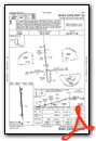
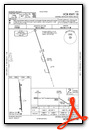
Instrument Approach Procedure (IAP) Charts

Nearby Airports with Instrument Procedures
| ID | Name | Heading / Distance | ||
|---|---|---|---|---|
 |
KDVK | Stuart Powell Field Airport | 261° | 21.1 |
|
KLEX | Blue Grass Airport | 331° | 27.6 |
|
KIOB | Mount Sterling/Montgomery County Airport | 033° | 30.6 |
|
KLOZ | London/Corbin/Magee Airport | 159° | 34.8 |
|
27K | Georgetown-Scott County Regional Airport | 352° | 36.5 |
|
KSME | Lake Cumberland Regional Airport | 201° | 37.2 |
|
KFFT | Capital City Airport | 320° | 42.8 |
|
6I2 | Lebanon Springfield/George Hoerter Field Airport | 270° | 43.3 |
|
0I8 | Cynthiana-Harrison County Airport | 003° | 44.1 |
|
KJKL | Julian Carroll Airport | 092° | 48.5 |
|
KAAS | Taylor County Airport | 250° | 49.4 |
|
KSYM | Morehead-Rowan County Clyde A Thomas Regional Airport | 045° | 49.7 |
Airport Images

By: 2flaps


