Login
Register
S36
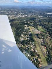
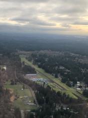
Norman Grier Field Airport
Official FAA Data Effective 2026-01-22 0901Z
VFR Chart of S36
Sectional Charts at SkyVector.com
IFR Chart of S36
Enroute Charts at SkyVector.com
Location Information for S36
Coordinates: N47°20.23' / W122°6.21'Located 01 miles SSE of Covington, Washington on 66 acres of land. View all Airports in Washington.
Estimated Elevation is 472 feet MSL.
Operations Data
|
|
Airport Communications
| CTAF: | 123.000 |
|---|---|
| UNICOM: | 123.000 |
| ASOS at RNT (10.4 NW): | 126.95 425-255-6080 |
| ATIS at RNT (10.4 NW): | 126.95 |
| ASOS at SEA (10.8 NW): | 206-214-2592 |
Nearby Navigation Aids
|
| ||||||||||||||||||||||||||||||||||||||||||
Runway 15/33
| Dimensions: | 3288 x 40 feet / 1002 x 12 meters | |
|---|---|---|
| Surface: | Asphalt in Good Condition | |
| Weight Limits: | S-12 | |
| Edge Lighting: | Low Intensity | |
| Runway 15 | Runway 33 | |
| Coordinates: | N47°20.49' / W122°6.27' | N47°19.96' / W122°6.15' |
| Elevation: | 472.0 | 472.0 |
| Traffic Pattern: | Left | Left |
| Displaced Threshold: | 281 Feet | |
| Markings: | Non-Standard in poor condition. | Non-Standard in poor condition. |
| Obstacles: | 76 ft Trees 901 ft from runway TREES IN PRIM SFC, PARKED ACFT IN PRIM SFC BOTH SIDES OF RWY AND 3 FT SIGN, 92 FT LEFT, 27 FT FROM THR. |
107 ft Trees 1560 ft from runway RWY 33 APPROACH RATIO 6:1 FROM DSPLCD THR. +95 FT TREES IN PRI SFC 0-200 FT FM THR, 120 FT RIGHT. |
Services Available
| Fuel: | 100LL (blue) |
|---|---|
| Transient Storage: | Tiedowns PILOTS BRING OWN TIEDOWNS. |
| Airframe Repair: | MAJOR |
| Engine Repair: | MAJOR |
| Bottled Oxygen: | NONE |
| Bulk Oxygen: | NONE |
| Other Services: | PILOT INSTRUCTION,AIRCRAFT RENTAL |
Ownership Information
| Ownership: | Privately Owned | |
|---|---|---|
| Owner: | NEW CREST AIRPARK, LLC | |
| 29300 179 PLACE SE | ||
| COVINGTON, WA 98042 | ||
| 425-533-9651 | ||
| Manager: | JEFF MILLER | |
| 29300 179TH PLACE SE, P.O. BOX 7282 | ||
| COVINGTON, WA 98042-7282 | ||
| 425-533-9651 | ||
Other Remarks
- TREES BOTH SIDES OF RWY IN TRSN SFC.
- TREES ON BOTH SIDES OF RWY 15/33.
- NIGHT OPS USE RWY 15, WIND AND WX PMTG.
- ARPT CLSD WHEN SNOW ON RWY.
- FOR CD CTC SEATTLE APCH AT 206-214-4723.
- TGLS PROHIBITED.
- MARKINGS FADED.
- 15/33 NSTD MARKINGS NRS & CNTRLN ONLY; FADED.
- MARKINGS FADED.
- 0LL 24 HR CREDIT CARD FUEL AVBL.
Nearby Airports with Instrument Procedures
| ID | Name | Heading / Distance | ||
|---|---|---|---|---|
 |
S50 | Auburn Municipal Airport | 263° | 5.1 |
 |
KRNT | Renton Municipal Airport | 334° | 10.4 |
 |
KSEA | Seattle-Tacoma International Airport | 308° | 10.9 |
 |
KBFI | Boeing Field/King County International Airport | 325° | 14.1 |
 |
KPLU | Pierce County/Thun Field Airport | 208° | 15.9 |
 |
KTCM | Mcchord Field (Joint Base Lewis-Mcchord) Airport | 232° | 19.4 |
 |
KTIW | Tacoma Narrows Airport | 258° | 19.8 |
 |
KGRF | Gray AAF (Joint Base Lewis-Mcchord) Airport | 231° | 24.9 |
 |
KPWT | Bremerton Ntl Airport | 289° | 28.5 |
 |
S43 | Harvey Field Airport | 000° | 34.1 |
 |
KPAE | Seattle Paine Field International Airport | 348° | 35.0 |
 |
KOLM | Olympia Regional Airport | 236° | 39.5 |


