Login
Register


SMS
Sumter Airport
Official FAA Data Effective 2025-12-25 0901Z
Chart Supplement

VFR Chart of KSMS
Sectional Charts at SkyVector.com
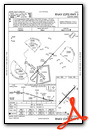
IFR Chart of KSMS
Enroute Charts at SkyVector.com
Location Information for KSMS
Coordinates: N33°59.70' / W80°21.68'Located 04 miles N of Sumter, South Carolina on 429 acres of land. View all Airports in South Carolina.
Surveyed Elevation is 182 feet MSL.
Operations Data
|
|
Airport Communications
| AWOS-3: | 118.075 Tel. 803-469-6750 |
|---|---|
| SHAW APPROACH: | 125.4 |
| SHAW DEPARTURE: | 125.4 |
| IC: | 125.4 |
| UNICOM: | 122.700 |
| CTAF: | 122.700 |
| ATIS at SSC (5.6 W): | 132.125 |
| AWOS-3PT at CDN (19.9 NW): | 119.975 803-424-1979 |
| ATIS at MMT (22.4 W): | 327.05 |
- APCH/DEP SVC PRVDD BY JACKSONVILLE ARTCC ON FREQS 124.7/269.55 (COLUMBIA RCAG) WHEN SHAW APCH CTL CLSD.
Nearby Navigation Aids
|
| ||||||||||||||||||||||||||||||||||||||||||||||||||||||||||||


Runway 05/23
| Dimensions: | 5501 x 100 feet / 1677 x 30 meters | |
|---|---|---|
| Surface: | Asphalt in Good Condition | |
| Weight Limits: | 12 /F/D/Y/T, S-31, D-42 | |
| Edge Lighting: | Medium Intensity | |
| Runway 05 | Runway 23 | |
| Coordinates: | N33°59.41' / W80°22.06' | N34°0.07' / W80°21.32' |
| Elevation: | 178.7 | 181.8 |
| Traffic Pattern: | Right | Left |
| Runway Heading: | 43° True | 223° True |
| Markings: | Non-Precision Instrument in good condition. | Precision Instrument in good condition. |
| Glide Slope Indicator | P4L (3.00° Glide Path Angle) | P4L (3.00° Glide Path Angle) |
| Approach Lights: | ODALS Omnidirectional Approach Lighting System | |
| REIL: | Yes | Yes |
| Obstacles: | 79 ft Trees 2373 ft from runway, 565 ft left of center | 88 ft Trees 2748 ft from runway, 659 ft left of center |
Runway 14/32
| Dimensions: | 3081 x 120 feet / 939 x 37 meters | |
|---|---|---|
| Surface: | Turf in Good Condition | |
| Runway 14 | Runway 32 | |
| Coordinates: | N33°59.81' / W80°21.88' | N33°59.45' / W80°21.44' |
| Elevation: | 176.9 | 179.3 |
| Traffic Pattern: | Left | Right |
| Runway Heading: | 134° True | 314° True |
| Markings: | None | None |
| Obstacles: | 84 ft Trees 941 ft from runway, 152 ft left of center | 95 ft Tree 1369 ft from runway, 113 ft right of center |
Services Available
| Fuel: | 100LL (blue), Jet-A |
|---|---|
| Transient Storage: | Hangars,Tiedowns |
| Airframe Repair: | MAJOR |
| Engine Repair: | MAJOR |
| Bottled Oxygen: | NONE |
| Bulk Oxygen: | NONE |
| Other Services: | AVIONICS,PILOT INSTRUCTION,AIRCRAFT RENTAL |
Ownership Information
| Ownership: | Publicly owned | |
|---|---|---|
| Owner: | COUNTY OF SUMTER | |
| 13 EAST CANAL STREET | ||
| SUMTER, SC 29150 | ||
| (803) 469-4639 | ||
| Manager: | JEFF KNAUER | |
| 2945 AIRPORT ROAD | ||
| SUMTER, SC 29153 | ||
| 803-469-4639 | ||
Other Remarks
- WILDLIFE ON & INVOF ARPT WITH INCR ACTVTY DUSK & DAWN.
- FOR CD CTC SHAW APCH AT 803-895-4884, WHEN APCH CLSD CTC JACKSONVILLE ARTCC AT 904-845-1592.
- FOR 100LL AFT 1700 CALL 803-469-4639.
- AFT 2000, ACTVT REILS RWY 05/23; MIRL RWY 05/23 - CTAF. PAPI RWY 05 & 23 OPER CONSLY.
Weather Minimums
Instrument Approach Procedure (IAP) Charts


Nearby Airports with Instrument Procedures
| ID | Name | Heading / Distance | ||
|---|---|---|---|---|
 |
KSSC | Shaw AFB Airport | 256° | 5.6 |
|
KCDN | Woodward Field Airport | 329° | 20.0 |
|
KMMT | Mc Entire Jngb Airport | 258° | 22.4 |
|
KHVS | Hartsville Regional Airport | 026° | 27.2 |
|
KCKI | Williamsburg Regional Airport | 123° | 30.2 |
|
51J | Lake City Municipal Cj Evans Field Airport | 105° | 30.8 |
|
KCUB | Jim Hamilton L B Owens Airport | 267° | 31.7 |
|
KFLO | Florence Regional Airport | 070° | 33.7 |
|
KUDG | Darlington County Airport | 040° | 36.0 |
|
KCAE | Columbia Metro Airport | 265° | 38.0 |
|
KOGB | Orangeburg Municipal Airport | 217° | 40.7 |
|
KFDW | Fairfield County Airport | 297° | 41.9 |
Airport Images
Do you have a recent image of this airport? Upload it here!


