Login
Register


TX2
Chase Field Industrial Airport
Official FAA Data Effective 2026-01-22 0901Z
Chart Supplement

VFR Chart of TX2
Sectional Charts at SkyVector.com
IFR Chart of TX2
Enroute Charts at SkyVector.com
Location Information for TX2
Coordinates: N28°21.75' / W97°39.72'Located 05 miles SE of Beeville, Texas on 1491 acres of land. View all Airports in Texas.
Surveyed Elevation is 184 feet MSL.
Operations Data
|
|
Airport Communications
| UNICOM: | 122.800 |
|---|---|
| CTAF: | 122.800 |
| AWOS-3 at BEA (7.1 W): | 118.675 361-362-7627 |
| ASOS at NGT (15.2 N): | 353.675 |
| AWOS-3 at T69 (20.3 S): | 118.25 361-364-1844 |
- APCH/DEP CTL SVC PRVDD BY HOUSTON ARTCC (ZHU) ON FREQS 134.6/322.5 (THREE RIVERS RCAG).
Nearby Navigation Aids
|
| ||||||||||||||||||||||||||||||||||||||||||


Runway 13/31
| Dimensions: | 8000 x 200 feet / 2438 x 61 meters | |
|---|---|---|
| Surface: | Asphalt in Fair Condition RWY SFC ROUGH & UNEVEN, SPCLY BTN TXYS C2 & C5. LOOSE STONES THRUT. | |
| Edge Lighting: | Medium Intensity | |
| Runway 13 | Runway 31 | |
| Coordinates: | N28°22.22' / W97°40.24' | N28°21.28' / W97°39.19' |
| Elevation: | 181.7 | 172.8 |
| Runway Heading: | 135° True | 315° True |
| Markings: | Precision Instrument in fair condition. | Precision Instrument in fair condition. |
Services Available
| Fuel: | Jet-A |
|---|---|
| Transient Storage: | NONE |
| Airframe Repair: | NOT AVAILABLE |
| Engine Repair: | NOT AVAILABLE |
| Bottled Oxygen: | NOT AVAILABLE |
| Bulk Oxygen: | NOT AVAILABLE |
Ownership Information
| Ownership: | Publicly owned | |
|---|---|---|
| Owner: | BEEVILLE DEVELOPMENT AUTHORITY | |
| 2745 BROWN LN | ||
| BEEVILLE, TX 78102 | ||
| 361-358-2023 | ||
| Manager: | MICHAEL BLAIR | |
| 2745 BROWN LN | ||
| BEEVILLE, TX 78102 | ||
| 361-358-2023 | 480-244-2857 MGR CELL. | |
Other Remarks
- FOR CD CTC HOUSTON ARTCC AT 281-230-5622.
- ARPT FENCED, GATES LOCKED. FOR ACES CALL AMGR.
- THE PREV PARL RWY 13R/31L CLSD.
- JET A 24 HR. SELF-SERVE.
- MIRL RWY 13/31 PRESET TO LOW INTST SS-SR; TO INCR INTST AND ACTVT - CTAF.
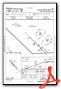
Instrument Approach Procedure (IAP) Charts

Nearby Airports with Instrument Procedures
| ID | Name | Heading / Distance | ||
|---|---|---|---|---|
 |
KBEA | Beeville Municipal Airport | 270° | 6.9 |
|
T69 | Sinton Airport | 161° | 20.4 |
|
8T6 | Live Oak County Airport | 270° | 24.1 |
|
2R9 | Kenedy Regional Airport | 338° | 29.7 |
|
KNOG | Orange Grove Nalf Airport | 216° | 34.4 |
|
KRBO | Nueces County Airport | 182° | 35.0 |
|
KTFP | Ingleside Regional Airport | 138° | 36.0 |
|
KCRP | Corpus Christi International Airport | 166° | 36.3 |
|
KRKP | Aransas County Airport | 116° | 36.7 |
|
KALI | Alice International Airport | 207° | 41.9 |
|
KNGP | Corpus Christi NAS (Truax Field) Airport | 153° | 44.7 |
|
KRAS | Mustang Beach Airport | 137° | 44.8 |
Airport Images
Do you have a recent image of this airport? Upload it here!


