Login
Register


NOG
Orange Grove Nalf Airport
Official FAA Data Effective 2026-02-19 0901Z
Chart Supplement

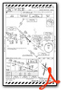
KNOG Airport Diagram

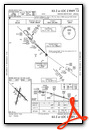
VFR Chart of KNOG
Sectional Charts at SkyVector.com
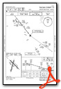
IFR Chart of KNOG
Enroute Charts at SkyVector.com
Location Information for KNOG
Coordinates: N27°53.81' / W98°2.61'Located 08 miles N of Orange Grove, Texas. View all Airports in Texas.
Surveyed Elevation is 257 feet MSL.
Operations Data
|
|
Airport Communications
| ATIS: | 254.35 |
|---|---|
| NAVY ORANGE TOWER: | 128.4 281.425 318.85 |
| NAVY ORANGE GROUND: | 229.4 |
| KINGSVILLE APPROACH: | 119.9 290.45 |
| KINGSVILLE DEPARTURE: | 119.9 290.45 |
| CLEARANCE DELIVERY: | 229.4 |
| PMSV METRO: | 225.6 |
| ASOS at ALI (9.4 S): | 119.225 361-668-0069 |
| AWOS-3 at RBO (20.2 E): | 118.175 361-767-1982 |
| AWOS-3P at IKG (20.8 S): | 119.075 361-592-9152 |
- APCH/DEP SVC PRVDD BY HOUSTON ARTCC (ZHU) ON FREQS 128.15/350.3 (SARITA RCAG) WHEN KINGSVILLE APCH CLSD.
- FREQ 318.85 LDG SIGNAL OFFICER
Nearby Navigation Aids
|
| ||||||||||||||||||||||||||||||||||||||||||


Runway 13/31
| Dimensions: | 8001 x 198 feet / 2439 x 60 meters | |
|---|---|---|
| Surface: | PEM in Fair Condition | |
| Weight Limits: | 19 /R/C/W/T | |
| Edge Lighting: | Medium Intensity | |
| Runway 13 | Runway 31 | |
| Coordinates: | N27°54.35' / W98°3.02' | N27°53.42' / W98°1.96' |
| Elevation: | 257.2 | 224.3 |
| Runway Heading: | 135° True | 315° True |
| Markings: | Precision Instrument in fair condition. | Precision Instrument in fair condition. |
Runway 01/19
| Dimensions: | 8000 x 198 feet / 2438 x 60 meters | |
|---|---|---|
| Surface: | PEM in Fair Condition | |
| Weight Limits: | 25 /R/C/W/T | |
| Edge Lighting: | Medium Intensity | |
| Runway 01 | Runway 19 | |
| Coordinates: | N27°53.09' / W98°2.92' | N27°54.37' / W98°2.55' |
| Elevation: | 229.6 | 240.8 |
| Runway Heading: | 15° True | 195° True |
| Markings: | Precision Instrument in fair condition. | Precision Instrument in fair condition. |
Services Available
| Fuel: | NONE |
|---|---|
| Transient Storage: | NONE |
| Airframe Repair: | NOT AVAILABLE |
| Engine Repair: | NOT AVAILABLE |
| Bottled Oxygen: | NONE |
| Bulk Oxygen: | NONE |
Ownership Information
| Ownership: | Owned by the Navy | |
|---|---|---|
| Owner: | US NAVY | |
| OCEANOGRAPHIC OFC - CODE 3142 | ||
| WASHINGTON, DC 20373 | ||
| Manager: | ||
Other Remarks
- CAUTION: STUDENT JET TRNG IN VCNTY DUR OPR HR.
- RWY-LGTS: RWY 01 - OLS. RWY 19 - OLS.
- RWY-LGTS: RWY 13 - OLS. RWY 31 - OLS.
- SERVICE-LGT: OLS GS 3.25DEG.
- CAUTION: BIRD AND LARGE WILDLIFE HAZARD.
- JET BREAK ALT 1300 FT MSL. USE LDG/TAXI LGT ON FINAL APCH DUR VFR COND.
- RSTD: CNATRA USE ONLY EXC IN EMERG, NALF ADMIN DSN 876-6140, NAS KINGSVILLE BASE OPS DSN 876-6108.
- TRAN ALERT: NO TRAN MAINT OR SVC AVBL. REFUEL CNATRA ACFT ONLY.
- BEARING STRENGTH RWY 13/31: ST119 SBTT320 TRT306.
- FUEL: JAA.
- FLUID: SP PRESAIR.
- OIL: O-156.
- AVBL ONLY DURING HRS OF OPERATION.
- HOOK E28(B) (1500').
- HOOK E28(B) (1500').
- HOOK E28(B) (1500').
- HOOK E28(B) (1501').
Weather Minimums

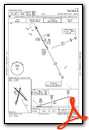
Instrument Approach Procedure (IAP) Charts


Nearby Airports with Instrument Procedures
| ID | Name | Heading / Distance | ||
|---|---|---|---|---|
 |
KALI | Alice International Airport | 174° | 9.4 |
|
KRBO | Nueces County Airport | 110° | 20.1 |
|
KIKG | Kleberg County Airport | 178° | 20.7 |
|
KNQI | Kingsville NAS Airport | 151° | 26.6 |
|
T69 | Sinton Airport | 072° | 27.9 |
|
8T6 | Live Oak County Airport | 352° | 28.2 |
|
KCRP | Corpus Christi International Airport | 104° | 29.7 |
|
KBEA | Beeville Municipal Airport | 025° | 31.0 |
|
TX2 | Chase Field Industrial Airport | 035° | 34.4 |
|
KBKS | Brooks County Airport | 185° | 41.5 |
|
KNGP | Corpus Christi NAS (Truax Field) Airport | 106° | 41.9 |
|
KTFP | Ingleside Regional Airport | 088° | 44.2 |
Airport Images
Do you have a recent image of this airport? Upload it here!


