Login
Register


TZV
Tompkinsville/Monroe County Airport
Official FAA Data Effective 2026-02-19 0901Z
Chart Supplement

VFR Chart of KTZV
Sectional Charts at SkyVector.com
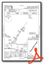
IFR Chart of KTZV
Enroute Charts at SkyVector.com
Location Information for KTZV
Coordinates: N36°43.74' / W85°39.14'Located 02 miles NE of Tompkinsville, Kentucky on 120 acres of land. View all Airports in Kentucky.
Surveyed Elevation is 1036 feet MSL.
Operations Data
|
|
Airport Communications
| AWOS-AV: | 124.175 |
|---|---|
| UNICOM: | 123.050 |
| CTAF: | 123.050 |
| AWOS-3 at GLW (23.3 NW): | 118.525 270-678-5787 |
| AWOS-3 at 8A3 (25.1 SE): | 126.175 931-823-3329 |
| AWOS-3P at K24 (31.3 NE): | 119.6 270-343-5556 |
- APCH/DEP SVC PRVDD BY MEMPHIS ARTCC ON FREQS 133.85/285.5 (NASHVILLE RCAG).
Nearby Navigation Aids
|
| ||||||||||||||||||||||||||||||||||||||||||||||||||||||||||||


Runway 04/22
| Dimensions: | 4000 x 75 feet / 1219 x 23 meters | |
|---|---|---|
| Surface: | Asphalt in Good Condition | |
| Weight Limits: | S-12 | |
| Edge Lighting: | Medium Intensity | |
| Runway 04 | Runway 22 | |
| Coordinates: | N36°43.47' / W85°39.37' | N36°44.01' / W85°38.91' |
| Elevation: | 1015.3 | 1036.2 |
| Runway Heading: | 34° True | 214° True |
| Markings: | Non-Precision Instrument in poor condition. | Non-Precision Instrument in poor condition. |
| Glide Slope Indicator | P2L (3.75° Glide Path Angle) | P2L (3.00° Glide Path Angle) |
| REIL: | Yes | Yes |
Services Available
| Fuel: | 100LL (blue) |
|---|---|
| Transient Storage: | Hangars,Tiedowns |
| Airframe Repair: | MAJOR |
| Engine Repair: | MAJOR |
| Bottled Oxygen: | NOT AVAILABLE |
| Bulk Oxygen: | NOT AVAILABLE |
Ownership Information
| Ownership: | Publicly owned | |
|---|---|---|
| Owner: | TOMPKINSVILLE-MONROE CO APT | |
| P.O. BOX 175 | ||
| TOMPKINSVILLE, KY 42167 | ||
| 270-487-0678 | ||
| Manager: | KANEIA COPASS | |
| PO BOX 175 | ||
| TOMPKINSVILLE, KY 42167 | ||
| 270-646-0544 | 214-458-0600 | |
Other Remarks
- USE CTAF FOR TRML ACES.
- FOR CD CTC MEMPHIS ARTCC AT 901-368-8453/8449.
- ALGAE COVERED.
- ALGAE COVERED.
- ACTVT REIL RWY 04 & 22; PAPI RWY 04 & 22; MIRL RWY 04/22 - CTAF.
Weather Minimums

Instrument Approach Procedure (IAP) Charts

Nearby Airports with Instrument Procedures
| ID | Name | Heading / Distance | ||
|---|---|---|---|---|
 |
3M7 | Lafayette Municipal Airport | 237° | 23.3 |
|
KGLW | Glasgow Municipal Airport | 321° | 23.2 |
|
8A3 | Livingston Municipal Airport | 138° | 25.1 |
|
K24 | Russell County Airport | 057° | 31.4 |
|
KEKQ | Wayne County Airport | 078° | 39.1 |
|
KBWG | Bowling Green-Warren County Regional Airport | 291° | 39.6 |
|
1M5 | Douglas Hunter Field Airport | 258° | 40.6 |
|
KSRB | Upper Cumberland Regional Airport | 171° | 40.7 |
|
2A1 | Jamestown Municipal Airport | 123° | 41.0 |
|
KAAS | Taylor County Airport | 023° | 41.1 |
|
KXNX | Music City Exec Airport | 240° | 42.3 |
|
0A3 | Smithville Municipal Airport | 189° | 45.2 |
Airport Images

By: Big Orange Bird


