Login
Register


SRB
Upper Cumberland Regional Airport
Official FAA Data Effective 2026-02-19 0901Z
Chart Supplement

VFR Chart of KSRB
Sectional Charts at SkyVector.com
IFR Chart of KSRB
Enroute Charts at SkyVector.com
Location Information for KSRB
Coordinates: N36°3.40' / W85°31.81'Located 09 miles NW of Sparta, Tennessee on 362 acres of land. View all Airports in Tennessee.
Surveyed Elevation is 1025 feet MSL.
Operations Data
|
|
Airport Communications
| AWOS-3P: | 128.25 Tel. 931-738-3111 |
|---|---|
| UNICOM: | 122.975 |
| CTAF: | 122.975 |
| ASOS at CSV (22.7 E): | 120.625 931-456-4406 |
| AWOS-3 at 8A3 (24.2 NE): | 126.175 931-823-3329 |
| AWOS-3 at RNC (26.2 SW): | 135.525 931-668-7056 |
- APCH/DEP SVC PRVDD BY MEMPHIS ARTCC ON FREQS 128.15/323.125 (SHELBYVILLE RCAG).
Nearby Navigation Aids
|
| ||||||||||||||||||||||||||||||||||||||||||||||||||||||||||||


Runway 04/22
| Dimensions: | 6704 x 100 feet / 2043 x 30 meters | |
|---|---|---|
| Surface: | Asphalt in Good Condition | |
| Weight Limits: | 38 /F/C/X/T, S-97, D-135 | |
| Edge Lighting: | High Intensity | |
| Runway 04 | Runway 22 | |
| Coordinates: | N36°2.95' / W85°32.20' | N36°3.86' / W85°31.42' |
| Elevation: | 1013.6 | 1023.8 |
| Traffic Pattern: | Left | Left |
| Runway Heading: | 35° True | 215° True |
| Displaced Threshold: | 691 Feet | |
| Declared Distances: | TORA:6704 TODA:6704 ASDA:6000 LDA:6000 | TORA:6704 TODA:6704 ASDA:6704 LDA:6000 |
| Markings: | Precision Instrument in good condition. | Precision Instrument in good condition. |
| Glide Slope Indicator | P4L (3.00° Glide Path Angle) | P4L (3.00° Glide Path Angle) |
| Approach Lights: | RLLS RLLS | |
| REIL: | Yes | Yes |
| Obstacles: | 74 ft Tree 3011 ft from runway, 299 ft left of center | |
Services Available
| Fuel: | 100LL (blue), Jet A+ |
|---|---|
| Transient Storage: | Hangars,Tiedowns |
| Airframe Repair: | MAJOR |
| Engine Repair: | MAJOR |
| Bottled Oxygen: | LOW |
| Bulk Oxygen: | NOT AVAILABLE |
| Other Services: | AIR FREIGHT SERVICES,AIR AMBULANCE SERVICES,AVIONICS,CARGO HANDLING SERVICES,PILOT INSTRUCTION,AIRCRAFT RENTAL,AIRCRAFT SALES |
Ownership Information
| Ownership: | Publicly owned | |
|---|---|---|
| Owner: | UPPER CUMBERLAND ARPT AUTH | |
| 750 AIRPORT RD | ||
| SPARTA, TN 38583 | ||
| 931-739-7000 | ||
| Manager: | DEAN SELBY | |
| 750 AIRPORT RD | ||
| SPARTA, TN 38583 | ||
| 931-739-7000 | ||
Other Remarks
- FOR CD CTC MEMPHIS ARTCC AT 901-368-8453/8449.
- ACTVT RLLS RWY 04; REIL RWY 04 & 22; HIRL RWY 04/22 - CTAF.
Weather Minimums

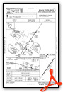
Instrument Approach Procedure (IAP) Charts


Nearby Airports with Instrument Procedures
| ID | Name | Heading / Distance | ||
|---|---|---|---|---|
 |
0A3 | Smithville Municipal Airport | 252° | 14.2 |
|
KCSV | Crossville Memorial-Whitson Field Airport | 106° | 22.6 |
|
8A3 | Livingston Municipal Airport | 026° | 23.9 |
|
KRNC | Warren County Memorial Airport | 215° | 26.3 |
|
2A1 | Jamestown Municipal Airport | 058° | 33.3 |
|
3M7 | Lafayette Municipal Airport | 317° | 37.8 |
|
M54 | Lebanon Municipal Airport | 282° | 39.0 |
|
KTZV | Tompkinsville/Monroe County Airport | 351° | 40.7 |
|
KRKW | Rockwood Municipal Airport | 100° | 41.7 |
|
KMBT | Murfreesboro Municipal Airport | 255° | 42.6 |
|
2A0 | Mark Anton Airport | 139° | 45.0 |
|
KXNX | Music City Exec Airport | 294° | 46.7 |
Fuel Providers

Airport Images

By: Big Orange Bird

By: axisofentropy@g...


