Login
Register


1M5
Douglas Hunter Field Airport
Official FAA Data Effective 2026-01-22 0901Z
Chart Supplement

VFR Chart of 1M5
Sectional Charts at SkyVector.com
IFR Chart of 1M5
Enroute Charts at SkyVector.com
Location Information for 1M5
Coordinates: N36°35.57' / W86°28.61'Located 03 miles NE of Portland, Tennessee on 157 acres of land. View all Airports in Tennessee.
Surveyed Elevation is 817 feet MSL.
Operations Data
|
|
Airport Communications
| AWOS-3PT: | 118.175 Tel. 615-325-4971 |
|---|---|
| NASHVILLE APPROACH: | 119.35 372.0 |
| NASHVILLE DEPARTURE: | 119.35 372.0 |
| UNICOM: | 122.975 |
| CTAF: | 122.975 |
| AWOS-3 at XNX (13.5 S): | 132.725 615-230-8005 |
| AWOS-3 at M91 (21.6 W): | 120.675 615-656-5333 |
| ASOS at BWG (22.5 N): | 127.825 270-843-8136 |
Nearby Navigation Aids
|
| ||||||||||||||||||||||||||||||||||||||||||||||||||||||||||||


Runway 01/19
| Dimensions: | 5003 x 100 feet / 1525 x 30 meters | |
|---|---|---|
| Surface: | Asphalt in Fair Condition | |
| Weight Limits: | 13 /F/C/X/T, S-30, D-50 | |
| Edge Lighting: | Medium Intensity | |
| Runway 01 | Runway 19 | |
| Coordinates: | N36°35.17' / W86°28.71' | N36°35.98' / W86°28.52' |
| Elevation: | 817.6 | 770.4 |
| Traffic Pattern: | Left | Left |
| Runway Heading: | 11° True | 191° True |
| Markings: | Non-Precision Instrument in fair condition. | Non-Precision Instrument in fair condition. |
| Glide Slope Indicator | P4R | P4R |
| REIL: | Yes | Yes |
| Obstacles: | 75 ft Tree 1844 ft from runway, 337 ft right of center | |
Services Available
| Fuel: | 100LL (blue), Jet A+ |
|---|---|
| Transient Storage: | Tiedowns |
| Airframe Repair: | MAJOR |
| Engine Repair: | MAJOR |
| Bottled Oxygen: | NOT AVAILABLE |
| Bulk Oxygen: | NOT AVAILABLE |
| Other Services: | PILOT INSTRUCTION,AIRCRAFT RENTAL |
Ownership Information
| Ownership: | Publicly owned | |
|---|---|---|
| Owner: | CITY OF PORTLAND | |
| 100 SOUTH RUSSELL ST. | ||
| MOBILE, TN 37148 | ||
| 615-533-7210 | ||
| Manager: | DOUGLAS HUNTER | |
| 601 AIRPORT RD | ||
| PORTLAND, TN 37148 | ||
| 615-323-7500 | 615-533-7210. | |
Other Remarks
- FOR CD CTC NASHVILLE APCH AT 615-695-4524.
- ACTVT MIRL RWY 01/19 - CTAF. PAPI RWY 01 & 19 ON CONSLY.
Weather Minimums


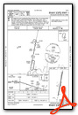
Instrument Approach Procedure (IAP) Charts

Nearby Airports with Instrument Procedures
| ID | Name | Heading / Distance | ||
|---|---|---|---|---|
 |
KXNX | Music City Exec Airport | 165° | 13.5 |
|
4M7 | Russellville-Logan County Airport | 307° | 20.3 |
|
3M7 | Lafayette Municipal Airport | 102° | 20.7 |
|
M91 | Springfield Robertson County Airport | 261° | 21.7 |
|
KBWG | Bowling Green-Warren County Regional Airport | 007° | 22.4 |
|
M54 | Lebanon Municipal Airport | 162° | 25.3 |
|
KBNA | Nashville International Airport | 199° | 29.7 |
|
KJWN | John C Tune Airport | 219° | 31.6 |
|
KMQY | Smyrna Airport | 183° | 35.0 |
|
KGLW | Glasgow Municipal Airport | 043° | 36.4 |
|
KTZV | Tompkinsville/Monroe County Airport | 078° | 40.6 |
|
KMBT | Murfreesboro Municipal Airport | 173° | 43.1 |
Airport Images

By: 2flaps


