Login
Register
VG22
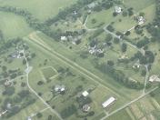
Rockfish Airport
Official FAA Data Effective 2026-01-22 0901Z
VFR Chart of VG22
Sectional Charts at SkyVector.com
IFR Chart of VG22
Enroute Charts at SkyVector.com
Location Information for VG22
Coordinates: N37°52.73' / W78°53.61'Located 01 miles SW of Nellysford, Virginia. View all Airports in Virginia.
Estimated Elevation is 760 feet MSL.
Operations Data
|
|
Airport Communications
| CTAF: | 122.900 |
|---|---|
| AWOS-3PT at W13 (12.2 N): | 118.625 540-941-7570 |
| AWOS-3 at SHD (22.9 N): | 124.925 540-234-0110 |
| ASOS at CHO (25.9 NE): | 434-975-0110 |
Nearby Navigation Aids
|
| ||||||||||||||||||||||||||||||||||||||||||||||||||||||||||||
Runway 06/24
| Dimensions: | 1750 x 40 feet / 533 x 12 meters | |
|---|---|---|
| Surface: | Turf in Fair Condition | |
| Runway 06 | Runway 24 | |
| Traffic Pattern: | Left | Right |
Ownership Information
| Ownership: | Privately Owned | |
|---|---|---|
| Owner: | ROCKFISH GLIDERPORT LLC | |
| 227 EDGEWOOD DRIVE, PO BOX 602 | ||
| NELLYSFORD, VA 22958 | ||
| 540-209-5684 | ||
| Manager: | CHRISTOPHER NYE | |
| 227 EDGEWOOD DRIVE, PO BOX 602 | ||
| NELLYSFORD, VA 22958 | ||
| 540-209-5684 | ||
Other Remarks
- FOR CD CTC POTOMAC APCH AT 866-640-4124.
Nearby Airports with Instrument Procedures
| ID | Name | Heading / Distance | ||
|---|---|---|---|---|
 |
W13 | Eagle's Nest Airport | 348° | 12.1 |
 |
KSHD | Shenandoah Valley Regional Airport | 359° | 23.1 |
 |
KCHO | Charlottesville-Albemarle Airport | 053° | 26.1 |
 |
KVBW | Bridgewater Air Park Airport | 353° | 29.3 |
 |
W24 | Falwell Airport | 200° | 31.9 |
 |
KLYH | Lynchburg Regional/Preston Glenn Field Airport | 203° | 36.3 |
 |
KFVX | Farmville Regional Airport | 145° | 38.1 |
 |
KGVE | Gordonsville Municipal Airport | 064° | 38.3 |
 |
W90 | New London Airport | 210° | 42.1 |
 |
KLKU | Louisa County/Freeman Field Airport | 079° | 44.5 |
 |
0V4 | Brookneal/Campbell County Airport | 187° | 44.6 |
 |
KHSP | Ingalls Field Airport | 275° | 44.9 |


