Login
Register


WVL
Waterville Regional Airport
Official FAA Data Effective 2025-11-27 0901Z
Chart Supplement

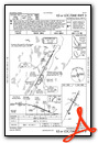
VFR Chart of KWVL
Sectional Charts at SkyVector.com
IFR Chart of KWVL
Enroute Charts at SkyVector.com
Location Information for KWVL
Coordinates: N44°32.00' / W69°40.53'Located 02 miles SW of Waterville, Maine on 375 acres of land. View all Airports in Maine.
Surveyed Elevation is 332 feet MSL.
Operations Data
|
|
Airport Communications
| AWOS-3PT: | 118.375 Tel. 207-877-0519 |
|---|---|
| PORTLAND APPROACH: | 128.35 299.2 |
| PORTLAND DEPARTURE: | 128.35 299.2 |
| CLEARANCE DELIVERY: | 124.6 299.2 |
| UNICOM: | 122.700 |
| CTAF: | 122.700 |
| AWOS-AV at OWK (13.6 NW): | 123.075 |
| ASOS at AUG (14.0 S): | 118.325 207-623-0432 |
| AWOS-AV at ME23 (21.6 W): | 122.8 207-779-3105 |
- APCH/DEP SVC PRVDD BY BOSTON ARTCC ON FREQS 128.2/263.05 (112-292) (WATERBORO RCAG); FREQS 124.25/290.50 (293-111) (BANGOR RCAG) WHEN PORTLAND APCH CTL CLSD.
Nearby Navigation Aids
|
| ||||||||||||||||||||||||||||||||||||||||||||||||


Runway 05/23
| Dimensions: | 5500 x 100 feet / 1676 x 30 meters | |
|---|---|---|
| Surface: | Asphalt / Grooved in Excellent Condition | |
| Weight Limits: | S-40, D-60, ST-105 | |
| Edge Lighting: | High Intensity | |
| Runway 05 | Runway 23 | |
| Coordinates: | N44°31.59' / W69°40.84' | N44°32.39' / W69°40.23' |
| Elevation: | 267.9 | 332.8 |
| Traffic Pattern: | Left | Left |
| Runway Heading: | 29° True | 209° True |
| Markings: | Precision Instrument in good condition. | Precision Instrument in good condition. |
| Glide Slope Indicator | V4L (3.00° Glide Path Angle) | P4L (3.00° Glide Path Angle) |
| Approach Lights: | MALSF 1,400 Foot Medium-intensity Approach Lighting System with sequenced flashers. | |
| REIL: | Yes | |
Runway 14/32
| Dimensions: | 2301 x 60 feet / 701 x 18 meters | |
|---|---|---|
| Surface: | Asphalt in Excellent Condition | |
| Weight Limits: | S-25 | |
| Runway 14 | Runway 32 | |
| Coordinates: | N44°32.12' / W69°40.74' | N44°31.90' / W69°40.30' |
| Elevation: | 307.6 | 298.6 |
| Traffic Pattern: | Left | Left |
| Runway Heading: | 125° True | 305° True |
| Markings: | Basic in fair condition. | Basic in fair condition. |
| Obstacles: | 15 ft Trees 402 ft from runway, 50 ft left of center | |
Services Available
| Fuel: | 100LL (blue), Jet A+ |
|---|---|
| Transient Storage: | Hangars,Tiedowns CALL AHD FOR AVBL. |
| Airframe Repair: | NONE |
| Engine Repair: | NONE |
| Bottled Oxygen: | NONE |
| Bulk Oxygen: | NONE |
| Other Services: | PILOT INSTRUCTION,PARACHUTE JUMP ACTIVITY,AIRCRAFT RENTAL |
Ownership Information
| Ownership: | Publicly owned | |
|---|---|---|
| Owner: | CITY OF WATERVILLE | |
| 1 COMMON ST | ||
| WATERVILLE, ME 04901 | ||
| 207-861-8013 | ||
| Manager: | RANDY MARSHALL JR | |
| 2 LAFLUER RD | ||
| WATERVILLE, ME 04901 | ||
| 207-861-8013 | EMAIL: RMARSHALL@WATERVILLE-ME.GOV. | |
Other Remarks
- THIS AIRPORT HAS BEEN SURVEYED BY THE NATIONAL GEODETIC SURVEY.
- ACFT OPS ON PAVED AREA ONLY.
- AVOID HOSPITAL 1 MI NORTH.
- ACFT DE-ICING AVBL.
- FOR CD WHEN APCH CLSD CTC BOSTON ARTCC AT 603-879-6859.
- 0LL 24 HR SELF SERVE.
- FOR FUEL AFT HRS EMAIL AIRPORT@WATERVILLE-ME.GOV.
- ACTVT MALSF RWY 05; REIL RWY 23; HIRL RWY 05/23 - CTAF.
Weather Minimums
Instrument Approach Procedure (IAP) Charts


Nearby Airports with Instrument Procedures
| ID | Name | Heading / Distance | ||
|---|---|---|---|---|
 |
KOWK | Central Maine/Norridgewock Airport | 323° | 13.7 |
|
KAUG | Augusta State Airport | 202° | 13.8 |
|
2B7 | Pittsfield Municipal Airport | 042° | 19.1 |
|
KBST | Belfast Municipal Airport | 104° | 29.5 |
|
1B0 | Dexter Regional Airport | 033° | 33.9 |
|
KIWI | Wiscasset Airport | 182° | 34.3 |
|
KRKD | Knox County Regional Airport | 138° | 37.7 |
|
KLEW | Auburn/Lewiston Municipal Airport | 222° | 39.1 |
|
KBGR | Bangor International Airport | 065° | 39.8 |
|
KBXM | Brunswick Exec Airport | 196° | 40.1 |
|
B21 | Sugarloaf Regional Airport | 325° | 40.4 |
|
81B | Oxford County Regional Airport | 237° | 41.4 |
Airport Images
Do you have a recent image of this airport? Upload it here!


