Login
Register
CNH
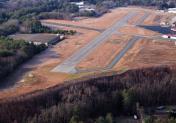
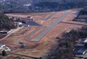
Claremont Municipal Airport
Official FAA Data Effective 2024-10-31 0901Z
VFR Chart of KCNH
Sectional Charts at SkyVector.com
IFR Chart of KCNH
Enroute Charts at SkyVector.com
Location Information for KCNH
Coordinates: N43°22.23' / W72°22.09'Located 01 miles W of Claremont, New Hampshire on 120 acres of land. View all Airports in New Hampshire.
Surveyed Elevation is 543 feet MSL.
Operations Data
|
|
Airport Communications
| UNICOM: | 122.700 |
|---|---|
| CTAF: | 122.700 |
| ASOS at VSF (6.7 W): | 121.425 802-886-6006 |
| ATIS at LEB (15.6 N): | 118.65 |
| ASOS at LEB (15.6 N): | 118.65 603-298-8780 |
- APCH/DEP SVC PRVDD BY BOSTON ARTCC ON FREQS 134.7/269.475 (LEBANON RCAG).
Nearby Navigation Aids
|
| ||||||||||||||||||||||||||||||||||||||||||||||||||||||||||||
Runway 11/29
| Dimensions: | 3098 x 75 feet / 944 x 23 meters | |
|---|---|---|
| Surface: | Asphalt in Excellent Condition | |
| Weight Limits: | S-30
PCR VALUE: 383/F/A/X/T
| |
| Edge Lighting: | Medium Intensity | |
| Runway 11 | Runway 29 | |
| Coordinates: | N43°22.24' / W72°22.44' | N43°22.22' / W72°21.74' |
| Elevation: | 532.8 | 541.9 |
| Traffic Pattern: | Left | Left |
| Runway Heading: | 93° True | 273° True |
| Markings: | Basic in good condition. | Non-Precision Instrument in good condition. |
| Glide Slope Indicator | P2L (4.00° Glide Path Angle) | |
| REIL: | Yes | |
Services Available
| Fuel: | 100LL (blue) |
|---|---|
| Transient Storage: | Tiedowns |
| Airframe Repair: | MINOR |
| Engine Repair: | MINOR |
| Bottled Oxygen: | NONE |
| Bulk Oxygen: | NONE |
| Other Services: | AVIONICS |
Ownership Information
| Ownership: | Publicly owned | |
|---|---|---|
| Owner: | CITY OF CLAREMONT | |
| CITY HALL | ||
| CLAREMONT, NH 03743 | ||
| 603-542-7002 | ||
| Manager: | JAMES CHAMBERLAIN | |
| 100 BROAD ST | ||
| CLAREMONT, NH 03743 | ||
| (603) 542-5156 | ||
Other Remarks
- HAZ BCNS ON SRNDG HILLS.
- EXPC DOWNDRAFT ON APCH TO RWY 29.
- TKOF, LNDG & TAX ON UNPAVED AREAS PROHIBITED.
- WILDLIFE ON & INVOF ARPT.
- COLD TEMPERATURE AIRPORT. ALTITUDE CORRECTION REQUIRED AT OR BELOW -25C.
- FOR CD CTC BOSTON ARTCC AT 603-879-6859.
- 0LL FUEL SELF SVC 24 HRS BY CREDIT CARD.
- ACTVT REIL RWY 29; MIRL RWY 11/29 - CTAF.
Weather Minimums
Instrument Approach Procedure (IAP) Charts
Nearby Airports with Instrument Procedures
| ID | Name | Heading / Distance | ||
|---|---|---|---|---|
 |
KVSF | Hartness State (Springfield) Airport | 256° | 6.7 |
 |
2B3 | Parlin Field Airport | 082° | 8.0 |
 |
KLEB | Lebanon Municipal Airport | 010° | 15.6 |
 |
KRUT | Rutland/Southern Vermont Regional Airport | 290° | 27.1 |
 |
KEEN | Dillant/Hopkins Airport | 171° | 28.6 |
 |
KAFN | Jaffrey Airfield Silver Ranch Airport | 154° | 37.5 |
 |
KCON | Concord Municipal Airport | 104° | 39.3 |
 |
KLCI | Laconia Municipal Airport | 073° | 43.3 |
 |
5B9 | Dean Memorial Airport | 020° | 45.4 |
 |
0B5 | Turners Falls Airport | 188° | 47.2 |
 |
KDDH | William H Morse State Airport | 233° | 48.1 |
 |
KORE | Orange Municipal Airport | 175° | 48.1 |


