Login
Register
EDE
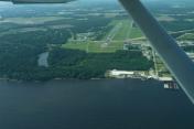
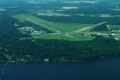
Northeastern Regional Airport
Official FAA Data Effective 2024-12-26 0901Z
VFR Chart of KEDE
Sectional Charts at SkyVector.com
IFR Chart of KEDE
Enroute Charts at SkyVector.com
Location Information for KEDE
Coordinates: N36°1.72' / W76°34.19'Located 03 miles SE of Edenton, North Carolina on 734 acres of land. View all Airports in North Carolina.
Surveyed Elevation is 18 feet MSL.
Operations Data
|
|
Airport Communications
| AWOS-3: | 118.275 Tel. 252-482-0757 |
|---|---|
| CTAF: | 123.000 |
| UNICOM: | 123.000 |
| ASOS at ECG (23.7 NE): | 124.375 252-338-4750 |
| AWOS-3P at MCZ (31.1 W): | 118.65 252-802-4261 |
| AWOS-3 at ASJ (33.3 NW): | 119.075 252-345-2967 |
- APCH/DEP SVC PRVDD BY WASHINGTON ARTCC (ZDC) ON 123.85/279.65 (NEW BERN RCAG).
Nearby Navigation Aids
|
| ||||||||||||||||||||||||||||||||||||||||||||||||||||||||||||
Runway 01/19
| Dimensions: | 6001 x 100 feet / 1829 x 30 meters RY 01/19 HAS 1500 FT STOPWAY AT N END & 500 FT STOPWAY AT S END. | |
|---|---|---|
| Surface: | Asphalt in Good Condition | |
| Weight Limits: | S-60, D-80 | |
| Edge Lighting: | Medium Intensity | |
| Runway 01 | Runway 19 | |
| Coordinates: | N36°1.22' / W76°34.19' | N36°2.21' / W76°34.19' |
| Elevation: | 17.5 | 17.3 |
| Traffic Pattern: | Left | Left |
| Runway Heading: | 0 | 180° True |
| Markings: | Non-Precision Instrument in good condition. | Precision Instrument in good condition. |
| Glide Slope Indicator | P2L (3.00° Glide Path Angle) | P2R (3.00° Glide Path Angle) |
| REIL: | Yes | Yes |
| Obstacles: | 78 ft Trees 2182 ft from runway, 272 ft left of center | 36 ft Trees 1131 ft from runway, 561 ft right of center |
Services Available
| Fuel: | 100LL (blue), Jet A-1+ |
|---|---|
| Transient Storage: | Hangars,Tiedowns |
| Airframe Repair: | MAJOR |
| Engine Repair: | MAJOR |
| Bottled Oxygen: | NONE |
| Bulk Oxygen: | NONE |
| Other Services: | CROP DUSTING SERVICES,PILOT INSTRUCTION |
Ownership Information
| Ownership: | Publicly owned | |
|---|---|---|
| Owner: | TOWN OF EDENTON | |
| PO BOX 300 | ||
| EDENTON, NC 27932 | ||
| (252) 482-2155 | ||
| Manager: | HARRY DAVIS | |
| 113 AIRPORT ROAD | ||
| EDENTON, NC 27932 | ||
| 252-482-4664 | ||
Other Remarks
- SEASONAL PROBLEM WITH BIRDS & DEER ON & INVOF ARPT.
- TWYS SERVING RY 01/19 HAVE GREEN CNTRLN REFLECTORS AND NSTD SOLAR LGTS.
- FOR CD CTC WASHINGTON ARTCC AT 703-771-3587.
- 0LL AFTER HRS SELF SERVICE FUEL FOR 100LL AND A1+ AVBL WITH CREDIT CARD.
- + JET A TRUCK AVAILABLE WITH SINGLE POINT AND OVER THE WING FILLING
- PAPI RYS 01& 19 OPER CONT. ACTVT MIRL RY 1/19 AND REIL RYS 01 & 19 - CTAF.
Weather Minimums
Instrument Approach Procedure (IAP) Charts
Nearby Airports with Instrument Procedures
| ID | Name | Heading / Distance | ||
|---|---|---|---|---|
 |
KPMZ | Plymouth Municipal Airport | 215° | 16.0 |
 |
KECG | Elizabeth City Cg Air Station/Regional Airport | 053° | 23.7 |
 |
KMCZ | Martin County Airport | 251° | 31.3 |
 |
KASJ | Tri-County At Henry Joyner Field Airport | 299° | 33.4 |
 |
KONX | Currituck County Regional Airport | 050° | 34.9 |
 |
KOCW | Washington-Warren Airport | 220° | 36.1 |
 |
KSFQ | Suffolk Exec Airport | 357° | 39.2 |
 |
KCPK | Chesapeake Regional Airport | 017° | 40.0 |
 |
7W6 | Hyde County Airport | 132° | 41.0 |
 |
KMQI | Dare County Regional Airport | 098° | 43.1 |
 |
KFKN | Franklin Regional Airport | 338° | 43.3 |
 |
KFFA | First Flight Airport | 090° | 43.7 |


