Login
Register


1C1
Paxton Airport
Official FAA Data Effective 2026-02-19 0901Z
Chart Supplement

VFR Chart of 1C1
Sectional Charts at SkyVector.com
IFR Chart of 1C1
Enroute Charts at SkyVector.com
Location Information for 1C1
Coordinates: N40°26.94' / W88°7.66'Located 02 miles SW of Paxton, Illinois on 58 acres of land. View all Airports in Illinois.
Surveyed Elevation is 779 feet MSL.
Operations Data
|
|
Airport Communications
| CHAMPAIGN APPROACH: | 121.35 285.65 |
|---|---|
| CHAMPAIGN DEPARTURE: | 121.35 285.65 |
| UNICOM: | 122.800 |
| CTAF: | 122.800 |
| AWOS-3 at TIP (9.4 S): | 119.025 217-892-4999 |
| ATIS at CMI (25.6 S): | 124.85 |
| ASOS at CMI (25.9 S): | 217-355-4072 |
- APCH/DEP SVC PRVDD BY CHICAGO ARTCC ON FREQ 121.35 (REMOTED CHAMPAIGN APCH CTL) AND FREQ 353.95 (DANVILLE RCAG) WHEN CHAMPAIGN APCH CTL CLSD.
Nearby Navigation Aids
|
| ||||||||||||||||||||||||||||||||||||||||||||||||||||||||||||


Runway 18/36
| Dimensions: | 3409 x 50 feet / 1039 x 15 meters | |
|---|---|---|
| Surface: | Asphalt in Poor Condition RWY 18/36 HAS WIDESPREAD CRACKING WITH VEGETATION GROWING IN CRACKS. | |
| Weight Limits: | S-12 | |
| Edge Lighting: | Non-Standard NSTD LIRL - FIXTURE SPACING & LGT INTSTY VARIES. | |
| Runway 18 | Runway 36 | |
| Coordinates: | N40°27.22' / W88°7.67' | N40°26.66' / W88°7.66' |
| Elevation: | 779.0 | 755.0 |
| Traffic Pattern: | Left | |
| Runway Heading: | 180° True | 360° True |
| Displaced Threshold: | 800 Feet DTHR PAINTED WHITE LINE ACRS RWY. |
|
| Markings: | Non-Precision Instrument in poor condition. | Numbers Only in poor condition. |
| Glide Slope Indicator | TRIL (3.00° Glide Path Angle) | |
| REIL: | Yes | |
| Obstacles: | 56 ft Tree 601 ft from runway, 85 ft left of center APCH RATIO 25:1 TO DTHR. 20 FT BLDG 120 FT FM RWY END AND 130 FT R OF CNTRLN. |
|
Services Available
| Fuel: | 100LL (blue), Jet-A |
|---|---|
| Transient Storage: | Hangars,Tiedowns |
| Airframe Repair: | NONE |
| Engine Repair: | NONE |
| Bottled Oxygen: | NONE |
| Bulk Oxygen: | NONE |
| Other Services: | CROP DUSTING SERVICES |
Ownership Information
| Ownership: | Privately Owned | |
|---|---|---|
| Owner: | 1C1, LLC | |
| 482 AIRPORT ROAD, BUILDING G | ||
| MATTOON, IL 61938 | ||
| 217-234-9439 | ||
| Manager: | DOMINIQUE, YOUAKIM | |
| 482 AIRPORT ROAD, BUILDING G | ||
| MATOON, IL 61938 | ||
| 217-234-9439 | ||
Other Remarks
- THIS AIRPORT HAS BEEN SURVEYED BY THE NATIONAL GEODETIC SURVEY.
- AFT HR ACES TO AP TERM VIA CIPHER LOCK HINT TO COMBO POSTED.
- FOR CD CTC CHAMPAIGN APCH AT 217-355-4071, WHEN APCH CLSD CTC CHICAGO ARTCC AT 630-906-8921
- SUMMER AG OPS.
- RWY 18 MARKINGS FADED.
- RWY 36 MARKINGS FADED.
- 0LL SELF SERVE 100LL AND JET A
Weather Minimums

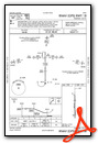
Instrument Approach Procedure (IAP) Charts

Nearby Airports with Instrument Procedures
| ID | Name | Heading / Distance | ||
|---|---|---|---|---|
 |
KTIP | Rantoul Ntl Avn Cntr-Frank Elliott Field Airport | 184° | 9.3 |
|
C16 | Frasca Field Airport | 190° | 18.4 |
|
KCMI | University of Illinois/Willard Airport | 195° | 25.5 |
|
KDNV | Vermilion Regional Airport | 121° | 28.6 |
|
KBMI | Central Il Regional/Bloomington-Normal Airport | 272° | 36.1 |
|
KPNT | Pontiac Municipal Airport | 321° | 36.4 |
|
50I | Kentland Municipal Airport | 059° | 36.9 |
|
KIKK | Greater Kankakee Airport | 018° | 39.5 |
|
KPRG | Edgar County Airport | 154° | 49.6 |
|
KDEC | Decatur Airport | 222° | 50.1 |
|
KRZL | Jasper County Airport | 054° | 52.5 |
|
KLAF | Purdue University Airport | 091° | 54.6 |
Airport Images

By: 2flaps
) from WSW")
By: 2flaps


