Login
Register


DNV
Vermilion Regional Airport
Official FAA Data Effective 2026-01-22 0901Z
Chart Supplement

VFR Chart of KDNV
Sectional Charts at SkyVector.com
IFR Chart of KDNV
Enroute Charts at SkyVector.com
Location Information for KDNV
Coordinates: N40°11.99' / W87°35.71'Located 04 miles NE of Danville, Illinois on 817 acres of land. View all Airports in Illinois.
Surveyed Elevation is 696 feet MSL.
Operations Data
|
|
Airport Communications
| AWOS-3: | 119.275 Tel. 217-442-4660 |
|---|---|
| CHAMPAIGN APPROACH: | 121.35 285.65 |
| CHAMPAIGN DEPARTURE: | 121.35 285.65 |
| CLEARANCE DELIVERY: | 121.7 |
| UNICOM: | 122.700 |
| CTAF: | 122.700 |
| AWOS-3 at TIP (25.7 W): | 119.025 217-892-4999 |
| AWOS-3 at PRG (30.2 S): | 124.175 217-465-4304 |
| ATIS at LAF (32.7 NE): | 127.75 |
- APCH/DEP SVC PRVDD BY CHICAGO ARTCC ON REMOTED CHAMPAIGN APCH CTL FREQS 121.35 & 353.95 (DANVILLE RCAG) WHEN CHAMPAIGN APCH CTL CLSD.
Nearby Navigation Aids
|
| ||||||||||||||||||||||||||||||||||||||||||||||||||||||||||||


Runway 03/21
| Dimensions: | 6006 x 100 feet / 1831 x 30 meters | |
|---|---|---|
| Surface: | Asphalt / Porous Friction Course in Good Condition | |
| Weight Limits: | S-50, D-75 | |
| Edge Lighting: | High Intensity | |
| Runway 03 | Runway 21 | |
| Coordinates: | N40°11.63' / W87°35.98' | N40°12.49' / W87°35.35' |
| Elevation: | 651.3 | 696.9 |
| Traffic Pattern: | Left | Left |
| Runway Heading: | 29° True | 209° True |
| Markings: | Non-Precision Instrument in good condition. | Precision Instrument in good condition. |
| Glide Slope Indicator | V4L (3.00° Glide Path Angle) | P4L (3.00° Glide Path Angle) |
| Approach Lights: | MALSR 1,400 Foot Medium-intensity Approach Lighting System with runway alignment indicator lights. | |
| Obstacles: | 39 ft Tree 1529 ft from runway | |
Runway 16/34
| Dimensions: | 3999 x 100 feet / 1219 x 30 meters | |
|---|---|---|
| Surface: | Asphalt / Grooved in Good Condition | |
| Weight Limits: | S-40, D-50 | |
| Edge Lighting: | Medium Intensity | |
| Runway 16 | Runway 34 | |
| Coordinates: | N40°12.18' / W87°35.95' | N40°11.55' / W87°35.72' |
| Elevation: | 681.8 | 656.3 |
| Traffic Pattern: | Left | Left |
| Runway Heading: | 164° True | 344° True |
| Markings: | Basic in good condition. | Non-Precision Instrument in good condition. |
| Glide Slope Indicator | V2L (3.00° Glide Path Angle) | V2L (3.00° Glide Path Angle) |
Runway 12/30
SEASONAL RWY NOV 1 - MAY 1; CTC AMGR 217-442-4624. | ||
| Dimensions: | 2500 x 150 feet / 762 x 46 meters | |
|---|---|---|
| Surface: | Turf in Good Condition | |
| Runway 12 | Runway 30 | |
| Coordinates: | N40°12.12' / W87°35.86' | N40°11.92' / W87°35.39' |
| Elevation: | 678.2 | 670.8 |
| Runway Heading: | 119° True | 299° True |
| Markings: | None | None |
Services Available
| Fuel: | 100LL (blue), Jet-A |
|---|---|
| Transient Storage: | Hangars,Tiedowns |
| Airframe Repair: | MAJOR |
| Engine Repair: | MAJOR |
| Bottled Oxygen: | NONE |
| Bulk Oxygen: | NONE |
| Other Services: | AIR FREIGHT SERVICES,CROP DUSTING SERVICES,AVIONICS,CARGO HANDLING SERVICES,CHARTER SERVICE,GLIDER SERVICE,PILOT INSTRUCTION,GLIDER TOWING SERVICES |
Ownership Information
| Ownership: | Publicly owned | |
|---|---|---|
| Owner: | VERMILION REGIONAL ARPT AUTH | |
| 22633 N. BOWMAN AVE. , SUITE 1 | ||
| DANVILLE, IL 61834 | ||
| 217-442-4624 | ||
| Manager: | TESS COOK | ROD HIGHTOWER |
| 22633 N. BOWMAN AVE. , SUITE 1 | EMAIL ADDRESS: MANAGER@VRAIRPORT.COM | |
| DANVILLE, IL 61834 | ||
| 217-442-4624 | ||
Other Remarks
- EXTSV GLDR OPS WKENDS.
- FOR CD IF UNABLE VIA RADIO CTC CHAMPAIGN APCH AT 217-355-4071, WHEN APCH CLSD CTC CHICAGO ARTCC AT 630-906-8921
- AIR CARGO PART 135 FLT DEPS NGTLY 2200, ARRS DLY 0600 MON THRU SAT.
- HIRL RWY 03/21 PRESET LOW INTST - TO INCR INTST & ACTVT MALSR RWY 21; VASI RWYS 03, 16 & 34; PAPI RWY 21; MIRL RWY 16/34 - CTAF.
Weather Minimums


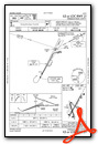
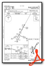
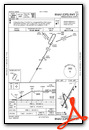
Instrument Approach Procedure (IAP) Charts

Nearby Airports with Instrument Procedures
| ID | Name | Heading / Distance | ||
|---|---|---|---|---|
 |
KTIP | Rantoul Ntl Avn Cntr-Frank Elliott Field Airport | 282° | 25.8 |
|
C16 | Frasca Field Airport | 263° | 27.9 |
|
1C1 | Paxton Airport | 301° | 28.6 |
|
KPRG | Edgar County Airport | 186° | 30.2 |
|
KLAF | Purdue University Airport | 066° | 32.8 |
|
KCMI | University of Illinois/Willard Airport | 253° | 32.8 |
|
KCFJ | Crawfordsville Regional Airport | 113° | 33.9 |
|
50I | Kentland Municipal Airport | 012° | 34.4 |
|
3I3 | Sky King Airport | 165° | 40.4 |
|
1I9 | Delphi Municipal Airport | 063° | 46.6 |
|
KHUF | Terre Haute Regional Airport | 163° | 46.8 |
|
KFKR | Frankfort Clinton County Regional Airport | 084° | 47.7 |
Airport Images
Do you have a recent image of this airport? Upload it here!


