Login
Register


3DW
Downtown Airport
Official FAA Data Effective 2026-02-19 0901Z
Chart Supplement

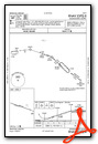
VFR Chart of 3DW
Sectional Charts at SkyVector.com
IFR Chart of 3DW
Enroute Charts at SkyVector.com
Location Information for 3DW
Coordinates: N37°13.36' / W93°14.90'Located 00 miles E of Springfield, Missouri on 160 acres of land. View all Airports in Missouri.
Estimated Elevation is 1375 feet MSL.
Operations Data
|
|
Airport Communications
| SPRINGFIELD APPROACH: | 124.95 353.925 |
|---|---|
| SPRINGFIELD DEPARTURE: | 124.95 353.925 |
| UNICOM: | 122.800 |
| CTAF: | 122.800 |
| ATIS at SGF (6.8 W): | 135.125 |
| ASOS at SGF (6.8 W): | 417-869-4491 |
| AWOS-3PT at FWB (32.3 S): | 119.725 417-272-3922 |
Nearby Navigation Aids
|
| ||||||||||||||||||||||||||||||||||||||||||


Runway 11/29
| Dimensions: | 4037 x 50 feet / 1230 x 15 meters | |
|---|---|---|
| Surface: | Asphalt in Good Condition | |
| Weight Limits: | S-8 | |
| Edge Lighting: | Non-Standard NSTD MIRL; 3 THR LGTS EACH RWY, EDGE LGTS SPACED 240 FT APART. | |
| Runway 11 | Runway 29 | |
| Coordinates: | N37°13.47' / W93°15.29' | N37°13.25' / W93°14.51' |
| Elevation: | 1355.0 | 1375.0 |
| Traffic Pattern: | Left | Left |
| Runway Heading: | 109° True | 289° True |
| Markings: | Non-Precision Instrument in fair condition. | Non-Precision Instrument in fair condition. |
| Obstacles: | 44 ft Trees 890 ft from runway, 116 ft left of center | 58 ft Trees 1080 ft from runway, 130 ft left of center |
Services Available
| Fuel: | 100LL (blue), Jet-A |
|---|---|
| Transient Storage: | Hangars,Tiedowns |
| Airframe Repair: | MAJOR |
| Engine Repair: | MAJOR |
| Bottled Oxygen: | HIGH/LOW |
| Bulk Oxygen: | NONE |
Ownership Information
| Ownership: | Privately Owned | |
|---|---|---|
| Owner: | SHERMAN STREET ACQUISITION CO INC | |
| 605 N. SHERMAN ST | ||
| SPRINGFIELD, MO 65803 | ||
| Manager: | LAUREN LEA | |
| 2546 E DIVISION ST | ||
| SPRINGFIELD, MO 65803 | ||
| 417-862-2418 | ||
Other Remarks
- 600 FT LGTD TOWER 950 FT N OF RY 29 THLD.
- NTSD RY SAFETY AREA BYD RY 29 THLD; LARGE SLOPE.
- PEDESTRIAN GATE CODE IS CTAF FREQ.
- FOR CD CTC SPRINGFIELD APCH AT 417-868-5620/5619.
- ACTVT NSTD MIRL RWY 11/29 - CTAF-THREE CLICKS.
Weather Minimums

Instrument Approach Procedure (IAP) Charts

Nearby Airports with Instrument Procedures
| ID | Name | Heading / Distance | ||
|---|---|---|---|---|
 |
KSGF | Springfield-Branson Ntl Airport | 281° | 6.9 |
|
M17 | Bolivar Municipal Airport | 348° | 22.9 |
|
2H2 | Jerry Sumners Sr Aurora Municipal Airport | 234° | 26.5 |
|
KAOV | Ava Bill Martin Memorial Airport | 118° | 31.1 |
|
KFWB | Branson West Municipal/Emerson Field Airport | 193° | 32.3 |
|
KPLK | M Graham Clark Downtown Airport | 178° | 35.8 |
|
MO3 | Stockton Lake Airport | 314° | 37.8 |
|
KLBO | Floyd W Jones Lebanon Airport | 047° | 38.2 |
|
KHFJ | Monett Regional Airport | 242° | 41.4 |
|
KBBG | Branson Airport | 176° | 41.4 |
|
94K | Cassville Municipal Airport | 225° | 44.4 |
|
1MO | Mountain Grove Memorial Airport | 097° | 45.4 |
Airport Images

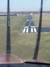
By: Big Orange Bird
By: jberrer


