Login
Register


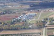
3OH0
Andy Barnhart Memorial Airport
Official FAA Data Effective 2026-02-19 0901Z
VFR Chart of 3OH0
Sectional Charts at SkyVector.com
IFR Chart of 3OH0
Enroute Charts at SkyVector.com
Location Information for 3OH0
Coordinates: N39°55.85' / W84°0.81'Located 01 miles SE of New Carlisle, Ohio on 50 acres of land. View all Airports in Ohio.
Estimated Elevation is 895 feet MSL.
Operations Data
|
|
Airport Communications
| COLUMBUS APPROACH: | 134.45 |
|---|---|
| COLUMBUS DEPARTURE: | 134.45 |
| CTAF: | 122.900 |
| ATIS at FFO (6.5 S): | 269.9 |
| ATIS at DAY (9.6 W): | 125.8 |
| AWOS-3PT at SGH (9.7 SE): | 134.975 937-324-4532 |
Nearby Navigation Aids
|
| ||||||||||||||||||||||||||||||||||||||||||||||||||||||||||||


Runway 09/27
| Dimensions: | 2000 x 30 feet / 610 x 9 meters | |
|---|---|---|
| Surface: | Asphalt | |
| Edge Lighting: | Low Intensity | |
| Runway 09 | Runway 27 | |
| Traffic Pattern: | Left | Left |
Runway 10/28
| Dimensions: | 2000 x 150 feet / 610 x 46 meters | |
|---|---|---|
| Surface: | Turf | |
| Edge Lighting: | Low Intensity | |
| Runway 10 | Runway 28 | |
| Traffic Pattern: | Left | Left |
Services Available
| Fuel: | NONE |
|---|---|
| Transient Storage: | NONE |
| Airframe Repair: | NONE |
| Engine Repair: | NONE |
| Bottled Oxygen: | NOT AVAILABLE |
| Bulk Oxygen: | NOT AVAILABLE |
Ownership Information
| Ownership: | Privately Owned | |
|---|---|---|
| Owner: | FLYING ANGELS, INC | |
| PO BOX 7 | ||
| NEW CARLISLE, OH 45344-0007 | ||
| 937-260-8517 | ||
| Manager: | DAVE PARROTT | |
| 10639 MILTON CARLISLE RD, PO BOX 7 | ||
| NEW CARLISLE, OH 45344-0007 | ||
| 937-845-3896 | ||
Other Remarks
- FOR CD CTC COLUMBUS APCH AT 614-338-8537.
- ACTVT LIRL RWY 09/27 & 10/28 - CTAF.
Nearby Airports with Instrument Procedures
| ID | Name | Heading / Distance | ||
|---|---|---|---|---|
 |
KFFO | Wright-Patterson AFB Airport | 193° | 6.5 |
|
KDAY | James M Cox Dayton International Airport | 259° | 9.7 |
|
KSGH | Springfield/Beckley Municipal Airport | 124° | 9.7 |
|
KGDK | Greene County/Lewis A Jackson Regional Airport | 176° | 14.4 |
|
I74 | Grimes Field Airport | 044° | 17.0 |
|
3I7 | Dayton/Phillipsburg Airport | 266° | 17.9 |
|
I73 | Moraine Air Park Airport | 215° | 18.2 |
|
I17 | Piqua/Hartzell Field Airport | 315° | 19.5 |
|
KSCA | Sidney Municipal Airport | 341° | 19.6 |
|
KMGY | Dayton/Wright Brothers Airport | 205° | 22.7 |
|
KUYF | Madison County Airport | 089° | 25.5 |
|
I66 | Clinton Field Airport | 164° | 26.6 |