Login
Register


47V
Curtis Municipal Airport
Official FAA Data Effective 2026-01-22 0901Z
Chart Supplement

VFR Chart of 47V
Sectional Charts at SkyVector.com
IFR Chart of 47V
Enroute Charts at SkyVector.com
Location Information for 47V
Coordinates: N40°38.33' / W100°28.41'Located 02 miles E of Curtis, Nebraska on 189 acres of land. View all Airports in Nebraska.
Surveyed Elevation is 2677 feet MSL.
Operations Data
|
|
Airport Communications
| CTAF: | 122.900 |
|---|---|
| AWOS-3PT at CSB (24.5 SE): | 118.375 308-697-4279 |
| ASOS at MCK (26.6 S): | 119.025 308-345-1193 |
| ASOS at LBF (30.3 N): | 118.425 308-220-0580 |
- APCH/DEP CTL SVC PRVDD BY DENVER ARTCC (ZDV) ON FREQS 132.7/226.675 (NORTH PLATTE RCAG).
Nearby Navigation Aids
|
| ||||||||||||||||||||||||||||||||||||||||||||||||||||||||||||


Runway 12/30
| Dimensions: | 3402 x 60 feet / 1037 x 18 meters | |
|---|---|---|
| Surface: | Concrete in Good Condition | |
| Weight Limits: | S-12 | |
| Edge Lighting: | Medium Intensity | |
| Runway 12 | Runway 30 | |
| Coordinates: | N40°38.52' / W100°28.65' | N40°38.17' / W100°28.08' |
| Elevation: | 2677.2 | 2661.0 |
| Traffic Pattern: | Left | Left |
| Runway Heading: | 129° True | 309° True |
| Markings: | Non-Precision Instrument in good condition. | Non-Precision Instrument in good condition. |
Runway 17/35
RY 17/35 MKD WITH YELLOW CONES. | ||
| Dimensions: | 2200 x 120 feet / 671 x 37 meters | |
|---|---|---|
| Surface: | Turf in Fair Condition | |
| Runway 17 | Runway 35 | |
| Coordinates: | N40°38.48' / W100°28.46' | N40°38.12' / W100°28.48' |
| Elevation: | 2675.6 | 2667.9 |
| Traffic Pattern: | Left | Left |
| Runway Heading: | 182° True | 2° True |
Services Available
| Fuel: | 100LL (blue) |
|---|---|
| Transient Storage: | Hangars,Tiedowns |
| Airframe Repair: | NOT AVAILABLE |
| Engine Repair: | NOT AVAILABLE |
| Bottled Oxygen: | NONE |
| Bulk Oxygen: | NONE |
Ownership Information
| Ownership: | Publicly owned | |
|---|---|---|
| Owner: | CURTIS AIRPORT AUTHORITY | RYAN PATE, CHAIRMAN OF AIRPORT AUTHORITY. |
| PO BOX 11 | ||
| CURTIS, NE 69025-0011 | ||
| (308) 362-7088 | ||
| Manager: | TOM BROWN | |
| PO BOX 131 | ||
| CURTIS, NE 69025-0131 | ||
| (308) 367-7352 | ||
Other Remarks
- FOR CD CTC DENVER ARTCC AT 303-651-4257.
- 0LL FOR FUEL AFT HRS & UNATNDD DAYS CALL AMGR (308) 367-7352.
- ACTVT MIRL RY 12/30 - CTAF.
Weather Minimums

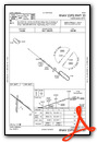
Instrument Approach Procedure (IAP) Charts

Nearby Airports with Instrument Procedures
| ID | Name | Heading / Distance | ||
|---|---|---|---|---|
 |
KGTE | Gothenburg Municipal Airport | 040° | 22.7 |
|
KCSB | Cambridge Municipal Airport | 144° | 24.5 |
|
KCZD | Cozad Municipal Airport | 056° | 25.5 |
|
KMCK | Mc Cook Ben Nelson Regional Airport | 191° | 26.5 |
|
KLBF | North Platte Regional/Lee Bird Field Airport | 341° | 30.8 |
|
KLXN | Jim Kelly Field Airport | 073° | 33.1 |
|
KOIN | Oberlin Municipal Airport | 183° | 48.3 |
|
KIML | Imperial Municipal Airport | 262° | 53.0 |
|
KHDE | Brewster Field Airport | 101° | 53.2 |
|
KNRN | Norton Municipal Airport | 150° | 54.2 |
|
KADT | Atwood-Rawlins County City-County Airport | 208° | 54.5 |
|
KGGF | Grant Municipal Airport | 284° | 59.1 |
Airport Images
Do you have a recent image of this airport? Upload it here!


