Login
Register


IML
Imperial Municipal Airport
Official FAA Data Effective 2026-02-19 0901Z
Chart Supplement

VFR Chart of KIML
Sectional Charts at SkyVector.com
IFR Chart of KIML
Enroute Charts at SkyVector.com
Location Information for KIML
Coordinates: N40°30.62' / W101°37.21'Located 01 miles SE of Imperial, Nebraska on 213 acres of land. View all Airports in Nebraska.
Surveyed Elevation is 3276 feet MSL.
Operations Data
|
|
Airport Communications
| ASOS: | 124.175 Tel. 308-882-5186 |
|---|---|
| UNICOM: | 122.800 |
| CTAF: | 122.800 |
| AWOS-3PT at GGF (22.3 N): | 118.025 308-352-4689 |
| AWOS-3 at HEQ (30.2 W): | 119.275 970-854-3679 |
| AWOS-3 at OGA (37.0 N): | 121.275 308-284-6573 |
- APCH/DEP CTL SVC PRVDD BY DENVER ARTCC (ZDV) ON FREQS 132.7/397.85 (OGALLALA RCAG).
Nearby Navigation Aids
|
| ||||||||||||||||||||||||||||||||||||||||||||||||||||||||||||


Runway 13/31
| Dimensions: | 5022 x 100 feet / 1531 x 30 meters | |
|---|---|---|
| Surface: | Concrete in Good Condition | |
| Weight Limits: | S-21 | |
| Edge Lighting: | Medium Intensity | |
| Runway 13 | Runway 31 | |
| Coordinates: | N40°30.89' / W101°37.55' | N40°30.22' / W101°36.91' |
| Elevation: | 3272.6 | 3264.6 |
| Traffic Pattern: | Left | Left |
| Runway Heading: | 144° True | 324° True |
| Markings: | Non-Precision Instrument in good condition. | Non-Precision Instrument in good condition. |
| Glide Slope Indicator | P2L (3.00° Glide Path Angle) | P2L (3.00° Glide Path Angle) |
| REIL: | Yes | Yes |
Runway 03/21
| Dimensions: | 2756 x 280 feet / 840 x 85 meters | |
|---|---|---|
| Surface: | Turf in Fair Condition | |
| Runway 03 | Runway 21 | |
| Coordinates: | N40°30.57' / W101°37.38' | N40°30.89' / W101°36.96' |
| Elevation: | 3267.2 | 3274.3 |
| Traffic Pattern: | Left | Left |
| Runway Heading: | 46° True | 226° True |
| Markings: | None | None |
Services Available
| Fuel: | 100LL (blue) |
|---|---|
| Transient Storage: | Tiedowns |
| Airframe Repair: | NOT AVAILABLE |
| Engine Repair: | NOT AVAILABLE |
| Bottled Oxygen: | NONE |
| Bulk Oxygen: | NONE |
| Other Services: | CROP DUSTING SERVICES |
Ownership Information
| Ownership: | Publicly owned | |
|---|---|---|
| Owner: | IMPERIAL AIRPORT AUTHORITY | |
| P.O. BOX 637, BOX 637 | ||
| IMPERIAL, NE 69033-0637 | ||
| 308-882-5643 | ||
| Manager: | ADRIAN FOREMAN | RICK CHANDLER AMGR APR-SEPT. |
| P.O. BOX 637 | ||
| IMPERIAL, NE 69033-0637 | ||
| 308-414-3002 | CTC FOR BOTH AMGRS. | |
Other Remarks
- BIRDS INVOF ARPT - SEASONAL.
- EXTENSIVE CROP SPRAYING OPNS INVOF ARPT APR THRU AUG.
- RY 03/21 NOT PLOWED WINTER MONTHS.
- FOR CD CTC DENVER ARTCC AT 303-651-4257.
- 0LL FUEL AVBL H24 VIA CREDIT CARD.
- ACTVT MIRL RY 13/31 PAPI RY 13 & 31 AND REIL RY 13 & 31 - CTAF.
Weather Minimums


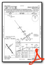
Instrument Approach Procedure (IAP) Charts

Nearby Airports with Instrument Procedures
| ID | Name | Heading / Distance | ||
|---|---|---|---|---|
 |
KGGF | Grant Municipal Airport | 346° | 22.2 |
|
KHEQ | Holyoke Airport | 276° | 30.1 |
|
KOGA | Searle Field Airport | 349° | 37.2 |
|
2V5 | Wray Municipal Airport | 229° | 37.6 |
|
KSYF | Cheyenne County Municipal Airport | 190° | 45.7 |
|
KADT | Atwood-Rawlins County City-County Airport | 146° | 48.2 |
|
KMCK | Mc Cook Ben Nelson Regional Airport | 110° | 50.6 |
|
47V | Curtis Municipal Airport | 081° | 53.0 |
|
2V6 | Yuma Municipal Airport | 244° | 55.8 |
|
KLBF | North Platte Regional/Lee Bird Field Airport | 048° | 56.4 |
|
KOKS | Garden County/King Rhiley Field Airport | 328° | 63.1 |
|
KOIN | Oberlin Municipal Airport | 128° | 64.1 |
Airport Images

By: WebRuss


