Login
Register


4I9
Morrow County Airport
Official FAA Data Effective 2026-02-19 0901Z
Chart Supplement

VFR Chart of 4I9
Sectional Charts at SkyVector.com
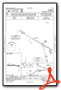
IFR Chart of 4I9
Enroute Charts at SkyVector.com
Location Information for 4I9
Coordinates: N40°31.47' / W82°51.00'Located 02 miles SW of Mount Gilead, Ohio on 88 acres of land. View all Airports in Ohio.
Surveyed Elevation is 1085 feet MSL.
Operations Data
|
|
Airport Communications
| AWOS-3PT: | 121.4 Tel. 419-947-1039 |
|---|---|
| COLUMBUS APPROACH: | 125.95 317.775 371.975 |
| COLUMBUS DEPARTURE: | 125.95 317.775 371.975 |
| IC: | 125.95 317.775 |
| CTAF: | 122.800 |
| UNICOM: | 122.800 |
| ASOS at MNN (11.3 NW): | 119.975 740-223-7502 |
| AWOS-3 at 17G (16.6 N): | 126.625 419-562-0279 |
| AWOS-3 at DLZ (19.0 SW): | 119.025 740-203-1878 |
Nearby Navigation Aids
|
| ||||||||||||||||||||||||||||||||||||||||||||||||||||||||||||


Runway 10/28
| Dimensions: | 3495 x 65 feet / 1065 x 20 meters | |
|---|---|---|
| Surface: | Asphalt in Fair Condition | |
| Weight Limits: | S-3 | |
| Edge Lighting: | Medium Intensity | |
| Runway 10 | Runway 28 | |
| Coordinates: | N40°31.48' / W82°51.38' | N40°31.47' / W82°50.63' |
| Elevation: | 1075.2 | 1085.0 |
| Traffic Pattern: | Left | Left |
| Runway Heading: | 91° True | 271° True |
| Markings: | Non-Precision Instrument in good condition. | Non-Precision Instrument in good condition. |
| Glide Slope Indicator | P4L (4.00° Glide Path Angle) | |
| Obstacles: | 56 ft Trees 903 ft from runway, 308 ft left of center +2 FT CROPS, 60-200 FT DIST, 60-250 FT L. |
60 ft Trees 916 ft from runway, 303 ft left of center |
Services Available
| Fuel: | NONE |
|---|---|
| Transient Storage: | Tiedowns PRIOR CDN RQRD FOR ROPES. |
| Airframe Repair: | MINOR |
| Engine Repair: | MINOR |
| Bottled Oxygen: | NOT AVAILABLE |
| Bulk Oxygen: | NOT AVAILABLE |
| Other Services: | CROP DUSTING SERVICES |
Ownership Information
| Ownership: | Publicly owned | |
|---|---|---|
| Owner: | MORROW COUNTY ARPT AUTH | |
| 4679 TOWNSHIP ROAD 126 | ||
| CARDINGTON, OH 43315-9511 | ||
| 419-947-4735 | COUNTY ECONOMIC DEVELOPMENT OFC. | |
| Manager: | CARL FISHER JR | |
| 4679 TOWNSHIP ROAD 126 | ||
| CARDINGTON, OH 43315-9511 | ||
| 419-947-1833 | OFC. | |
Other Remarks
- FOR CD CTC COLUMBUS APCH AT 614-338-8537.
- ACTVT PAPI RWY 28; MIRL RWY 10/28 - CTAF.
Weather Minimums

Instrument Approach Procedure (IAP) Charts
Nearby Airports with Instrument Procedures
| ID | Name | Heading / Distance | ||
|---|---|---|---|---|
 |
KMNN | Marion Municipal Airport | 299° | 11.2 |
|
KGQQ | Galion Municipal Airport | 022° | 14.9 |
|
17G | Port Bucyrus/Crawford County Airport | 339° | 16.4 |
|
4I3 | Knox County Airport | 128° | 18.9 |
|
KDLZ | Delaware Municipal/Jim Moore Field Airport | 219° | 19.0 |
|
KMFD | Mansfield Lahm Regional Airport | 040° | 23.4 |
|
KOSU | Ohio State University Airport | 201° | 28.6 |
|
KMRT | Union County Airport | 232° | 29.2 |
|
56D | Wyandot County Airport | 315° | 30.2 |
|
8G1 | Willard Airport | 010° | 31.4 |
|
KCMH | John Glenn Columbus International Airport | 183° | 31.7 |
|
KVTA | Licking County Regional Airport | 149° | 34.9 |
Airport Images
Do you have a recent image of this airport? Upload it here!


