Login
Register


GQQ
Galion Municipal Airport
Official FAA Data Effective 2026-02-19 0901Z
Chart Supplement

VFR Chart of KGQQ
Sectional Charts at SkyVector.com
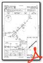
IFR Chart of KGQQ
Enroute Charts at SkyVector.com
Location Information for KGQQ
Coordinates: N40°45.20' / W82°43.43'Located 03 miles NE of Galion, Ohio on 152 acres of land. View all Airports in Ohio.
Surveyed Elevation is 1224 feet MSL.
Operations Data
|
|
Airport Communications
| CLEVELAND APPROACH: | 128.35 360.65 |
|---|---|
| CLEVELAND DEPARTURE: | 128.35 360.65 |
| CLEARANCE DELIVERY: | 126.8 |
| UNICOM: | 122.800 |
| CTAF: | 122.800 |
| ASOS at MFD (10.3 NE): | 125.3 419-520-7277 |
| ATIS at MFD (10.3 NE): | 125.3 |
| AWOS-3 at 17G (11.5 W): | 126.625 419-562-0279 |
- APCH/DEP SVC PRVDD BY CLEVELAND APCH (CLE) 0600-0100. APCH/DEP SVC PRVDD BY CLEVELAND ARTCC (ZOB) ON FREQS 134.9/269.475 (MANSFIELD RCAG) 0100-0600.
Nearby Navigation Aids
|
| ||||||||||||||||||||||||||||||||||||||||||||||||||||||||||||


Runway 05/23
| Dimensions: | 3504 x 75 feet / 1068 x 23 meters | |
|---|---|---|
| Surface: | Asphalt in Excellent Condition | |
| Weight Limits: | S-12 | |
| Edge Lighting: | Medium Intensity | |
| Runway 05 | Runway 23 | |
| Coordinates: | N40°45.01' / W82°43.71' | N40°45.40' / W82°43.15' |
| Elevation: | 1222.1 | 1218.4 |
| Traffic Pattern: | Left | Left |
| Runway Heading: | 47° True | 227° True |
| Displaced Threshold: | 186 Feet | |
| Markings: | Non-Precision Instrument in good condition. | Non-Precision Instrument in good condition. |
| Glide Slope Indicator | P4L (3.00° Glide Path Angle) | P4L (3.00° Glide Path Angle) |
| REIL: | Yes | Yes |
| Obstacles: | 35 ft Tree 568 ft from runway, 103 ft left of center APCH RATIO 18:1 TO DTHR. |
10 ft Crops 201 ft from runway CTLG OBSTN EXCEEDS A 45 DEG SLP. +10 CROPS, 172 FT DIST, 200 FT L/R. |
Services Available
| Fuel: | 100LL (blue), Jet-A |
|---|---|
| Transient Storage: | Hangars,Tiedowns |
| Airframe Repair: | MAJOR |
| Engine Repair: | MAJOR |
| Bottled Oxygen: | NONE |
| Bulk Oxygen: | NONE |
| Other Services: | AIR AMBULANCE SERVICES,PILOT INSTRUCTION,AIRCRAFT RENTAL |
Ownership Information
| Ownership: | Publicly owned | |
|---|---|---|
| Owner: | CITY OF GALION | |
| 301 HARDING WAY E | ||
| GALION, OH 44833-2087 | ||
| 419-468-2818 | ||
| Manager: | DR HOLBROOK RILES JR | |
| 8240 STATE ROUTE 309 | ||
| GALION, OH 44833-9712 | ||
| 419-295-1821 | FBO 419-565-3647. | |
Other Remarks
- STUDENT TRAINING ACTIVITY.
- FOR CD CTC CLEVELAND APCH AT 216-352-2323, WHEN APCH CLSD CTC CLEVELAND ARTCC AT 440-774-0223/0490.
- AND CRAWFORD CO.
- 0LL 100LL AVBL H24 SELF SVC VIA CREDIT CARD.
- FOR JET A AFT HRS CALL 419-565-3647.
- ACTVT REIL RWY 05 & 23; PAPI RWY 05 & 23; MIRL RWY 05/23 - CTAF.
Weather Minimums

Instrument Approach Procedure (IAP) Charts

Nearby Airports with Instrument Procedures
| ID | Name | Heading / Distance | ||
|---|---|---|---|---|
 |
KMFD | Mansfield Lahm Regional Airport | 066° | 10.3 |
|
17G | Port Bucyrus/Crawford County Airport | 278° | 11.6 |
|
4I9 | Morrow County Airport | 202° | 14.9 |
|
8G1 | Willard Airport | 359° | 17.1 |
|
KMNN | Marion Municipal Airport | 242° | 17.5 |
|
3G4 | Ashland County Airport | 067° | 23.1 |
|
4I3 | Knox County Airport | 160° | 27.0 |
|
56D | Wyandot County Airport | 286° | 28.0 |
|
16G | Seneca County Airport | 312° | 30.2 |
|
5A1 | Norwalk/Huron County Airport | 014° | 30.5 |
|
KDLZ | Delaware Municipal/Jim Moore Field Airport | 212° | 33.5 |
|
S24 | Sandusky County Regional Airport | 336° | 35.5 |
Airport Images

By: btracy62


