Login
Register


5I4
Sheridan Airport
Official FAA Data Effective 2026-02-19 0901Z
Chart Supplement

VFR Chart of 5I4
Sectional Charts at SkyVector.com
IFR Chart of 5I4
Enroute Charts at SkyVector.com
Location Information for 5I4
Coordinates: N40°10.69' / W86°13.02'Located 03 miles N of Sheridan, Indiana on 126 acres of land. View all Airports in Indiana.
Surveyed Elevation is 936 feet MSL.
Operations Data
|
|
Airport Communications
| INDIANAPOLIS APPROACH: | 124.65 317.8 |
|---|---|
| INDIANAPOLIS DEPARTURE: | 124.65 317.8 |
| CTAF: | 123.075 |
| UNICOM: | 123.075 |
| AWOS-3PT at TYQ (8.7 S): | 120.725 317-769-3154 |
| AWOS-3PT at UMP (16.5 SE): | 119.375 317-842-3911 |
| AWOS-3 at FKR (16.9 W): | 124.325 765-654-0328 |
Nearby Navigation Aids
|
| ||||||||||||||||||||||||||||||||||||||||||||||||||||||||||||


Runway 05/23
| Dimensions: | 3760 x 50 feet / 1146 x 15 meters | |
|---|---|---|
| Surface: | Asphalt in Fair Condition | |
| Edge Lighting: | Non-Standard NSTD; RY 23 NSTD THLD LGTS | |
| Runway 05 | Runway 23 | |
| Coordinates: | N40°10.41' / W86°13.39' | N40°10.79' / W86°12.76' |
| Elevation: | 930.0 | 932.0 |
| Traffic Pattern: | Left | Left |
| Runway Heading: | 52° True | 232° True |
| Displaced Threshold: | 650 Feet | |
| Markings: | Basic in fair condition. | Basic in fair condition. |
| Glide Slope Indicator | TRIL | |
| Obstacles: | 10 ft Crops 201 ft from runway RWY 05 APCH RATIO 22:1 TO DSPLCD THLD. RWY 05 RD 15' FRM END, CROPS 50' FM RWY END. |
10 ft Crops 201 ft from runway |
Runway 09/27
| Dimensions: | 3387 x 88 feet / 1032 x 27 meters HAS A 325 FT STWY WEST END. | |
|---|---|---|
| Surface: | Turf in Good Condition | |
| Runway 09 | Runway 27 | |
| Coordinates: | N40°10.79' / W86°13.33' | N40°10.80' / W86°12.61' |
| Elevation: | 936.0 | 934.0 |
| Traffic Pattern: | Left | Left |
| Runway Heading: | 88° True | 268° True |
| Displaced Threshold: | 250 Feet | |
| Markings: | None | None |
| Obstacles: | 18 ft Building 280 ft from runway, 125 ft right of center | 10 ft Crops 5 ft from runway APCH RATIO 21:1 TO DSPLCD THLD. |
Services Available
| Fuel: | 100LL (blue) |
|---|---|
| Transient Storage: | Hangars,Tiedowns |
| Airframe Repair: | MAJOR |
| Engine Repair: | MAJOR |
| Bottled Oxygen: | NONE |
| Bulk Oxygen: | NONE |
| Other Services: | PILOT INSTRUCTION,AIRCRAFT RENTAL |
Ownership Information
| Ownership: | Privately Owned | |
|---|---|---|
| Owner: | HAMILTON COUNTY AIRPORT AUTHORITY | |
| 11329 E. SR 32 | ||
| ZIONSVILLE, IN 46077 | ||
| 317-385-3015 | ||
| Manager: | SAM SACHS | |
| 27045 JERKWATER ROAD | ||
| SHERIDAN, IN 46069 | ||
| 317-385-3015 | ||
Other Remarks
- THIS AIRPORT HAS BEEN SURVEYED BY THE NATIONAL GEODETIC SURVEY.
- BIRDS ON & INVOF ARPT
- DURG WINTER MONTHS CALL AMGR TO VFY RWY CONDS - 317-385-3015.
- FOR CD CTC INDIANAPOLIS APCH AT 317-227-5743.
- ACTVT NSTD LIRL RY 05/23 - CTAF.
- PHONE REQ
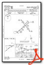
Instrument Approach Procedure (IAP) Charts

Nearby Airports with Instrument Procedures
| ID | Name | Heading / Distance | ||
|---|---|---|---|---|
 |
KTYQ | Indianapolis Exec Airport | 190° | 9.1 |
|
KUMP | Indianapolis Metro Airport | 151° | 16.6 |
|
KFKR | Frankfort Clinton County Regional Airport | 289° | 16.9 |
|
KEYE | Eagle Creek Airpark Airport | 189° | 21.1 |
|
KOKK | Kokomo Municipal Airport | 018° | 22.2 |
|
KMQJ | Indianapolis Regional Airport | 143° | 24.9 |
 |
8A4 | Indianapolis Downtown Heliport | 172° | 24.9 |
|
KIND | Indianapolis International Airport | 187° | 27.9 |
|
KAID | Anderson Regional Airport | 098° | 28.1 |
|
KGUS | Grissom Arb Airport | 006° | 28.3 |
|
2R2 | Hendricks County-Gordon Graham Field Airport | 204° | 28.5 |
|
1I9 | Delphi Municipal Airport | 315° | 30.4 |
Airport Images
 from N")
By: 2flaps


