Login
Register
6G8
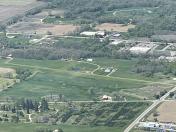
Brooklyn Airport
Official FAA Data Effective 2026-01-22 0901Z
VFR Chart of 6G8
Sectional Charts at SkyVector.com
IFR Chart of 6G8
Enroute Charts at SkyVector.com
Location Information for 6G8
Coordinates: N42°5.65' / W84°14.46'Located 01 miles SE of Brooklyn, Michigan on 97 acres of land. View all Airports in Michigan.
Estimated Elevation is 981 feet MSL.
Operations Data
|
|
Airport Communications
| CTAF: | 122.900 |
|---|---|
| ASOS at JXN (14.0 NW): | 517-768-7506 |
| ATIS at JXN (14.0 NW): | 125.725 |
| ASOS at ADG (15.4 SE): | 118.825 517-265-9089 |
Nearby Navigation Aids
|
| ||||||||||||||||||||||||||||||||||||||||||||||||||||||||||||
Runway 01/19
| Dimensions: | 2829 x 100 feet / 862 x 30 meters | |
|---|---|---|
| Surface: | Turf in Good Condition | |
| Edge Lighting: | Low Intensity | |
| Runway 01 | Runway 19 | |
| Coordinates: | N42°5.42' / W84°14.50' | N42°5.88' / W84°14.41' |
| Elevation: | 979.0 | 979.0 |
| Traffic Pattern: | Right | Left |
| Runway Heading: | 9° True | 189° True |
| Displaced Threshold: | 613 Feet | |
| Obstacles: | 32 ft Tree 44 ft from runway, 107 ft left of center | 55 ft Trees 435 ft from runway, 140 ft right of center |
Services Available
| Fuel: | NONE |
|---|---|
| Transient Storage: | Hangars,Tiedowns |
| Airframe Repair: | NOT AVAILABLE |
| Engine Repair: | NOT AVAILABLE |
| Bottled Oxygen: | NOT AVAILABLE |
| Bulk Oxygen: | NOT AVAILABLE |
| Other Services: | PILOT INSTRUCTION,AIRCRAFT SALES |
Ownership Information
| Ownership: | Privately Owned | |
|---|---|---|
| Owner: | CRAIG PEARSON | RESIDES ON ARPT PREMISES. |
| PO BOX 324 | ||
| BROOKLYN, MI 49230-0324 | ||
| 586-646-8199 | ||
| Manager: | CRAIG PEARSON | |
| PO BOX 324 | ||
| BROOKLYN, MI 49230-0324 | ||
| 586-646-8199 | ||
Other Remarks
- 105 FT MKD PLINE & TWR, 0.25 NM FM RWY 19 THR, EXTDD L & R OF CNTRLN.
- DEER & LRG BIRDS ON & INVOF ARPT.
- ADMIN BLDG ACES 1-2-2-9.
- FOR CD CTC GREAT LAKES APCH AT 269-459-3345, WHEN APCH CLSD CTC CLEVELAND ARTCC AT 440-774-0229/0490.
- ARPT CLSD WHEN SNOW COVD EXC FOR SKI EQUIPPED ACFT.
- PRKG & OVNGT FEE.
- 3 FT YELLOW CONES.
- RWY & DTHR MKD WITH 3 FT YELLOW CONES.
- LIRL RWY 01/19 OTS INDEFLY.
Nearby Airports with Instrument Procedures
| ID | Name | Heading / Distance | ||
|---|---|---|---|---|
 |
KJXN | Jackson County/Reynolds Field Airport | 315° | 14.0 |
 |
KADG | Lenawee County Airport | 151° | 15.4 |
 |
KJYM | Hillsdale Municipal Airport | 236° | 18.6 |
 |
KARB | Ann Arbor Municipal Airport | 070° | 23.4 |
 |
KTEW | Mason Jewett Field Airport | 344° | 29.4 |
 |
KUSE | Fulton County Airport | 170° | 29.5 |
 |
KYIP | Willow Run Airport | 074° | 32.8 |
 |
KRMY | Brooks Field Airport | 286° | 33.2 |
 |
KDUH | Toledo Suburban Airport | 129° | 33.9 |
 |
KOZW | Livingston County/Spencer J Hardy Airport | 019° | 34.1 |
 |
KTOL | Eugene F Kranz Toledo Express Airport | 147° | 36.1 |
 |
Y47 | Oakland Southwest Airport | 048° | 36.8 |


