Login
Register
7V5
Brush Municipal Airport
Official FAA Data Effective 2026-01-22 0901Z
VFR Chart of 7V5
Sectional Charts at SkyVector.com
IFR Chart of 7V5
Enroute Charts at SkyVector.com
Location Information for 7V5
Coordinates: N40°15.86' / W103°34.54'Located 03 miles E of Brush, Colorado on 65 acres of land. View all Airports in Colorado.
Estimated Elevation is 4280 feet MSL.
Operations Data
|
|
Airport Communications
| UNICOM: | 122.800 |
|---|---|
| CTAF: | 122.800 |
| AWOS-3PT at FMM (11.3 W): | 132.95 970-867-1992 |
| ASOS at AKO (17.4 E): | 135.475 970-345-2320 |
| AWOS-3 at STK (25.4 NE): | 118.525 970-526-3009 |
Nearby Navigation Aids
|
| ||||||||||||||||||||||||||||||||||||||||||||||||||||||
Runway 07/25
| Dimensions: | 4300 x 60 feet / 1311 x 18 meters | |
|---|---|---|
| Surface: | Asphalt in Fair Condition | |
| Weight Limits: | S-6 | |
| Edge Lighting: | Non-Standard NSTD LIRL; ONE THLD LGT EACH SIDE OF RWY BOTH ENDS; RWY 25 LGTD THLD DISPLACED 195 FT FOR NIGHT OPNS. | |
| Runway 07 | Runway 25 | |
| Coordinates: | N40°15.82' / W103°35.00' | N40°15.90' / W103°34.08' |
| Traffic Pattern: | Left | Left |
| Markings: | Basic in poor condition. | Basic in poor condition. |
| Obstacles: | 39 ft Tree 1269 ft from runway, 6 ft right of center | 11 ft Fence 362 ft from runway 10 FT FENCE 550 FT FM DTHR, OB; 34:1 SLOPE TO DTHR. 5 FT FENCE 95 FT FM END OF PAVEMENT OB; 7 FT FENCE 70 FT LEFT OF AND PARL TO CNTRLN; 8 FT SIGN 150 FT FM END OF PAVEMENT, 60 FT LEFT OF CNTRLN. |
Services Available
| Fuel: | NONE |
|---|---|
| Transient Storage: | Tiedowns |
| Airframe Repair: | NOT AVAILABLE |
| Engine Repair: | NOT AVAILABLE |
| Bottled Oxygen: | NOT AVAILABLE |
| Bulk Oxygen: | NOT AVAILABLE |
Ownership Information
| Ownership: | Publicly owned | |
|---|---|---|
| Owner: | CITY OF BRUSH | |
| PO BOX 363 | ||
| BRUSH, CO 80723 | ||
| 970-842-5001 | ||
| Manager: | CITY OF BRUSH/TYLER PURVIS | |
| PO BOX 363 | ||
| BRUSH, CO 80723 | ||
| 970-847-8029 | ||
Other Remarks
- RY 07 END - 810 FT ALIGNED TAXIWAY WITH RY - FOR TAXIING ONLY.
- RY 25 HAS +4 FT FENCE AT VARIOUS TERRAIN HEIGHTS AS CLOSE AS 70 FT L OF CNTRLN FULL LENGTH OF RY.
- HIGH TENSION POWERLINES WITHIN 1 MI S OF ARPT.
- LARGE WASHOUT AT SW CORNER OF WEST ALIGNED TWY.
- UNLGTD 320 FT TWR 3 MILES EAST OF ARPT.
- BE ALERT; INTENSIVE USAF STUDENT TRAINING IN VICINITY OF COLORADO SPRINGS & PUEBLO COLORADO.
- FOR CD CTC DENVER ARTCC AT 303-651-4257.
- RWY MKGS BADLY WORN AND FADED.
- RWY MKGS BADLY WORN AND FADED.
- THLD MKG BEGINS 195 FT WEST OF PAVEMENT END.
- DUSK-DAWN, ACTVT LIRL RWY 07/25 5 TIMES - 8 TIMES OFF - CTAF.
Nearby Airports with Instrument Procedures
| ID | Name | Heading / Distance | ||
|---|---|---|---|---|
 |
KFMM | Fort Morgan Municipal Airport | 292° | 11.3 |
 |
KAKO | Colorado Plains Regional Airport | 108° | 17.1 |
 |
KSTK | Sterling Municipal Airport | 034° | 25.4 |
 |
2V6 | Yuma Municipal Airport | 103° | 40.7 |
 |
KGXY | Greeley-Weld County Airport | 282° | 49.6 |
 |
KCFO | Colorado Air and Space Port Airport | 237° | 52.9 |
 |
KIBM | Kimball Municipal/Robert E Arraj Field Airport | 355° | 55.6 |
 |
KDEN | Denver International Airport | 244° | 56.0 |
 |
KSNY | Sidney Municipal/Lloyd W Carr Field Airport | 028° | 56.9 |
 |
82V | Pine Bluffs Municipal Airport | 334° | 59.0 |
 |
KLIC | Limon Municipal Airport | 184° | 59.5 |
 |
2V5 | Wray Municipal Airport | 098° | 62.1 |


Comments
Emergencies Only
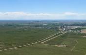
The runway doesn't look bad from the air. It's full of very large expansion cracks that have been sealed, but not leveled. Landing felt like a continuous crash. Once the plane shuddered to a halt, back-taxing involved more banging and crashing over the surface. Aircraft with large tires will be happier here.
There are no services. Hangers are located at the west end of the runway. The town is close by. There is a large substation immediately southwest of the runway full of towers.