Login
Register


SNY
Sidney Municipal/Lloyd W Carr Field Airport
Official FAA Data Effective 2025-11-27 0901Z
Chart Supplement

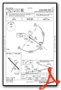
VFR Chart of KSNY
Sectional Charts at SkyVector.com
IFR Chart of KSNY
Enroute Charts at SkyVector.com
Location Information for KSNY
Coordinates: N41°5.99' / W102°59.10'Located 03 miles S of Sidney, Nebraska on 732 acres of land. View all Airports in Nebraska.
Surveyed Elevation is 4314 feet MSL.
Operations Data
|
|
Airport Communications
| ASOS: | 125.775 Tel. 308-254-3525 |
|---|---|
| CTAF: | 122.800 |
| UNICOM: | 122.800 |
| AWOS-3 at IBM (31.8 W): | 118.075 308-235-2516 |
| AWOS-3 at STK (31.8 SW): | 118.525 970-526-3009 |
| AWOS-3 at HEQ (45.2 SE): | 119.275 970-854-3679 |
- APCH/DEP CTL SVC PRVDD BY DENVER ARTCC (ZDV) ON FREQS 118.475/225.4 (BRUSH/B/ RCAG).
Nearby Navigation Aids
|
| ||||||||||||||||||||||||||||||||||||||||||||||||||||||||||||


Runway 13/31
| Dimensions: | 6600 x 100 feet / 2012 x 30 meters | |
|---|---|---|
| Surface: | Concrete in Good Condition | |
| Weight Limits: | S-32, D-52, ST-96 | |
| Edge Lighting: | High Intensity | |
| Runway 13 | Runway 31 | |
| Coordinates: | N41°6.46' / W102°59.63' | N41°5.70' / W102°58.61' |
| Elevation: | 4314.2 | 4281.9 |
| Traffic Pattern: | Left | Left |
| Runway Heading: | 135° True | 315° True |
| Markings: | Non-Precision Instrument in good condition. | Non-Precision Instrument in good condition. |
| Glide Slope Indicator | P2L (3.00° Glide Path Angle) | P2L (3.00° Glide Path Angle) UNUSBL BYD 8 DEGS RIGHT OF CNTRLN. |
| REIL: | Yes | Yes |
Runway 03/21
| Dimensions: | 4705 x 75 feet / 1434 x 23 meters | |
|---|---|---|
| Surface: | Turf in Good Condition | |
| Runway 03 | Runway 21 | |
| Coordinates: | N41°5.54' / W102°59.38' | N41°6.17' / W102°58.77' |
| Elevation: | 4297.5 | 4284.4 |
| Runway Heading: | 36° True | 216° True |
| Markings: | in fair condition. | in fair condition. |
Services Available
| Fuel: | 100LL (blue), Jet-A |
|---|---|
| Transient Storage: | Hangars,Tiedowns |
| Airframe Repair: | MAJOR |
| Engine Repair: | MINOR |
| Bottled Oxygen: | LOW |
| Bulk Oxygen: | NONE |
| Other Services: | PILOT INSTRUCTION,AIRCRAFT RENTAL |
Ownership Information
| Ownership: | Publicly owned | |
|---|---|---|
| Owner: | SIDNEY AIRPORT AUTHORITY | RON MEYER, CHAIRMAN, AIRPORT AUTHORITY |
| PO BOX 490 | ||
| SIDNEY, NE 69162-0490 | ||
| (308) 254-5058 | ||
| Manager: | GEORGE LAPASEOTES | |
| 11149 ROAD 16 | ||
| SIDNEY, NE 69162-4002 | ||
| (308) 254-5058 | MGR CAN ALSO BE REACHED AT 308-641-2584. | |
Other Remarks
- FOR CD CTC DENVER ARTCC ON FREQ. IF UNA, CTC FSS ON FREQ VIA RCO. IF UNA, CTC DENVER ARTCC AT 303-651-4257.
- DUSK-DAWN. ACTVT HIRL RY 13/31 & REIL RYS 13 & 31 - CTAF.
Weather Minimums


Instrument Approach Procedure (IAP) Charts


Nearby Airports with Instrument Procedures
| ID | Name | Heading / Distance | ||
|---|---|---|---|---|
 |
KIBM | Kimball Municipal/Robert E Arraj Field Airport | 279° | 31.8 |
|
KSTK | Sterling Municipal Airport | 203° | 31.8 |
|
KOKS | Garden County/King Rhiley Field Airport | 057° | 33.7 |
|
KHEQ | Holyoke Airport | 134° | 45.4 |
|
82V | Pine Bluffs Municipal Airport | 273° | 52.2 |
|
KBFF | Scottsbluff/Western Nebraska Regional/Wm B Heilig Field Airport | 329° | 54.0 |
|
KOGA | Searle Field Airport | 088° | 55.1 |
|
KAKO | Colorado Plains Regional Airport | 191° | 56.5 |
|
KAIA | Alliance Municipal Airport | 008° | 57.8 |
|
KGGF | Grant Municipal Airport | 103° | 58.5 |
|
KFMM | Fort Morgan Municipal Airport | 219° | 59.1 |
|
2V6 | Yuma Municipal Airport | 168° | 60.9 |
Airport Images
Do you have a recent image of this airport? Upload it here!


