Login
Register


A20
Sun Valley Airport
Official FAA Data Effective 2026-02-19 0901Z
Chart Supplement

VFR Chart of A20
Sectional Charts at SkyVector.com
IFR Chart of A20
Enroute Charts at SkyVector.com
Location Information for A20
Coordinates: N35°0.34' / W114°33.90'Located 07 miles S of Bullhead City, Arizona on 100 acres of land. View all Airports in Arizona.
Estimated Elevation is 725 feet MSL.
Operations Data
|
|
Airport Communications
| CTAF: | 122.975 |
|---|---|
| UNICOM: | 122.975 |
| AWOS-3PT at IFP (8.6 N): | 119.825 928-754-4462 |
| ATIS at IFP (8.9 N): | 119.825 |
| ASOS at EED (14.7 S): | 128.325 760-326-4281 |
Nearby Navigation Aids
|
| ||||||||||||||||||||||||||||||||||||


Runway 18/36
+2-6 FT BRUSH 35 FT E OF CNTRLN FULL LEN. DRAINAGE SWALE 25 FT LONG 40 FT R OF RWY FULL LEN. | ||
| Dimensions: | 3700 x 42 feet / 1128 x 13 meters | |
|---|---|---|
| Surface: | Asphalt in Good Condition | |
| Edge Lighting: | Low Intensity | |
| Runway 18 | Runway 36 | |
| Coordinates: | N35°0.64' / W114°33.90' | N35°0.03' / W114°33.90' |
| Traffic Pattern: | Right | |
| Markings: | Non-Standard in good condition. | Non-Standard in good condition. |
| Glide Slope Indicator | NSTD (3.00° Glide Path Angle) NON STD; SINGLE UNIT RED & WHITE LGTS L SIDE OF RWY; 3 DEG. | |
| Obstacles: | 10 ft Road 265 ft from runway 2-3 FT BRUSH 50-200 FT FM THR 40-125 FT R & L OF CNTRLN. 4 FT DIRT PILES 125-200 FT FM THR 75 FT R OF CNTRLN. |
1-2 FT BRUSH 20-200 FT FM RWY END ACRS CNTRLN. |
Services Available
| Fuel: | 100LL (blue), Jet-A |
|---|---|
| Transient Storage: | Hangars AVBLTY - AMGR. |
| Airframe Repair: | NOT AVAILABLE |
| Engine Repair: | NOT AVAILABLE |
| Bottled Oxygen: | NOT AVAILABLE |
| Bulk Oxygen: | NOT AVAILABLE |
| Other Services: | PILOT INSTRUCTION,AIRCRAFT RENTAL |
Ownership Information
| Ownership: | Privately Owned | |
|---|---|---|
| Owner: | CORRIGAN NAV STRAT LLC | |
| 5096 ANTELOPE | ||
| FORT MOHAVE, AZ 86426 | ||
| 760-315-5096 | ||
| Manager: | JIM LAMBERT | |
| 5050 S BISON AVE, SUITE 140-201 | ||
| MOHAVE, AZ 86426 | ||
| 760-315-5096 | ||
Other Remarks
- ALL OPS RMN E; SI OR DEP NA.
- FOR CD CTC LOS ANGELES ARTCC AT 661-575-2079.
- SELF SVC FUEL H24 WITH CREDIT CARD.
- NSTD LEN & WID.
- NSTD LEN & WID.
- FEE.
- ACTVT LIRL RWY 18/36 - CTAF.
Nearby Airports with Instrument Procedures
| ID | Name | Heading / Distance | ||
|---|---|---|---|---|
 |
KIFP | Laughlin/Bullhead International Airport | 001° | 8.9 |
|
KEED | Needles Airport | 191° | 14.6 |
|
KHII | Lake Havasu City Airport | 158° | 28.0 |
|
KIGM | Kingman Airport | 063° | 34.4 |
|
P20 | Avi Suquilla Airport | 163° | 53.3 |
|
KBVU | Boulder City Municipal Airport | 345° | 58.2 |
|
KHND | Henderson Exec Airport | 334° | 64.3 |
|
KLAS | Harry Reid International Airport | 336° | 70.5 |
|
KLSV | Nellis AFB Airport | 342° | 77.2 |
|
KVGT | North Las Vegas Airport | 337° | 78.5 |
|
KBLH | Blythe Airport | 185° | 83.4 |
|
KTNP | Twentynine Palms Airport | 232° | 86.1 |
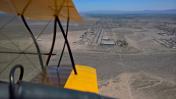
Airport Images

By: Barnstormers Bi...
By: Barnstormers Bi...


Comments
There is now a beacon and
There is now a beacon and lighted tetrahedron.
Fuel discounts are available contact Jim Lambert at jim@bullheadcityairport.com or by calling (760) 315-5096
One hangar is available. 42' X 33' with 3/4 bathroom. Electric bi-fold door. Annual, monthly, and daily rates.
Jim Lambert
Courtesy Car
Airnav suggests you have a courtesy car available. Is that correct?