Login
Register


AUW
Wausau Downtown Airport
Official FAA Data Effective 2025-11-27 0901Z
Chart Supplement

VFR Chart of KAUW
Sectional Charts at SkyVector.com
IFR Chart of KAUW
Enroute Charts at SkyVector.com
Location Information for KAUW
Coordinates: N44°55.58' / W89°37.62'Located 00 miles S of Wausau, Wisconsin on 294 acres of land. View all Airports in Wisconsin.
Surveyed Elevation is 1201 feet MSL.
Operations Data
|
|
Airport Communications
| ASOS: | 125.925 Tel. 715-843-7215 |
|---|---|
| UNICOM: | 122.700 |
| CTAF: | 122.700 |
| ATIS at CWA (9.1 S): | 127.45 |
| AWOS-3 at CWA (9.1 S): | 127.45 715-693-1116 |
| AWOS-3 at RRL (16.7 N): | 119.925 715-539-8422 |
- APCH/DEP SVC PRVDD BY MINNEAPOLIS ARTCC ON FREQS 124.4/317.7 (MOSINEE RCAG).
Nearby Navigation Aids
|
| ||||||||||||||||||||||||||||||||||||||||||||||||||||||||||||


Runway 12W/30W
| Dimensions: | 8000 x 300 feet / 2438 x 91 meters | |
|---|---|---|
| Surface: | Water in Good Condition | |
| Runway 12W | Runway 30W | |
| Coordinates: | N44°55.82' / W89°38.68' | N44°55.01' / W89°37.22' |
| Elevation: | 1166.0 | 1166.0 |
| Markings: | None in good condition. | None in good condition. |
Runway 13/31
| Dimensions: | 5200 x 100 feet / 1585 x 30 meters | |
|---|---|---|
| Surface: | Asphalt in Fair Condition | |
| Weight Limits: | S-45, D-80, ST-140 | |
| Edge Lighting: | Medium Intensity | |
| Runway 13 | Runway 31 | |
| Coordinates: | N44°55.84' / W89°38.35' | N44°55.36' / W89°37.35' |
| Elevation: | 1192.1 | 1190.1 |
| Traffic Pattern: | Left | Left |
| Runway Heading: | 124° True | 304° True |
| Markings: | Non-Precision Instrument in fair condition. | Non-Precision Instrument in fair condition. |
| Glide Slope Indicator | P4L (3.00° Glide Path Angle) | P4L (3.00° Glide Path Angle) |
| REIL: | Yes | Yes |
| Obstacles: | 34 ft Trees 250 ft from runway, 410 ft left of center 40 FT TREES 0-200 FT FM THR 300 FT R & 450 FT L. |
38 ft Trees 225 ft from runway, 375 ft left of center 30 FT TREES 150 FT FM THR 425 FT L. |
Runway 05/23
| Dimensions: | 3041 x 100 feet / 927 x 30 meters | |
|---|---|---|
| Surface: | Asphalt in Fair Condition | |
| Weight Limits: | S-32, D-55, ST-95 | |
| Edge Lighting: | Medium Intensity | |
| Runway 05 | Runway 23 | |
| Coordinates: | N44°55.37' / W89°37.47' | N44°55.73' / W89°36.98' |
| Elevation: | 1190.4 | 1201.0 |
| Traffic Pattern: | Left | Left |
| Runway Heading: | 44° True | 224° True |
| Markings: | Basic in fair condition. | Basic in fair condition. |
Services Available
| Fuel: | 100LL (blue), Jet A+, Automotive Gasoline |
|---|---|
| Transient Storage: | Hangars,Tiedowns |
| Airframe Repair: | MAJOR |
| Engine Repair: | MAJOR |
| Bottled Oxygen: | NOT AVAILABLE |
| Bulk Oxygen: | NOT AVAILABLE |
| Other Services: | PILOT INSTRUCTION,AIRCRAFT RENTAL |
Ownership Information
| Ownership: | Publicly owned | |
|---|---|---|
| Owner: | CITY OF WAUSAU | |
| 407 GRANT ST. | ||
| WAUSAU, WI 54403 | ||
| 715-261-6740 | ||
| Manager: | JOHN P CHMIEL | |
| 725 WOODS PLACE | ||
| WAUSAU, WI 54401 | ||
| 715-845-3400 | ||
Other Remarks
- FOR CD IF UNA TO CTC ON FSS FREQ, CTC MINNEAPOLIS ARTCC AT 651-463-5588.
- MIRL RWY 13/31 PRESET TO LOW; TO INCR INTST AND ACTVT REILS RWY 13 & 31; PAPI RWY 13 & 31; MIRL RWY 5/23 - CTAF.
Weather Minimums
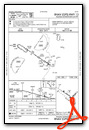
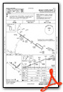
Instrument Approach Procedure (IAP) Charts
Nearby Airports with Instrument Procedures
| ID | Name | Heading / Distance | ||
|---|---|---|---|---|
 |
KCWA | Central Wisconsin Airport | 190° | 9.1 |
|
KRRL | Merrill Municipal Airport | 347° | 16.8 |
|
KSTE | Stevens Point Municipal Airport | 169° | 23.2 |
|
KAIG | Langlade County Airport | 057° | 25.9 |
|
KMFI | Marshfield Municipal Airport | 234° | 29.6 |
|
KMDZ | Taylor County Airport | 290° | 30.5 |
|
KTKV | Tomahawk Regional Airport | 347° | 33.5 |
|
KISW | Alexander Field South Wood County Airport | 195° | 35.2 |
|
KCLI | Clintonville Municipal Airport | 115° | 42.7 |
|
KRHI | Rhinelander/Oneida County Airport | 009° | 42.8 |
|
KVIQ | Neillsville Municipal Airport | 240° | 43.8 |
|
KPCZ | Waupaca Municipal Airport | 143° | 44.1 |
Airport Images
Do you have a recent image of this airport? Upload it here!


