Login
Register


CUT
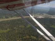
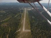
Custer County Airport
Official FAA Data Effective 2026-01-22 0901Z
Chart Supplement

VFR Chart of KCUT
Sectional Charts at SkyVector.com
IFR Chart of KCUT
Enroute Charts at SkyVector.com
Location Information for KCUT
Coordinates: N43°44.02' / W103°37.17'Located 02 miles SW of Custer, South Dakota on 86 acres of land. View all Airports in South Dakota.
Surveyed Elevation is 5619 feet MSL.
Operations Data
|
|
Airport Communications
| ASOS: | 120.00 Tel. 605-206-3961 |
|---|---|
| CTAF: | 122.800 |
| UNICOM: | 122.800 |
| ASOS at RAP (30.8 NE): | 118.525 605-223-0202 |
| AWOS-3PT at ECS (31.3 W): | 118.0 307-746-4896 |
| ATIS at RCA (33.3 NE): | 269.9 |
Nearby Navigation Aids
|
| ||||||||||||||||||||||||||||||||||||||||||||||||||||||||||||


Runway 08/26
| Dimensions: | 5500 x 60 feet / 1676 x 18 meters | |
|---|---|---|
| Surface: | Asphalt in Good Condition | |
| Weight Limits: | S-12 | |
| Edge Lighting: | Medium Intensity | |
| Runway 08 | Runway 26 | |
| Coordinates: | N43°43.99' / W103°37.79' | N43°44.04' / W103°36.55' |
| Elevation: | 5619.7 | 5549.1 |
| Traffic Pattern: | Left | Left |
| Runway Heading: | 87° True | 267° True |
| Markings: | Non-Precision Instrument in good condition. | Non-Precision Instrument in good condition. |
| Glide Slope Indicator | P4L (3.00° Glide Path Angle) | P4L (3.65° Glide Path Angle) |
| Obstacles: | 60 ft Trees 1500 ft from runway | |
Services Available
| Fuel: | 100LL (blue), Jet-A |
|---|---|
| Transient Storage: | Hangars,Tiedowns |
| Airframe Repair: | NONE |
| Engine Repair: | NONE |
| Bottled Oxygen: | NONE |
| Bulk Oxygen: | NONE |
| Other Services: | AIR AMBULANCE SERVICES,PILOT INSTRUCTION,AIRCRAFT RENTAL |
Ownership Information
| Ownership: | Publicly owned | |
|---|---|---|
| Owner: | CUSTER COUNTY | |
| 420 MT RUSHMORE RD | ||
| CUSTER, SD 57730 | ||
| 605-673-4824 | ||
| Manager: | BRENDEN HENDRICKSON | MGR CELL NUMBER 605-858-1246. |
| 12220 AVIATION WAY | ||
| CUSTER, SD 57730 | ||
| 605-673-3874 | ||
Other Remarks
- STRONG CROSSWINDS & WINDSHEAR MAY EXIST ON FINAL UNDER WINDY CONDS.
- CFM WINTER CONDS WITH AMGR 605-858-1246.
- BE ALERT: CHECK DENSITY ALT & LEAN MIXTURE FOR BEST OPERATION AT THIS ALT.
- 10 FT WILDLIFE FENCE AROUND PERIMETER OF AIRPORT.
- FUEL AVBL 24 HR WITH CREDIT CARD.
- FOR CD CTC ELLSWORTH APCH AT 605-385-6198, WHEN APCH CLSD CTC DENVER ARTCC AT 303-651-4257.
- HIGH VOL OF ACFT OPRNG INVOF OF MT RUSHMORE AND CRAZY HORSE MONUMENTS AT OR BLW 7500 FT; PILOTS ARE ADVISED TO MNT 122.85 FOR TFC ADVISORIES.
- ACTVT MIRL RWY 08/26; PAPI RWY 08 & 26 - CTAF.
Nearby Airports with Instrument Procedures
| ID | Name | Heading / Distance | ||
|---|---|---|---|---|
 |
KHSR | Hot Springs Municipal Airport | 155° | 24.1 |
|
KRAP | Rapid City Regional Airport | 052° | 30.7 |
|
KECS | Mondell Field Airport | 286° | 31.5 |
|
KRCA | Ellsworth AFB Airport | 042° | 33.3 |
|
49B | Sturgis Municipal Airport | 014° | 42.4 |
|
KSPF | Black Hills-Clyde Ice Field Airport | 350° | 45.4 |
|
KCDR | Chadron Municipal Airport | 156° | 58.5 |
|
KEFC | Belle Fourche Municipal Airport | 350° | 61.0 |
|
KIEN | Pine Ridge Airport | 130° | 64.8 |
|
W43 | Hulett Municipal Airport | 324° | 69.2 |
|
9V5 | Modisett Airport | 138° | 79.0 |
|
KGRN | Gordon Municipal Airport | 130° | 84.3 |