Login
Register


ECS
Mondell Field Airport
Official FAA Data Effective 2026-01-22 0901Z
Chart Supplement

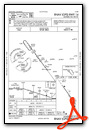
VFR Chart of KECS
Sectional Charts at SkyVector.com
IFR Chart of KECS
Enroute Charts at SkyVector.com
Location Information for KECS
Coordinates: N43°53.06' / W104°18.87'Located 05 miles NW of Newcastle, Wyoming on 241 acres of land. View all Airports in Wyoming.
Surveyed Elevation is 4177 feet MSL.
Operations Data
|
|
Airport Communications
| AWOS-3PT: | 118.0 Tel. 307-746-4896 |
|---|---|
| CTAF: | 122.800 |
| UNICOM: | 122.800 |
| ASOS at CUT (31.6 E): | 120.00 605-206-3961 |
| AWOS-3 at SPF (42.4 NE): | 118.325 605-642-8536 |
| AWOS-3PT at W43 (48.0 N): | 128.775 307-467-5575 |
- APCH/DEP CTL SVC PRVDD BY DENVER ARTCC (ZDV) ON FREQS 127.95/338.2 (CRAWFORD RCAG).
Nearby Navigation Aids
|
| ||||||||||||||||||||||||||||||||||||||||||


Runway 14/32
| Dimensions: | 5310 x 75 feet / 1618 x 23 meters | |
|---|---|---|
| Surface: | Asphalt in Good Condition | |
| Weight Limits: | 13 /F/C/W/U, S-30 | |
| Edge Lighting: | Medium Intensity | |
| Runway 14 | Runway 32 | |
| Coordinates: | N43°53.41' / W104°19.23' | N43°52.70' / W104°18.51' |
| Elevation: | 4168.7 | 4177.5 |
| Traffic Pattern: | Right | Left |
| Runway Heading: | 144° True | 324° True |
| Markings: | Non-Precision Instrument in good condition. | Non-Precision Instrument in good condition. |
| Glide Slope Indicator | P2L (3.00° Glide Path Angle) | P2L (3.00° Glide Path Angle) |
| Approach Lights: | ODALS Omnidirectional Approach Lighting System | |
| REIL: | Yes | |
| Obstacles: | 38 ft Railroad 1184 ft from runway, 125 ft left of center | |
Services Available
| Fuel: | 100LL (blue), Jet-A |
|---|---|
| Transient Storage: | Hangars,Tiedowns PILOT SUPPLIED ROPES RQD FOR TIE DOWNS. |
| Airframe Repair: | NONE |
| Engine Repair: | NONE |
| Bottled Oxygen: | NONE |
| Bulk Oxygen: | NONE |
| Other Services: | PILOT INSTRUCTION |
Ownership Information
| Ownership: | Publicly owned | |
|---|---|---|
| Owner: | CITY OF NEWCASTLE/WESTON CO | |
| COUNTY COURT HOUSE/1 W MAIN | ||
| NEWCASTLE, WY 82701 | ||
| 307-746-4744 | PHONE NUMBER FOR CITY 307-746-3535 | |
| Manager: | BYRAND STREETER | |
| PO BOX 699 | ||
| NEWCASTLE, WY 82701 | ||
| 307-746-4666 | ||
Other Remarks
- WILDLIFE ON OR NEAR THE RWYS. MIGRATORY BIRD FLT PATHS NEAR ARPT.
- SOFT SHOULDERS NEAR EDGES OF RWYS, TWYS, & RAMPS.
- FOR CD IF UNA TO CTC ON FSS FREQ, CTC DENVER ARTCC AT 303-651-4257.
- HIGH VOL OF ACFT OPRNG INVOF OF MT RUSHMORE AND CRAZY HORSE MONUMENTS AT OR BLW 7500 FT; PILOTS ARE ADVISED TO MNT 122.85 FOR TFC ADVISORIES.
- FOR ATTENDANT AFT HRS CALL 307-746-5805.
- 0LL FOR FUEL AFT HRS PHONE 307-746-5805.
- ACTVT ODALS RWY 32; REIL RWY 14; PAPI RWY 14 & 32; MIRL RWY 14/32 - CTAF.
Weather Minimums

Instrument Approach Procedure (IAP) Charts

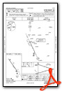
Nearby Airports with Instrument Procedures
| ID | Name | Heading / Distance | ||
|---|---|---|---|---|
 |
KSPF | Black Hills-Clyde Ice Field Airport | 032° | 42.5 |
|
W43 | Hulett Municipal Airport | 346° | 48.0 |
|
KHSR | Hot Springs Municipal Airport | 127° | 50.9 |
|
49B | Sturgis Municipal Airport | 051° | 51.6 |
|
KRCA | Ellsworth AFB Airport | 072° | 54.7 |
|
KEFC | Belle Fourche Municipal Airport | 020° | 54.6 |
|
KRAP | Rapid City Regional Airport | 079° | 55.3 |
|
KGCC | Northeast Wyoming Regional Airport | 298° | 59.8 |
|
KDGW | Converse County Airport | 216° | 80.3 |
|
KCDR | Chadron Municipal Airport | 139° | 82.4 |
|
KIEN | Pine Ridge Airport | 122° | 94.5 |
|
KGUR | Camp Guernsey Airport | 190° | 99.1 |
Airport Images
Do you have a recent image of this airport? Upload it here!


