Login
Register


DVP
Slayton Municipal Airport
Official FAA Data Effective 2026-01-22 0901Z
Chart Supplement

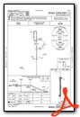
VFR Chart of KDVP
Sectional Charts at SkyVector.com
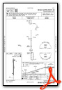
IFR Chart of KDVP
Enroute Charts at SkyVector.com
Location Information for KDVP
Coordinates: N43°59.21' / W95°46.96'Located 01 miles W of Slayton, Minnesota on 54 acres of land. View all Airports in Minnesota.
Estimated Elevation is 1623 feet MSL.
Operations Data
|
|
Airport Communications
| AWOS-3: | 118.55 Tel. 507-836-6128 |
|---|---|
| CTAF: | 122.900 |
| AWOS-3PT at TKC (17.6 NE): | 120.0 507-629-9006 |
| AWOS-3PT at OTG (21.8 SE): | 121.075 507-376-9441 |
| AWOS-3PT at PQN (22.4 W): | 118.375 507-825-6895 |
- APCH/DEP SVC PRVDD BY MINNEAPOLIS ARTCC ON FREQS 132.05/317.4 (SIOUX FALLS RCAG).
Nearby Navigation Aids
|
| ||||||||||||||||||||||||||||||||||||||||||||||||||||||||||||


Runway 17/35
| Dimensions: | 3005 x 60 feet / 916 x 18 meters | |
|---|---|---|
| Surface: | Asphalt in Good Condition | |
| Edge Lighting: | Medium Intensity | |
| Runway 17 | Runway 35 | |
| Coordinates: | N43°59.46' / W95°46.96' | N43°58.96' / W95°46.96' |
| Elevation: | 1614.7 | 1622.9 |
| Traffic Pattern: | Left | Left |
| Runway Heading: | 180° True | 0 |
| Markings: | Non-Precision Instrument in good condition. | Non-Precision Instrument in good condition. |
| Glide Slope Indicator | P2L (3.00° Glide Path Angle) | P2L (3.00° Glide Path Angle) |
| REIL: | Yes | Yes |
| Obstacles: | 15 ft Road 201 ft from runway, 235 ft right of center +44 FT TREES, 1356 FT DIST, 0 FT B, 26:1. +15 FT ROAD, 0-200 FT DIST, 235 FT R. |
15 ft Road 201 ft from runway, 235 ft left of center +30 FT PLINE, 1400 FT DIST, 0 FT B, 34:1. +15 FT ROAD, 0-200 FT DIST, 235 FT L. |
Services Available
| Fuel: | 100LL (blue) |
|---|---|
| Transient Storage: | Tiedowns |
| Airframe Repair: | NONE |
| Engine Repair: | NONE |
| Bottled Oxygen: | NONE |
| Bulk Oxygen: | NONE |
| Other Services: | CROP DUSTING SERVICES,AIRCRAFT SALES |
Ownership Information
| Ownership: | Publicly owned | |
|---|---|---|
| Owner: | CITY OF SLAYTON | |
| 2424 26TH ST | ||
| SLAYTON, MN 56172-1244 | ||
| 507-836-8534 | ||
| Manager: | JOSH MALCHOW | |
| 2424 26TH ST | ||
| SLAYTON, MN 56172-1244 | ||
| 507-836-8534 | ||
Other Remarks
- FOR CD CTC MINNEAPOLIS ARTCC AT 651-463-5588.
- ACTVT REIL RWY 17 & 35; PAPI RWY 17 & 35; MIRL RWY 17/35 - CTAF.
Weather Minimums


Instrument Approach Procedure (IAP) Charts
Nearby Airports with Instrument Procedures
| ID | Name | Heading / Distance | ||
|---|---|---|---|---|
 |
KTKC | Tracy Municipal Airport | 025° | 17.5 |
|
KOTG | Worthington Municipal Airport | 155° | 21.8 |
|
KPQN | Pipestone Municipal Airport | 269° | 22.4 |
|
KMML | Southwest Minnesota Regional Marshall/Ryan Field Airport | 356° | 28.0 |
|
KLYV | Quentin Aanenson Field Airport | 220° | 29.2 |
|
KMWM | Windom Municipal Airport | 098° | 29.5 |
|
KRRQ | Rock Rapids Municipal Airport | 208° | 36.4 |
|
D42 | Springfield Municipal Airport | 066° | 36.9 |
|
KISB | Sibley Municipal Airport | 178° | 37.1 |
|
KMJQ | Jackson Municipal Airport | 119° | 40.0 |
|
KRWF | Redwood Falls Municipal Airport | 041° | 45.2 |
|
KSHL | Sheldon Regional Airport | 182° | 46.8 |
Airport Images
Do you have a recent image of this airport? Upload it here!


