Login
Register
DYL
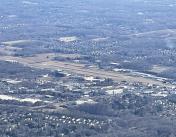
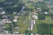
Doylestown Airport
Official FAA Data Effective 2026-01-22 0901Z
VFR Chart of KDYL
Sectional Charts at SkyVector.com
IFR Chart of KDYL
Enroute Charts at SkyVector.com
Location Information for KDYL
Coordinates: N40°19.98' / W75°7.34'Located 02 miles N of Doylestown, Pennsylvania on 200 acres of land. View all Airports in Pennsylvania.
Surveyed Elevation is 393 feet MSL.
Operations Data
|
|
Airport Communications
| ASOS: | 118.875 Tel. 215-345-0392 |
|---|---|
| PHILADELPHIA APPROACH: | 123.8 291.7 |
| PHILADELPHIA DEPARTURE: | 123.8 291.7 |
| CLEARANCE DELIVERY: | 118.55 |
| CTAF: | 122.975 |
| UNICOM: | 122.975 |
| AWOS-3 at CKZ (8.5 NW): | 126.325 215-257-7291 |
| AWOS-3 at UKT (13.4 NW): | 119.475 215-538-7610 |
| AWOS-3 at LOM (13.4 SW): | 118.925 215-646-1068 |
- CLEARANCE DELIVERY PHILADELPHIA APCH TF 800-354-9884.
Nearby Navigation Aids
|
| ||||||||||||||||||||||||||||||||||||||||||||||||||||||||||||
Runway 05/23
| Dimensions: | 3004 x 60 feet / 916 x 18 meters | |
|---|---|---|
| Surface: | Asphalt in Good Condition | |
| Weight Limits: | S-12 | |
| Edge Lighting: | Medium Intensity | |
| Runway 05 | Runway 23 | |
| Coordinates: | N40°19.79' / W75°7.54' | N40°20.18' / W75°7.14' |
| Elevation: | 391.8 | 393.5 |
| Traffic Pattern: | Left | Left |
| Runway Heading: | 37° True | 217° True |
| Displaced Threshold: | 84 Feet | |
| Markings: | Non-Precision Instrument in good condition. | Non-Precision Instrument in good condition. |
| Glide Slope Indicator | S2L (5.00° Glide Path Angle) | P2L (3.00° Glide Path Angle) |
| REIL: | Yes | |
| Obstacles: | 39 ft Trees 772 ft from runway, 281 ft right of center | 64 ft Trees 1162 ft from runway, 355 ft left of center |
Services Available
| Fuel: | 100LL (blue), Jet-A |
|---|---|
| Transient Storage: | Tiedowns |
| Airframe Repair: | MAJOR |
| Engine Repair: | MAJOR |
| Bottled Oxygen: | NONE |
| Bulk Oxygen: | LOW |
| Other Services: | CHARTER SERVICE,PILOT INSTRUCTION,AIRCRAFT RENTAL |
Ownership Information
| Ownership: | Publicly owned | |
|---|---|---|
| Owner: | BUCKS COUNTY AIRPORT AUTH | |
| BOX 1185 | ||
| DOYLESTOWN, PA 18902 | ||
| 215-345-1970 | ||
| Manager: | MARCEL BISSCHOPS | |
| 3879 OLD EASTON RD | ||
| DOYLESTOWN, PA 18902 | ||
| 215-340-0707 | ||
Other Remarks
- NOISE ABATEMENT PROCEDURES IN EFFECT; CTC AMGR 215-340-0707.
- DEER, GEESE AND OTHER WILDLIFE ON AND INVOF RWY.
- RWY 05 IS USED FOR CROSSWIND & CALM WIND RWY.
- FOR CD CTC PHILADELPHIA APCH AT 800-354-9884.
- ACTVT REIL 23; MIRL 05/23 - CTAF. MIRL 05/23 OPR CONSLY SS-SR.
Weather Minimums
Instrument Approach Procedure (IAP) Charts
Nearby Airports with Instrument Procedures
| ID | Name | Heading / Distance | ||
|---|---|---|---|---|
 |
KCKZ | Pennridge Airport | 293° | 8.4 |
 |
KUKT | Quakertown Airport | 297° | 13.4 |
 |
KLOM | Wings Field Airport | 209° | 13.4 |
 |
KTTN | Trenton Mercer Airport | 103° | 14.6 |
 |
N40 | Sky Manor Airport | 025° | 15.4 |
 |
KPNE | Northeast Philadelphia Airport | 161° | 15.9 |
 |
N85 | Alexandria Airport | 017° | 16.0 |
 |
KPTW | Heritage Field Airport | 254° | 20.7 |
 |
39N | Princeton Airport | 079° | 21.6 |
 |
KXLL | Allentown Queen City Municipal Airport | 310° | 22.0 |
 |
N51 | Solberg/Hunterdon Airport | 049° | 23.2 |
 |
KABE | Lehigh Valley International Airport | 322° | 24.1 |


