Login
Register


E01
Roy Hurd Memorial Airport
Official FAA Data Effective 2026-02-19 0901Z
Chart Supplement

VFR Chart of E01
Sectional Charts at SkyVector.com
IFR Chart of E01
Enroute Charts at SkyVector.com
Location Information for E01
Coordinates: N31°34.95' / W102°54.54'Located 01 miles SW of Monahans, Texas on 277 acres of land. View all Airports in Texas.
Surveyed Elevation is 2614 feet MSL.
Operations Data
|
|
Airport Communications
| AWOS-3PT: | 118.225 Tel. 432-943-2457 |
|---|---|
| UNICOM: | 122.800 |
| CTAF: | 122.800 |
| ASOS at INK (19.1 NW): | 118.325 432-527-3320 |
| AWOS-3 at PEQ (33.1 W): | 118.175 432-445-3867 |
| ASOS at ODO (33.5 NE): | 119.275 432-363-9719 |
- APCH/DEP SVC PRVDD BY FORT WORTH ARTCC (ZFW) ON FREQS 133.1/298.95 (MIDLAND RCAG).
Nearby Navigation Aids
|
| ||||||||||||||||||||||||||||||||||||||||||||||||||||||


Runway 12/30
| Dimensions: | 4268 x 75 feet / 1301 x 23 meters | |
|---|---|---|
| Surface: | Asphalt in Good Condition | |
| Weight Limits: | S-15 | |
| Edge Lighting: | Medium Intensity | |
| Runway 12 | Runway 30 | |
| Coordinates: | N31°35.16' / W102°54.85' | N31°34.74' / W102°54.19' |
| Elevation: | 2606.2 | 2610.4 |
| Traffic Pattern: | Left | Left |
| Runway Heading: | 127° True | 307° True |
| Markings: | Non-Precision Instrument in good condition. | Non-Precision Instrument in good condition. |
| Glide Slope Indicator | P2L (3.00° Glide Path Angle) | |
| Obstacles: | 25 ft Pole 495 ft from runway, 22 ft left of center | 46 ft Tree 1035 ft from runway, 36 ft right of center |
Runway 01/19
| Dimensions: | 2922 x 75 feet / 891 x 23 meters | |
|---|---|---|
| Surface: | Asphalt in Poor Condition NMRS LRG CRACKS. | |
| Weight Limits: | S-15 | |
| Edge Lighting: | Medium Intensity | |
| Runway 01 | Runway 19 | |
| Coordinates: | N31°34.72' / W102°54.67' | N31°35.17' / W102°54.48' |
| Elevation: | 2614.5 | 2608.1 |
| Traffic Pattern: | Left | Left |
| Runway Heading: | 20° True | 200° True |
| Markings: | Basic in good condition. | Basic in good condition. |
| Obstacles: | 25 ft Tank 1190 ft from runway, 60 ft left of center | 38 ft Tree 595 ft from runway, 200 ft right of center |
Services Available
| Fuel: | 100LL (blue), Jet-A |
|---|---|
| Transient Storage: | Tiedowns |
| Airframe Repair: | MINOR |
| Engine Repair: | MINOR |
| Bottled Oxygen: | NONE |
| Bulk Oxygen: | NONE |
| Other Services: | PILOT INSTRUCTION |
Ownership Information
| Ownership: | Publicly owned | |
|---|---|---|
| Owner: | CITY OF MONAHANS | |
| 112 WEST 2ND ST | ||
| MONAHANS, TX 79756 | ||
| 432-940-2633 | ||
| Manager: | JOHN CUTBIRTH | |
| P.O.BOX 1610 | ||
| MONAHANS, TX 79756 | ||
| 432-940-2633 | ||
Other Remarks
- THIS AIRPORT HAS BEEN SURVEYED BY THE NATIONAL GEODETIC SURVEY.
- DOWN SLOPE OFF END OF RWY 30.
- WILDLIFE & BIRDS ON & INVOF ARPT.
- FOR CD CTC FORT WORTH ARTCC AT 817-858-7584.
- RWY 19 APCH, 325 FT AGL 2953 MSL ANT, 1.45 NM NE OF ARPT.
- NMRS RWY LGTS OUT.
- HOLD LINE SIGNS FADED WHITE, RWY NRS NOT VSB.
- ACTVT PAPI RWY 12; MIRL RWY 01/19 & 12/30 - CTAF.
Weather Minimums


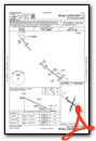
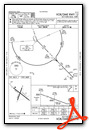
Instrument Approach Procedure (IAP) Charts

Nearby Airports with Instrument Procedures
| ID | Name | Heading / Distance | ||
|---|---|---|---|---|
 |
KINK | Winkler County Airport | 308° | 19.1 |
|
KPEQ | Pecos Municipal Airport | 248° | 33.1 |
|
KODO | Odessa-Schlemeyer Field Airport | 052° | 33.5 |
|
KFST | Fort Stockton-Pecos County Airport | 180° | 39.9 |
|
KMAF | Midland International Air and Space Port Airport | 059° | 42.1 |
|
E11 | Andrews County Airport | 023° | 48.8 |
|
KMDD | Midland Airpark Airport | 056° | 49.4 |
|
KGNC | Gaines County Airport | 011° | 66.7 |
|
KHOB | Lea County Regional Airport | 346° | 68.0 |
|
E41 | Reagan County Airport | 106° | 77.1 |
|
KBPG | Big Spring/Mc Mahon-Wrinkle Airport | 061° | 80.3 |
|
E38 | Alpine-Casparis Municipal Airport | 209° | 82.1 |
Airport Images
Do you have a recent image of this airport? Upload it here!


