Login
Register
F72
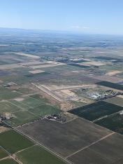
Franklin Field Airport
Official FAA Data Effective 2026-01-22 0901Z
VFR Chart of F72
Sectional Charts at SkyVector.com
IFR Chart of F72
Enroute Charts at SkyVector.com
Location Information for F72
Coordinates: N38°18.24' / W121°25.76'Located 04 miles SE of Franklin, California on 496 acres of land. View all Airports in California.
Surveyed Elevation is 23 feet MSL.
Operations Data
|
|
Airport Communications
| CTAF: | 122.900 |
|---|---|
| ASOS at SAC (12.6 N): | 916-421-0923 |
| ATIS at SAC (12.9 N): | 118.075 |
| AWOS-AV at O88 (14.6 SW): | 127.075 707-374-5396 |
Nearby Navigation Aids
|
| ||||||||||||||||||||||||||||||||||||
Runway 18/36
| Dimensions: | 3123 x 60 feet / 952 x 18 meters | |
|---|---|---|
| Surface: | Asphalt in Good Condition | |
| Weight Limits: | S-30 | |
| Runway 18 | Runway 36 | |
| Coordinates: | N38°18.63' / W121°25.67' | N38°18.13' / W121°25.83' |
| Elevation: | 22.8 | 20.6 |
| Traffic Pattern: | Right | |
| Runway Heading: | 194° True | 14° True |
| Markings: | Basic in good condition. | Basic in good condition. |
Runway 09/27
| Dimensions: | 3031 x 60 feet / 924 x 18 meters | |
|---|---|---|
| Surface: | Asphalt in Good Condition | |
| Weight Limits: | S-30 | |
| Runway 09 | Runway 27 | |
| Coordinates: | N38°18.16' / W121°26.08' | N38°18.03' / W121°25.46' |
| Elevation: | 19.3 | 21.8 |
| Traffic Pattern: | Right | |
| Runway Heading: | 104° True | 284° True |
| Markings: | Basic in good condition. | Basic in good condition. |
Services Available
| Fuel: | NONE |
|---|---|
| Transient Storage: | Tiedowns |
| Airframe Repair: | NONE |
| Engine Repair: | NONE |
| Bottled Oxygen: | NONE |
| Bulk Oxygen: | NONE |
Ownership Information
| Ownership: | Publicly owned | |
|---|---|---|
| Owner: | SACRAMENTO COUNTY | |
| 6151 FREEPORT BLVD | ||
| SACRAMENTO, CA 95822-3518 | ||
| 916-875-9035 | ||
| Manager: | RON OGLE | OFFICE AT SACRAMENTO EXECUTIVE AIRPORT. |
| 5999 FREEPORT BLVD | ||
| SACRAMENTO, CA 95822-3518 | ||
| 916-875-6852 | SACRAMENTO EXECUTIVE AIRPORT. | |
Other Remarks
- ALL RYS LTD TO 12,500 LBS GWT.
- TWY B CLSD PERMLY.
- MONITOR 122.9 WITHIN 5 MILES. EXTSV STUDENT TRAINING IN AREA.
- CALM WIND RY 18.
- AVOID OVERFLIGHT OF DETENTION FACILITY ON EAST SIDE OF ARPT EXCP IN EMERGENCY.
- CONDUCT HELICOPTER TRAINING N OF RY 09 & W OF RY 36.
- ULTRALIGHTS ACTIVITY INVOF ARPT.
- FOR CD CTC NORCAL APCH AT 916-361-6874.
Nearby Airports with Instrument Procedures
| ID | Name | Heading / Distance | ||
|---|---|---|---|---|
 |
1O3 | Lodi Airport | 128° | 9.7 |
 |
KSAC | Sacramento Exec Airport | 346° | 12.9 |
 |
O88 | Rio Vista Municipal Airport | 243° | 14.6 |
 |
KMHR | Sacramento Mather Airport | 022° | 16.3 |
 |
KEDU | University Airport | 309° | 21.7 |
 |
KMCC | Mc Clellan Airfield Airport | 003° | 21.8 |
 |
KSUU | Travis AFB Airport | 264° | 23.5 |
 |
KSMF | Sacramento International Airport | 342° | 24.7 |
 |
KVCB | Nut Tree Airport | 280° | 25.5 |
 |
KDWA | Yolo County Airport | 309° | 26.1 |
 |
KSCK | Stockton Metro Airport | 159° | 26.2 |
 |
C83 | Byron Airport | 198° | 30.0 |


