Login
Register


FET
Fremont Municipal Airport
Official FAA Data Effective 2026-02-19 0901Z
Chart Supplement

VFR Chart of KFET
Sectional Charts at SkyVector.com
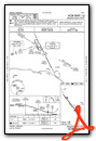
IFR Chart of KFET
Enroute Charts at SkyVector.com
Location Information for KFET
Coordinates: N41°27.00' / W96°31.27'Located 02 miles NW of Fremont, Nebraska on 639 acres of land. View all Airports in Nebraska.
Surveyed Elevation is 1204 feet MSL.
Operations Data
|
|
Airport Communications
| AWOS-3: | 121.275 Tel. 402-727-9135 |
|---|---|
| OMAHA APPROACH: | 135.875 354.05 |
| OMAHA DEPARTURE: | 135.875 354.05 |
| CTAF: | 122.800 |
| UNICOM: | 122.800 |
| AWOS-3P at AHQ (13.0 S): | 125.975 402-443-4030 |
| AWOS-3 at BTA (18.7 E): | 120.225 402-426-0448 |
| AWOS-3 at MLE (23.9 SE): | 118.25 402-895-6778 |
Nearby Navigation Aids
|
| ||||||||||||||||||||||||||||||||||||||||||||||||||||||||||||


Runway 14/32
| Dimensions: | 6353 x 100 feet / 1936 x 30 meters | |
|---|---|---|
| Surface: | Concrete in Good Condition RWY 14 PVMNT SOUTH OF DSP THR PCI RATED POOR FOR 2300 FT. | |
| Weight Limits: | S-28, D-48 | |
| Edge Lighting: | Medium Intensity | |
| Runway 14 | Runway 32 | |
| Coordinates: | N41°27.46' / W96°31.84' | N41°26.64' / W96°30.96' |
| Elevation: | 1203.0 | 1202.7 |
| Traffic Pattern: | Left | Right |
| Runway Heading: | 141° True | 321° True |
| Displaced Threshold: | 850 Feet | 850 Feet |
| Declared Distances: | TORA:5500 TODA:5500 ASDA:5500 LDA:4650 | TORA:5500 TODA:5500 ASDA:5500 LDA:4650 |
| Markings: | Non-Precision Instrument in good condition. | Non-Precision Instrument in good condition. |
| Glide Slope Indicator | P2L (3.00° Glide Path Angle) | P2L (3.00° Glide Path Angle) PAPI LGT OTS INDEF. |
| REIL: | Yes | |
| Obstacles: | 29 ft Pole 422 ft from runway, 93 ft right of center APCH SLP 43:1 TO DTHR OVR +29 FT LIGHT POLE, 1272 FT DIST. |
54 ft Tree 795 ft from runway, 243 ft left of center APCH SLP 30:1 TO DTHR OVR +66 FT TREE, 2017 FT DIST 309 L & +51 FT TREE, 1521 FT DIST, 405 L. |
Services Available
| Fuel: | 100LL (blue), Jet-A |
|---|---|
| Transient Storage: | Tiedowns |
| Airframe Repair: | MAJOR |
| Engine Repair: | MAJOR |
| Bottled Oxygen: | HIGH |
| Bulk Oxygen: | LOW |
| Other Services: | PILOT INSTRUCTION,AIRCRAFT RENTAL |
Ownership Information
| Ownership: | Publicly owned | |
|---|---|---|
| Owner: | CITY OF FREMONT | JODY SANDERS, CITY ADMINISTRATOR |
| 400 EAST MILITARY AVENUE | ||
| FREMONT, NE 68025-5141 | ||
| 402-727-2630 | ||
| Manager: | CARI HOFFART | CARI HOFFART, AIRPORT MANAGER & DAN GILLIS, PUBLIC WORKS DIRECTOR |
| 97 WEST 3RD STREET | ||
| FREMONT, NE 68025-4945 | ||
| 402-727-2691 | ||
Other Remarks
- (E81) TURN OFF ONLY.
- FOR CD CTC OMAHA APCH AT 402-682-4395.
- FORMER RWY 1/19 IN USE AS TWY ONLY.
- ACTVT REIL RY 14 & PAPI RYS 14 & 32 - CTAF.
Weather Minimums


Instrument Approach Procedure (IAP) Charts


Nearby Airports with Instrument Procedures
| ID | Name | Heading / Distance | ||
|---|---|---|---|---|
 |
KSCB | Scribner State Airport | 333° | 10.8 |
|
KAHQ | Wahoo Municipal Airport | 194° | 13.0 |
|
KBTA | Blair Exec Airport | 096° | 18.7 |
|
KMLE | Millard Airport | 129° | 24.0 |
|
KTQE | Tekamah Municipal Airport | 039° | 24.3 |
|
KOMA | Eppley Airfield Airport | 107° | 29.7 |
|
93Y | David City Municipal Airport | 244° | 30.2 |
|
KOFF | Offutt AFB Airport | 125° | 34.1 |
|
KCBF | Council Bluffs Municipal Airport | 108° | 36.3 |
|
KOLU | Columbus Municipal Airport | 270° | 37.0 |
|
KLNK | Lincoln Airport | 196° | 37.5 |
|
KPMV | Plattsmouth Municipal/Douglas V Duey Field Airport | 137° | 40.7 |
Airport Images
 Municipal")
By: 2flaps


