Login
Register


GGP
Logansport/Cass County Airport
Official FAA Data Effective 2026-01-22 0901Z
Chart Supplement

VFR Chart of KGGP
Sectional Charts at SkyVector.com
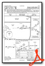
IFR Chart of KGGP
Enroute Charts at SkyVector.com
Location Information for KGGP
Coordinates: N40°42.68' / W86°22.36'Located 02 miles S of Logansport, Indiana on 120 acres of land. View all Airports in Indiana.
Surveyed Elevation is 738 feet MSL.
Operations Data
|
|
Airport Communications
| AWOS-3P: | 118.5 Tel. 574-737-7310 |
|---|---|
| GRISSOM APPROACH: | 121.05 338.275 |
| GRISSOM DEPARTURE: | 121.05 338.275 |
| UNICOM: | 122.800 |
| CTAF: | 122.800 |
| ATIS at GUS (10.7 E): | 270.8 |
| AWOS-3P at MCX (17.8 W): | 124.05 574-583-0531 |
| AWOS-3PT at OKK (18.1 SE): | 128.675 765-452-3014 |
- APCH/DEP SVC PRVDD BY CHICAGO ARTCC ON FREQS 121.05 (REMOTED FROM GRISSOM) WHEN GRISSOM APCH CTL CLSD.
Nearby Navigation Aids
|
| ||||||||||||||||||||||||||||||||||||||||||||||||||||||||||||


Runway 09/27
| Dimensions: | 5001 x 75 feet / 1524 x 23 meters | |
|---|---|---|
| Surface: | Asphalt / Grooved in Good Condition | |
| Weight Limits: | S-20 | |
| Edge Lighting: | Medium Intensity | |
| Runway 09 | Runway 27 | |
| Coordinates: | N40°42.67' / W86°22.90' | N40°42.68' / W86°21.82' |
| Elevation: | 735.9 | 738.1 |
| Traffic Pattern: | Left | Left |
| Runway Heading: | 89° True | 269° True |
| Declared Distances: | TORA:5001 TODA:5001 ASDA:5001 LDA:5001 | TORA:5001 TODA:5001 ASDA:5001 LDA:5001 |
| Markings: | Non-Precision Instrument in good condition. | Non-Precision Instrument in good condition. |
| Glide Slope Indicator | P2L (3.00° Glide Path Angle) | P2L (3.00° Glide Path Angle) |
| REIL: | Yes | Yes |
Services Available
| Fuel: | 100LL (blue), Jet-A |
|---|---|
| Transient Storage: | Hangars,Tiedowns |
| Airframe Repair: | MAJOR |
| Engine Repair: | MAJOR |
| Bottled Oxygen: | NONE |
| Bulk Oxygen: | NONE |
| Other Services: | AIR FREIGHT SERVICES,CROP DUSTING SERVICES,CARGO HANDLING SERVICES,CHARTER SERVICE,PILOT INSTRUCTION,AIRCRAFT RENTAL |
Ownership Information
| Ownership: | Publicly owned | |
|---|---|---|
| Owner: | LOGANSPORT CASS ARPT AUTHORITY | |
| 3735 S. AIRPORT RD | ||
| LOGANSPORT, IN 46947 | ||
| 574-753-4300 | ||
| Manager: | CHAD WEISEND | |
| 3735 S. AIRPORT RD | ||
| LOGANSPORT, IN 46947 | ||
| (574) 753-4300 | ||
Other Remarks
- LANDFILL 1.5 NM NE OF ARPT.
- FOR CD CTC CHICAGO ARTCC AT 630-906-8921.
- 0LL SELF SVC WITH CREDIT CARD.
- ACTVT REIL RWY 09 & 27; PAPI RWY 09 & 27; MIRL RWY 09/27 - CTAF. MIRL RWY 09/27 PRESET LOW INTST; INCR INTST - CTAF.
Weather Minimums

Instrument Approach Procedure (IAP) Charts

Nearby Airports with Instrument Procedures
| ID | Name | Heading / Distance | ||
|---|---|---|---|---|
 |
KGUS | Grissom Arb Airport | 110° | 10.8 |
|
I76 | Peru Municipal Airport | 066° | 11.2 |
|
1I9 | Delphi Municipal Airport | 234° | 17.4 |
|
KMCX | White County Airport | 269° | 18.0 |
|
KOKK | Kokomo Municipal Airport | 127° | 18.0 |
|
KRCR | Fulton County Airport | 022° | 23.0 |
|
KRWN | Arens Field Airport | 334° | 25.3 |
|
KIWH | Wabash Municipal Airport | 083° | 26.4 |
|
KFKR | Frankfort Clinton County Regional Airport | 198° | 27.6 |
|
KLAF | Purdue University Airport | 235° | 31.4 |
|
5I4 | Sheridan Airport | 167° | 32.7 |
|
KMZZ | Marion Municipal - Mckinney Field Airport | 112° | 34.3 |
Airport Images
Do you have a recent image of this airport? Upload it here!


