Login
Register


HRU
Herington Regional Airport
Official FAA Data Effective 2026-02-19 0901Z
Chart Supplement

VFR Chart of KHRU
Sectional Charts at SkyVector.com
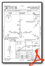
IFR Chart of KHRU
Enroute Charts at SkyVector.com
Location Information for KHRU
Coordinates: N38°41.68' / W96°48.48'Located 07 miles NE of Herington, Kansas on 1709 acres of land. View all Airports in Kansas.
Surveyed Elevation is 1480 feet MSL.
Operations Data
|
|
Airport Communications
| CTAF: | 122.900 |
|---|---|
| ATIS at FRI (21.6 N): | 121.025 |
| ASOS at FRI (21.6 N): | |
| AWOS-3P at K78 (23.5 NW): | 124.125 785-802-8625 |
- APCH/DEP CTL SVC PRVDD BY KANSAS CITY ARTCC (ZKC) ON 127.35/257.975 (MANHATTAN RCAG).
Nearby Navigation Aids
|
| ||||||||||||||||||||||||||||||||||||||||||||||||||||||||||||


Runway 17/35
| Dimensions: | 4184 x 75 feet / 1275 x 23 meters | |
|---|---|---|
| Surface: | Concrete in Excellent Condition | |
| Weight Limits: | 12 /R/B/W/T, S-38, D-52 | |
| Edge Lighting: | Medium Intensity | |
| Runway 17 | Runway 35 | |
| Coordinates: | N38°42.03' / W96°48.48' | N38°41.34' / W96°48.48' |
| Elevation: | 1478.1 | 1477.1 |
| Traffic Pattern: | Left | Left |
| Runway Heading: | 180° True | 0 |
| Markings: | Non-Precision Instrument in fair condition. | Non-Precision Instrument in fair condition. |
| Glide Slope Indicator | P4L (3.00° Glide Path Angle) | P4L (3.00° Glide Path Angle) |
| REIL: | Yes | Yes |
Services Available
| Fuel: | 100LL (blue) |
|---|---|
| Transient Storage: | Tiedowns |
| Airframe Repair: | NONE |
| Engine Repair: | NONE |
| Bottled Oxygen: | NONE |
| Bulk Oxygen: | NONE |
| Other Services: | CROP DUSTING SERVICES |
Ownership Information
| Ownership: | Publicly owned | |
|---|---|---|
| Owner: | CITY OF HERINGTON | |
| 17 N. BROADWAY, P O BOX 31 | ||
| HERINGTON, KS 67449 | ||
| 785-258-2271 | ||
| Manager: | MERLIN OSWALD | |
| 3134 US HWY 56 | ||
| HERINGTON, KS 67449 | ||
| 785-258-2877 | ASST AMGR 785-200-5019. | |
Other Remarks
- RDO-CTLD MODEL ACFT ACTIVITY ON ARPT WKENDS & HOLS.
- FOR CD CTC KANSAS CITY ARTCC AT 913-254-8508.
- 0LL FUEL 24 HRS SELF-SERVE.
- ACTIVT REIL RWY 17 & 35, PAPI RWY 17 & 35, MIRL RWY 17/35 - CTAF.
Weather Minimums

Instrument Approach Procedure (IAP) Charts


Nearby Airports with Instrument Procedures
| ID | Name | Heading / Distance | ||
|---|---|---|---|---|
 |
3JC | Freeman Field Airport | 355° | 21.0 |
|
K78 | Abilene Municipal Airport | 302° | 23.7 |
|
KMHK | Manhattan Regional Airport | 013° | 27.5 |
|
KEMP | Emporia Municipal Airport | 126° | 36.4 |
|
KSLN | Salina Regional Airport | 278° | 40.0 |
|
47K | Moundridge Municipal Airport | 228° | 43.8 |
|
KEWK | Newton-City-County Airport | 210° | 44.1 |
|
KCYW | Clay Center Municipal Airport | 338° | 44.6 |
|
KMPR | Mc Pherson Airport | 244° | 46.4 |
|
KEQA | El Dorado/Capt Jack Thomas Memorial Airport | 180° | 55.2 |
|
KFOE | Topeka Regional Airport | 073° | 55.8 |
|
KUKL | Coffey County Airport | 114° | 56.2 |
Airport Images

By: Michael Vernon


