Login
Register


CEK
Crete Municipal Airport
Official FAA Data Effective 2026-01-22 0901Z
Chart Supplement

VFR Chart of KCEK
Sectional Charts at SkyVector.com
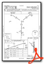
IFR Chart of KCEK
Enroute Charts at SkyVector.com
Location Information for KCEK
Coordinates: N40°37.10' / W96°55.54'Located 02 miles E of Crete, Nebraska on 211 acres of land. View all Airports in Nebraska.
Surveyed Elevation is 1499 feet MSL.
Operations Data
|
|
Airport Communications
| OMAHA APPROACH: | 124.0 270.3 |
|---|---|
| OMAHA DEPARTURE: | 124.0 270.3 |
| UNICOM: | 122.800 |
| CTAF: | 122.800 |
| ATIS at LNK (15.9 NE): | 118.05 |
| ASOS at LNK (15.9 NE): | 402-417-0560 |
| AWOS-3 at BIE (20.7 S): | 125.325 402-228-3229 |
Nearby Navigation Aids
|
| ||||||||||||||||||||||||||||||||||||||||||||||||||||||||||||


Runway 17/35
| Dimensions: | 4201 x 75 feet / 1280 x 23 meters | |
|---|---|---|
| Surface: | Concrete in Fair Condition | |
| Weight Limits: | S-28, D-48 | |
| Edge Lighting: | High Intensity | |
| Runway 17 | Runway 35 | |
| Coordinates: | N40°37.42' / W96°55.49' | N40°36.73' / W96°55.50' |
| Elevation: | 1499.1 | 1478.8 |
| Traffic Pattern: | Left | Left |
| Runway Heading: | 180° True | 0 |
| Markings: | Non-Precision Instrument in good condition. | Non-Precision Instrument in good condition. |
| Glide Slope Indicator | P2L (3.00° Glide Path Angle) RY 17 PAPI UNUSBL BYD 8 DEGS LEFT OF CNTRLN. | P2L (3.00° Glide Path Angle) |
| REIL: | Yes | Yes |
Runway 13/31
| Dimensions: | 3370 x 150 feet / 1027 x 46 meters | |
|---|---|---|
| Surface: | Turf in Fair Condition | |
| Runway 13 | Runway 31 | |
| Coordinates: | N40°37.34' / W96°55.86' | N40°36.94' / W96°55.35' |
| Elevation: | 1491.4 | 1495.8 |
| Runway Heading: | 135° True | 315° True |
Services Available
| Fuel: | 100LL (blue), Jet-A |
|---|---|
| Transient Storage: | Hangars,Tiedowns |
| Airframe Repair: | MAJOR |
| Engine Repair: | MAJOR |
| Bottled Oxygen: | HIGH/LOW |
| Bulk Oxygen: | NONE |
| Other Services: | AIR AMBULANCE SERVICES,AVIONICS,PILOT INSTRUCTION,AIRCRAFT RENTAL LIMITED BASIS - STUDENT MUST PROVIDE OWN AIRPLANE |
Ownership Information
| Ownership: | Publicly owned | |
|---|---|---|
| Owner: | CITY OF CRETE | BLAINE SPANJER, ACTING CHMN ADVISORY BOARD, PHONE 402-440-3153. |
| PO BOX 86 | ||
| CRETE, NE 68333-0086 | CITY OF CRETE, NEBRASKA | |
| (402) 826-7673 | ||
| Manager: | JUSTIN HAACK | |
| 2429 COUNTY ROAD F, CRETE AVIATION | ||
| CRETE, NE 68333-0014 | ||
| 402-826-4408 | ||
Other Remarks
- FOR CD CTC OMAHA APCH AT 402-682-4395.
- 0LL FOR SVC AFT HRS 402-314-0887.
- FOR SVC AFT HRS 402-314-0887.
- AVIONICS MAINT SVC PHONE NR: 402-710-0128.
Weather Minimums

Instrument Approach Procedure (IAP) Charts


Nearby Airports with Instrument Procedures
| ID | Name | Heading / Distance | ||
|---|---|---|---|---|
 |
KLNK | Lincoln Airport | 028° | 15.9 |
|
KSWT | Seward Municipal Airport | 330° | 17.0 |
|
KBIE | Beatrice Municipal Airport | 157° | 20.6 |
|
KFBY | Fairbury Municipal Airport | 203° | 28.4 |
|
KFMZ | Fairmont State Airport | 266° | 29.7 |
|
KJYR | York Municipal Airport | 297° | 35.9 |
|
0G3 | Tecumseh Municipal Airport | 110° | 36.9 |
|
93Y | David City Municipal Airport | 346° | 37.8 |
|
KAHQ | Wahoo Municipal Airport | 021° | 40.2 |
|
KHJH | Hebron Municipal Airport | 227° | 41.2 |
|
KMYZ | Marysville Municipal Airport | 163° | 47.7 |
|
KAFK | Nebraska City Municipal Airport | 090° | 48.4 |
Airport Images
Do you have a recent image of this airport? Upload it here!


