Login
Register


EWB
New Bedford Regional Airport
Official FAA Data Effective 2026-02-19 0901Z
Chart Supplement

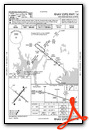
KEWB Airport Diagram

VFR Chart of KEWB
Sectional Charts at SkyVector.com
IFR Chart of KEWB
Enroute Charts at SkyVector.com
Location Information for KEWB
Coordinates: N41°40.59' / W70°57.47'Located 02 miles NW of New Bedford, Massachusetts on 925 acres of land. View all Airports in Massachusetts.
Surveyed Elevation is 79 feet MSL.
Operations Data
|
|
Airport Communications
| ATIS: | 126.85 (508-994-6277) |
|---|---|
| ASOS: | 126.85 Tel. 508-992-0195 |
| NEW BEDFORD TOWER: | 118.1 239.0 |
| NEW BEDFORD GROUND: | 121.9 |
| PROVIDENCE APPROACH: | 128.7 269.525 |
| PROVIDENCE DEPARTURE: | 128.7 269.525 |
| EMERG: | 121.5 243.0 |
| WIPOR STAR: | 123.675 244.875 |
| UNICOM: | 122.950 |
| CTAF: | 118.100 |
| ASOS at TAN (12.3 N): | 132.675 508-824-5005 |
| ASOS at UUU (16.9 SW): | 132.075 401-846-5910 |
| ASOS at PYM (17.3 NE): | 135.625 508-732-8358 |
- APCH/DEP SVC PRVDD BY BOSTON ARTCC ON FREQS 124.85/307.9 (WOODSTOCK RCAG) WHEN PROVIDENCE APCH CTL CLSD.
Nearby Navigation Aids
|
| ||||||||||||||||||||||||||||||||||||||||||||||||||||||


Runway 05/23
RWY 05/23 NOT AVBL FOR PART 121/PART 380 OPS WITH SKED PAX CARRYING OPS MORE THAN 9 PAX SEATS AND NON-SKED PAX CARRYING OPS MORE THAN 30 PAX SEATS. 90 DAY PPR FOR UNSKED ACR OPS GTR THAN 30 PAX SEATS - CALL AMGR. | ||
| Dimensions: | 5400 x 150 feet / 1646 x 46 meters | |
|---|---|---|
| Surface: | Asphalt / Grooved in Good Condition | |
| Weight Limits: | S-30, D-108, ST-195
PCR VALUE: 810/F/A/X/T
| |
| Edge Lighting: | High Intensity | |
| Runway 05 | Runway 23 | |
| Coordinates: | N41°40.28' / W70°57.90' | N41°40.97' / W70°57.16' |
| Elevation: | 64.4 | 79.1 |
| Traffic Pattern: | Left | Left |
| Runway Heading: | 38° True | 218° True |
| Displaced Threshold: | 400 Feet | |
| Markings: | Precision Instrument in good condition. | Precision Instrument in good condition. |
| Glide Slope Indicator | P4L (3.00° Glide Path Angle) | |
| RVR Equipment | Touchdown | Rollout |
| Approach Lights: | MALSR 1,400 Foot Medium-intensity Approach Lighting System with runway alignment indicator lights. | MALSR 1,400 Foot Medium-intensity Approach Lighting System with runway alignment indicator lights. |
| Obstacles: | 20 ft Tree 1200 ft from runway | 35 ft Tree 1400 ft from runway APCH SLP 50:1 AT DTHR. |
Runway 14/32
RWY 14/32 NOT AVBL FOR PART 121/PART 380 OPS WITH SKED PAX CARRYING OPS MORE THAN 9 PAX SEATS AND NON-SKED PAX CARRYING OPS MORE THAN 30 PAX SEATS. 90 DAY PPR FOR UNSKED ACR OPS GTR THAN 30 PAX SEATS - CALL AMGR. | ||
| Dimensions: | 5002 x 75 feet / 1525 x 23 meters | |
|---|---|---|
| Surface: | Asphalt in Fair Condition | |
| Weight Limits: | S-33, D-48, ST-95
PCR VALUE: 930/F/A/X/T
| |
| Edge Lighting: | Medium Intensity | |
| Runway 14 | Runway 32 | |
| Coordinates: | N41°40.82' / W70°57.84' | N41°40.31' / W70°56.98' |
| Elevation: | 77.3 | 66.2 |
| Traffic Pattern: | Left | Left |
| Runway Heading: | 128° True | 308° True |
| Markings: | Basic in good condition. | Basic in good condition. |
| Glide Slope Indicator | P4L (3.42° Glide Path Angle) | P4L (3.50° Glide Path Angle) |
| REIL: | Yes | |
| Obstacles: | 10 ft Tree 400 ft from runway | 11 ft Trees 600 ft from runway, 130 ft right of center |
Services Available
| Fuel: | 100LL (blue), Jet-A |
|---|---|
| Transient Storage: | Hangars,Tiedowns |
| Airframe Repair: | MAJOR |
| Engine Repair: | MAJOR |
| Bottled Oxygen: | HIGH/LOW |
| Bulk Oxygen: | NOT AVAILABLE |
| Other Services: | AIR FREIGHT SERVICES,CHARTER SERVICE,PILOT INSTRUCTION,AIRCRAFT RENTAL,AIRCRAFT SALES |
Ownership Information
| Ownership: | Publicly owned | |
|---|---|---|
| Owner: | CITY OF NEW BEDFORD | |
| 133 WILLIAMS ST | ||
| NEW BEDFORD, MA 02740 | ||
| 508-979-1410 | ||
| Manager: | SCOT SERVIS | |
| 1569 AIRPORT RD | ||
| NEW BEDFORD, MA 02746 | ||
| 508-991-6161 | ||
Other Remarks
- BIRDS & WILDLIFE ON & INVOF ARPT.
- LDG FEES FOR ACFT OVR 3000 LBS.
- FOR CD WHEN APCH CLSD CTC BOSTON ARTCC AT 603-879-6859.
- TWYS A1 & A2 FOR ACR ACFT ONLY.
- WHEN ATCT CLSD ACTVT MALSR RWYS 05 & 23; REIL RWY 32; HIRL RWY 05/23; MIRL RWY 14/32 - CTAF. PAPI RWYS 14, 23 & 32 OPR 24 HRS.
Weather Minimums

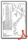
Standard Terminal Arrival (STAR) Charts
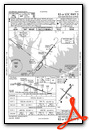
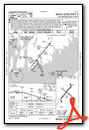
Instrument Approach Procedure (IAP) Charts


Nearby Airports with Instrument Procedures
| ID | Name | Heading / Distance | ||
|---|---|---|---|---|
 |
KTAN | Taunton Municipal/King Field Airport | 347° | 12.1 |
|
KUUU | Newport State Airport | 239° | 16.9 |
|
KPYM | Plymouth Municipal Airport | 036° | 17.3 |
|
5B6 | Falmouth Airpark Airport | 106° | 19.6 |
|
KFMH | Cape Cod Coast Guard Air Station Airport | 092° | 19.6 |
|
KOQU | Quonset State Airport | 257° | 21.0 |
|
KPVD | Rhode Island Tf Green International Airport | 277° | 21.3 |
|
1B9 | Mansfield Municipal Airport | 331° | 22.2 |
|
KMVY | Martha's Vineyard Airport | 137° | 23.0 |
|
KSFZ | North Central State Airport | 301° | 28.1 |
|
KGHG | Marshfield Municipal - George Harlow Field Airport | 026° | 28.3 |
|
KHYA | Cape Cod Gateway Airport | 090° | 30.5 |
Fuel Providers

Airport Images

By: grant powers


