Login
Register


GFZ
Greenfield Municipal Airport
Official FAA Data Effective 2025-12-25 0901Z
Chart Supplement

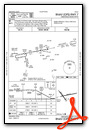
VFR Chart of KGFZ
Sectional Charts at SkyVector.com
IFR Chart of KGFZ
Enroute Charts at SkyVector.com
Location Information for KGFZ
Coordinates: N41°19.63' / W94°26.71'Located 02 miles NE of Greenfield, Iowa on 38 acres of land. View all Airports in Iowa.
Surveyed Elevation is 1363 feet MSL.
Operations Data
|
|
Airport Communications
| CTAF: | 122.900 |
|---|---|
| AWOS-3 at CSQ (18.7 S): | 124.75 641-782-6286 |
| AWOS-3 at AIO (27.5 W): | 127.825 712-243-2748 |
| AWOS-3 at ADU (31.0 NW): | 118.075 712-563-2101 |
- APCH/DEP SVC PRVDD BY MINNEAPOLIS ARTCC ON FREQS 125.65/306.950 (DES MOINES RCAG).
Nearby Navigation Aids
|
| ||||||||||||||||||||||||||||||||||||||||||


Runway 07/25
| Dimensions: | 3400 x 60 feet / 1036 x 18 meters | |
|---|---|---|
| Surface: | Concrete in Good Condition | |
| Weight Limits: | 6 /R/D/W/U | |
| Edge Lighting: | Medium Intensity | |
| Runway 07 | Runway 25 | |
| Coordinates: | N41°19.59' / W94°26.96' | N41°19.70' / W94°26.23' |
| Elevation: | 1359.1 | 1363.6 |
| Runway Heading: | 78° True | 258° True |
| Markings: | Non-Precision Instrument in good condition. | Non-Precision Instrument in good condition. |
Runway 14/32
| Dimensions: | 2500 x 50 feet / 762 x 15 meters | |
|---|---|---|
| Surface: | Concrete in Good Condition | |
| Weight Limits: | 6 /R/D/W/U, S-7 | |
| Runway 14 | Runway 32 | |
| Coordinates: | N41°19.78' / W94°27.03' | N41°19.45' / W94°26.70' |
| Elevation: | 1356.6 | 1362.2 |
| Traffic Pattern: | Left | Left |
| Runway Heading: | 142° True | 322° True |
| Displaced Threshold: | 250 Feet | |
| Declared Distances: | TORA:2250 TODA:2250 ASDA:2500 LDA:2500 | TORA:2500 TODA:2500 ASDA:2500 LDA:2250 |
| Markings: | Basic in good condition. | Basic in good condition. |
| Obstacles: | 16 ft Road 320 ft from runway, 250 ft right of center 18' HANGAR 50' FROM RWY END AND 250' RIGHT |
|
Services Available
| Fuel: | 100LL (blue) |
|---|---|
| Transient Storage: | Tiedowns |
| Airframe Repair: | NOT AVAILABLE |
| Engine Repair: | NOT AVAILABLE |
| Bottled Oxygen: | NONE |
| Bulk Oxygen: | NONE |
Ownership Information
| Ownership: | Publicly owned | |
|---|---|---|
| Owner: | CITY OF GREENFIELD | |
| 202 SOUTH 1ST STREET | ||
| GREENFIELD, IA 50849 | ||
| 641-743-2183 | ||
| Manager: | BRIAN HOADLEY | |
| 202 SOUTH 1ST STREET | ||
| GREENFIELD, IA 50849 | ||
| 641-743-6384 | ||
Other Remarks
- PHONE ON ARPT.
- INADQT CLNC FOR HLDG ON TURNAROUND AT THLD OF RWY 14.
- RY 25 IS CALM WIND RY.
- FOR CD CTC MINNEAPOLIS ARTCC AT 651-463-5588.
- ACTVT MIRL RY 7/25 - CTAF. MIRL RY 07/25 PRESET ON LOW INTST; TO INCR INTST - CTAF.
Weather Minimums
Instrument Approach Procedure (IAP) Charts

Nearby Airports with Instrument Procedures
| ID | Name | Heading / Distance | ||
|---|---|---|---|---|
 |
KCSQ | Creston Municipal Airport | 168° | 18.7 |
|
3Y3 | Winterset Municipal Airport | 083° | 19.3 |
|
KGCT | Guthrie County Regional Airport | 001° | 21.6 |
|
KCRZ | Corning Municipal Airport | 215° | 24.4 |
|
KAIO | Atlantic Municipal Airport | 279° | 27.7 |
|
KADU | Audubon County Airport | 316° | 31.0 |
|
KPRO | Perry Municipal Airport | 023° | 32.6 |
|
KDSM | Des Moines International Airport | 070° | 37.4 |
|
I75 | Osceola Municipal Airport | 115° | 38.0 |
|
KEFW | Jefferson Municipal Airport | 006° | 41.2 |
|
KRDK | Red Oak Municipal Airport | 243° | 41.5 |
|
KHNR | Harlan Municipal Airport | 291° | 43.2 |
Airport Images
Do you have a recent image of this airport? Upload it here!


