Login
Register


MAC
Macon Downtown Airport
Official FAA Data Effective 2025-12-25 0901Z
Chart Supplement

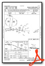
VFR Chart of KMAC
Sectional Charts at SkyVector.com
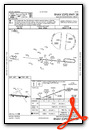
IFR Chart of KMAC
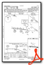
Enroute Charts at SkyVector.com
Location Information for KMAC
Coordinates: N32°49.31' / W83°33.72'Located 03 miles SE of Macon, Georgia on 401 acres of land. View all Airports in Georgia.
Surveyed Elevation is 436 feet MSL.
Operations Data
|
|
Airport Communications
| ATLANTA APPROACH: | 124.2 279.6 388.2 ;7000 FT & ABV |
|---|---|
| ATLANTA DEPARTURE: | 124.2 279.6 388.2 ;7000 FT & ABV |
| CTAF: | 123.000 |
| UNICOM: | 123.000 |
| ASOS at MCN (8.9 SW): | 478-795-1120 |
| ATIS at MCN (8.9 SW): | 120.775 |
| ATIS at WRB (11.0 S): | 273.475 |
- ATLANTA LARGE TRACON PROVIDES APCH/DEP SVC 0615-2300 ON FREQ 124.2; ATLANTA ARTCC PROVIDES APCH/DEP SVC 2300-0615 ON FREQ 134.5/360.75 (MACON RCAG).
Nearby Navigation Aids
|
| ||||||||||||||||||||||||||||||||||||||||||||||||||||||||||||


Runway 10/28
| Dimensions: | 4694 x 100 feet / 1431 x 30 meters | |
|---|---|---|
| Surface: | Asphalt / Grooved in Excellent Condition | |
| Weight Limits: | S-20 | |
| Edge Lighting: | Medium Intensity | |
| Runway 10 | Runway 28 | |
| Coordinates: | N32°49.38' / W83°34.26' | N32°49.30' / W83°33.35' |
| Elevation: | 409.3 | 411.8 |
| Traffic Pattern: | Left | Right |
| Runway Heading: | 96° True | 276° True |
| Displaced Threshold: | 255 Feet | 254 Feet |
| Declared Distances: | TORA:4694 TODA:4694 ASDA:4439 LDA:4184 | TORA:4694 TODA:4694 ASDA:4439 LDA:4184 |
| Markings: | Non-Precision Instrument in good condition. | Non-Precision Instrument in good condition. |
| Glide Slope Indicator | P4R (3.00° Glide Path Angle) | P4L (3.00° Glide Path Angle) RWY 28 PAPI UNUSBL BYD 7 DEG RT OF RCL. |
| Obstacles: | 29 ft Trees 388 ft from runway, 276 ft right of center RWY 10 APPROACH SLOPE TO DSPLCD THR IS 22:1; TREES 643FT FROM DSPLCD THR 277FT RIGHT. |
32 ft Trees 952 ft from runway, 321 ft left of center |
Services Available
| Fuel: | 100LL (blue), Jet A+ |
|---|---|
| Transient Storage: | Tiedowns |
| Airframe Repair: | NONE |
| Engine Repair: | NONE |
| Bottled Oxygen: | NONE |
| Bulk Oxygen: | NONE |
| Other Services: | PILOT INSTRUCTION |
Ownership Information
| Ownership: | Publicly owned | |
|---|---|---|
| Owner: | MACON-BIBB COUNTY CONSOLIDATED GOVT | |
| 700 POPULAR STREET | ||
| MACON, GA 31201 | ||
| 478-751-7170 | ||
| Manager: | DOUG FAOUR | |
| 1000 TERMINAL DRIVE, SUITE 100 | MIDDLE GEORGIA REGIONAL ARPT | |
| MACON, GA 31297 | ||
| 478-803-0460 | ||
Other Remarks
- 825 FT MSL RADIO TWR LCTD APRXLY 1 MILE SE OF ARPT.
- WILDLIFE NEAR ARPT.
- PDEW ADJ TO MOVEMENT AREAS FRM APR 1 TO NOV 1 FOR GRASS CUTTING.
- FOR CD CTC ATLANTA APCH AT 678-364-6132, WHEN APCH CLSD CTC ATLANTA ARTCC AT 770-210-7692.
- TWY A UNUSBL BY A/C GTR THAN 49 FT WINGSPAN WHILE ACFT ARR OR DEP ON RWY 10/28.
- ACTVT MIRL AND PAPI RY 10/28 - CTAF.
Weather Minimums
Instrument Approach Procedure (IAP) Charts
Nearby Airports with Instrument Procedures
| ID | Name | Heading / Distance | ||
|---|---|---|---|---|
 |
KMCN | Middle Georgia Regional Airport | 209° | 8.9 |
|
KWRB | Robins AFB Airport | 187° | 11.0 |
|
KPXE | Perry-Houston County Airport | 209° | 21.3 |
|
KMLJ | Baldwin County Regional Airport | 039° | 25.7 |
|
48A | Cochran Airport | 150° | 29.0 |
|
KDBN | W H 'Bud' Barron Airport | 117° | 33.0 |
|
KOPN | Thomaston-Upson County Airport | 282° | 36.4 |
|
KOKZ | Kaolin Field Airport | 076° | 37.6 |
|
6A1 | Butler Municipal Airport | 246° | 37.8 |
|
53A | Dr C P Savage Sr Airport | 216° | 38.4 |
|
KEZM | Heart of Georgia Regional Airport | 148° | 42.4 |
|
6A2 | Griffin-Spalding County Airport | 304° | 43.4 |
Airport Images
Do you have a recent image of this airport? Upload it here!


