Login
Register


LBL
Liberal Mid-America Regional Airport
Official FAA Data Effective 2026-02-19 0901Z
Chart Supplement

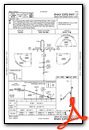
KLBL Airport Diagram

VFR Chart of KLBL
Sectional Charts at SkyVector.com
IFR Chart of KLBL
Enroute Charts at SkyVector.com
Location Information for KLBL
Coordinates: N37°2.64' / W100°57.60'Located 02 miles W of Liberal, Kansas on 2005 acres of land. View all Airports in Kansas.
Surveyed Elevation is 2885 feet MSL.
Operations Data
|
|
Airport Communications
| AWOS-3PT: | 118.375 Tel. 620-624-1221 |
|---|---|
| UNICOM: | 122.800 |
| CTAF: | 122.800 |
| AWOS-3PT at HQG (21.0 W): | 118.600 620-544-4000 |
| AWOS-3P at 19S (27.9 N): | 118.4 620-290-3873 |
| AWOS-3PT at MEJ (32.1 NE): | 119.425 620-518-2544 |
- COMMUNICATIONS PRVDD BY WICHITA RADIO ON FREQ 122.4 (LIBERAL RCO).
- APCH/DEP CTL SVC PRVDD BY KANSAS CITY ARTCC (ZKC) ON FREQS 134.0/257.625 (LIBERAL RCAG).
Nearby Navigation Aids
|
| ||||||||||||||||||||||||||||||||||||||||||||||||||||||


Runway 17/35
| Dimensions: | 7105 x 100 feet / 2166 x 30 meters | |
|---|---|---|
| Surface: | Concrete / Grooved in Excellent Condition | |
| Weight Limits: | S-89, D-107
PCR VALUE: 340/R/C/W/T
| |
| Edge Lighting: | High Intensity | |
| Runway 17 | Runway 35 | |
| Coordinates: | N37°3.24' / W100°57.39' | N37°2.07' / W100°57.38' |
| Elevation: | 2877.7 | 2874.6 |
| Traffic Pattern: | Left | Left |
| Runway Heading: | 180° True | 360° True |
| Declared Distances: | TORA:7105 TODA:7105 ASDA:7105 LDA:7105 | TORA:7105 TODA:7105 ASDA:7105 LDA:7105 |
| Markings: | Non-Precision Instrument in good condition. | Precision Instrument in good condition. |
| Glide Slope Indicator | V4L (3.00° Glide Path Angle) | V4L (3.00° Glide Path Angle) |
| Approach Lights: | MALSR 1,400 Foot Medium-intensity Approach Lighting System with runway alignment indicator lights. | |
| REIL: | Yes | |
Runway 04/22
| Dimensions: | 5000 x 75 feet / 1524 x 23 meters | |
|---|---|---|
| Surface: | Concrete in Excellent Condition | |
| Weight Limits: | S-35, D-44
PCR VALUE: 110/R/D/W/T
| |
| Edge Lighting: | Medium Intensity | |
| Runway 04 | Runway 22 | |
| Coordinates: | N37°2.32' / W100°58.26' | N37°2.90' / W100°57.54' |
| Elevation: | 2885.4 | 2878.4 |
| Traffic Pattern: | Left | Left |
| Runway Heading: | 45° True | 225° True |
| Declared Distances: | TORA:5000 TODA:5000 ASDA:5000 LDA:5000 | TORA:5000 TODA:5000 ASDA:5000 LDA:5000 |
| Markings: | Non-Precision Instrument in good condition. | Non-Precision Instrument in good condition. |
| Glide Slope Indicator | P4L (3.00° Glide Path Angle) | P4L (3.00° Glide Path Angle) |
| REIL: | Yes | Yes |
Services Available
| Fuel: | 100LL (blue), Jet-A |
|---|---|
| Transient Storage: | Hangars,Tiedowns |
| Airframe Repair: | MAJOR |
| Engine Repair: | MAJOR |
| Bottled Oxygen: | NONE |
| Bulk Oxygen: | LOW |
| Other Services: | CROP DUSTING SERVICES,CHARTER SERVICE,PILOT INSTRUCTION,AIRCRAFT RENTAL,AIRCRAFT SALES |
Ownership Information
| Ownership: | Publicly owned | |
|---|---|---|
| Owner: | CITY OF LIBERAL | |
| PO BOX 2199 | ||
| LIBERAL, KS 67905-2199 | ||
| 620-626-2207 | ||
| Manager: | MR. BRIAN FORNWALT | |
| PO BOX 2199 | ||
| LIBERAL, KS 67905-2199 | ||
| (620) 626-0188 | ||
Other Remarks
- FOR CD IF UNA TO CTC ON FSS FREQ, CTC KANSAS CITY ARTCC AT 913-254-8508.
- ACTVT MIRL RY 04/22 & HIRL RY 17/35; MALSR RY 35; VASI RYS 17 & 35; & PAPI RYS 04 & 22; REIL RYS 04, 17 & 22 - CTAF.
Weather Minimums


Instrument Approach Procedure (IAP) Charts


Nearby Airports with Instrument Procedures
| ID | Name | Heading / Distance | ||
|---|---|---|---|---|
 |
KHQG | Hugoton Municipal Airport | 290° | 21.0 |
|
KMEJ | Meade Municipal Airport | 063° | 32.2 |
|
KGUY | Guymon Municipal Airport | 230° | 34.0 |
|
KULS | Ulysses Airport | 329° | 39.0 |
|
KPYX | Perryton Ochiltree County Airport | 165° | 39.1 |
|
KEHA | Elkhart-Morton County Airport | 266° | 44.3 |
|
KJHN | Stanton County Municipal Airport | 311° | 49.2 |
|
E42 | Major Samuel B Cornelius Field Airport | 193° | 50.6 |
|
E19 | Gruver Municipal Airport | 205° | 53.6 |
|
KGCK | Garden City Regional Airport | 011° | 54.1 |
|
KDDC | Dodge City Regional Airport | 047° | 64.2 |
|
KBFK | Buffalo Municipal Airport | 099° | 65.4 |
Airport Images
Do you have a recent image of this airport? Upload it here!


