Login
Register


M79
John H Hooks Jr Memorial Airport
Official FAA Data Effective 2026-02-19 0901Z
Chart Supplement

VFR Chart of M79
Sectional Charts at SkyVector.com
IFR Chart of M79
Enroute Charts at SkyVector.com
Location Information for M79
Coordinates: N32°29.13' / W91°46.26'Located 01 miles NW of Rayville, Louisiana on 108 acres of land. View all Airports in Louisiana.
Surveyed Elevation is 82 feet MSL.
Operations Data
|
|
Airport Communications
| MONROE APPROACH: | 126.9 |
|---|---|
| MONROE DEPARTURE: | 126.9 |
| UNICOM: | 122.800 |
| CTAF: | 122.800 |
| ATIS at MLU (13.5 W): | 125.05 |
| ASOS at MLU (13.6 W): | 318-327-5675 |
| AWOS-3PT at BQP (17.1 N): | 118.375 318-281-1443 |
- APCH/DEP CTL SVC PRVDD BY FORT WORTH ARTCC (ZFW) ON FREQS 126.325/346.25 (MONROE RCAG) WHEN MONROE APCH CTL (MLU) CLSD.
Nearby Navigation Aids
|
| ||||||||||||||||||||||||||||||||||||||||||||||||||||||||||||


Runway 18/36
| Dimensions: | 3998 x 75 feet / 1219 x 23 meters | |
|---|---|---|
| Surface: | Asphalt in Good Condition | |
| Weight Limits: | S-12 | |
| Edge Lighting: | Medium Intensity | |
| Runway 18 | Runway 36 | |
| Coordinates: | N32°29.45' / W91°46.33' | N32°28.79' / W91°46.35' |
| Elevation: | 82.3 | 81.0 |
| Traffic Pattern: | Left | Left |
| Runway Heading: | 182° True | 2° True |
| Displaced Threshold: | 291 Feet | |
| Markings: | Non-Precision Instrument in good condition. | Non-Precision Instrument in good condition. |
| Glide Slope Indicator | P2L (3.00° Glide Path Angle) | P2L (3.00° Glide Path Angle) |
| REIL: | Yes | Yes |
| Obstacles: | 83 ft Trees 2006 ft from runway | 27 ft Trees 465 ft from runway APCH SLP 12:1 TO DSPLCD THLD. |
Services Available
| Fuel: | NONE |
|---|---|
| Transient Storage: | Tiedowns |
| Airframe Repair: | MAJOR |
| Engine Repair: | MAJOR |
| Bottled Oxygen: | NONE |
| Bulk Oxygen: | NONE |
| Other Services: | CROP DUSTING SERVICES,PILOT INSTRUCTION |
Ownership Information
| Ownership: | Publicly owned | |
|---|---|---|
| Owner: | CITY OF RAYVILLE | |
| PO BOX 878 | ||
| RAYVILLE, LA 71269 | ||
| 318-728-2011 | ||
| Manager: | CHARLIE ADAMS | |
| 12 ELLIS LANE | ||
| RAYVILLE, LA 71269 | ||
| 318-235-0187 | ||
Other Remarks
- ROAD 367 FT & RR TRACK 467 FT FM APCH END RY 36.
- RY 18/36 40-80 FT TREES WEST SIDE OF RY PENETRATE TRANSITION SLOPE.
- FOR CD CTC MONROE APCH AT 318-327-5641, IF UNAVBL, CTC FORT WORTH ARTCC AT 817-858-7584.
- CTC APRT MGR FOR DSGND RAMP SPACE FOR PUB USE.
- DUSK-DAWN. MIRL RY 18/36, REIL RYS 18 & 36 PRESET LOW INTST DUSK-DAWN; TO INCR INTST ACTVT - CTAF.
Weather Minimums

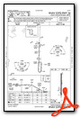
Instrument Approach Procedure (IAP) Charts


Nearby Airports with Instrument Procedures
| ID | Name | Heading / Distance | ||
|---|---|---|---|---|
 |
KMLU | Monroe Regional Airport | 276° | 13.5 |
|
KBQP | Morehouse Memorial Airport | 341° | 17.1 |
|
KTVR | Vicksburg Tallulah Regional Airport | 101° | 38.6 |
|
KRSN | Ruston Regional Airport | 272° | 41.5 |
|
KCRT | Z M Jack Stell Field Airport | 352° | 41.9 |
|
KVKS | Vicksburg Municipal Airport | 108° | 45.3 |
|
F88 | Jonesboro Airport | 251° | 51.8 |
|
0R5 | David G Joyce Airport | 235° | 55.0 |
|
M32 | Lake Village Municipal Airport | 023° | 56.5 |
|
0R4 | Concordia Parish Airport | 166° | 56.9 |
|
KHEZ | Hardy-Anders Field/Natchez-Adams County Airport | 155° | 57.5 |
|
3M9 | Warren Municipal/John B Frazer Jr Field Airport | 346° | 66.3 |
Airport Images
Do you have a recent image of this airport? Upload it here!


