Login
Register


MAI
Marianna Municipal Airport
Official FAA Data Effective 2026-02-19 0901Z
Chart Supplement

VFR Chart of KMAI
Sectional Charts at SkyVector.com
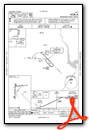
IFR Chart of KMAI
Enroute Charts at SkyVector.com
Location Information for KMAI
Coordinates: N30°50.29' / W85°10.93'Located 04 miles NE of Marianna, Florida on 632 acres of land. View all Airports in Florida.
Surveyed Elevation is 110 feet MSL.
Operations Data
|
|
Airport Communications
| ASOS: | 133.525 Tel. 850-482-6082 |
|---|---|
| CAIRNS APPROACH: | 133.75 270.35 |
| CAIRNS DEPARTURE: | 133.75 270.35 |
| UNICOM: | 123.000 |
| CTAF: | 123.000 |
| AWOS-3PT at 17J (18.5 NE): | 119.675 229-524-0001 |
| AWOS-3PT at F95 (21.3 S): | 119.35 850-674-1347 |
| ASOS at BCR (21.8 W): | 119.825 850-547-1431 |
- APCH/DEP SVC PRVDD BY JACKSONVILLE ARTCC ON FREQS 134.3/322.55 (DOTHAN RCAG) WHEN CAIRNS APCH/DEP CLSD.
Nearby Navigation Aids
|
| ||||||||||||||||||||||||||||||||||||||||||||||||||||||||||||


Runway 18/36
| Dimensions: | 6001 x 100 feet / 1829 x 30 meters | |
|---|---|---|
| Surface: | Asphalt in Good Condition | |
| Weight Limits: | 52 /F/A/W/T | |
| Edge Lighting: | Medium Intensity | |
| Runway 18 | Runway 36 | |
| Coordinates: | N30°50.63' / W85°11.14' | N30°49.64' / W85°11.14' |
| Elevation: | 110.5 | 104.6 |
| Traffic Pattern: | Left | Left |
| Runway Heading: | 180° True | 360° True |
| Markings: | Precision Instrument in fair condition. | Non-Precision Instrument in fair condition. |
| Glide Slope Indicator | P4L (2.83° Glide Path Angle) | P4L (3.00° Glide Path Angle) |
| Obstacles: | 30 ft Trees 1050 ft from runway, 35 ft right of center | 61 ft Trees 1950 ft from runway, 185 ft right of center |
Runway 08/26
| Dimensions: | 4763 x 100 feet / 1452 x 30 meters | |
|---|---|---|
| Surface: | Asphalt in Poor Condition RWY 08/26 CRACKING WITH GRASS GROWING & PRODUCING LOOSE AGGREGATE. | |
| Weight Limits: | 24 /F/A/W/T | |
| Runway 08 | Runway 26 | |
| Coordinates: | N30°50.44' / W85°11.12' | N30°50.55' / W85°10.22' |
| Elevation: | 110.0 | 108.9 |
| Traffic Pattern: | Left | Left |
| Runway Heading: | 82° True | 262° True |
| Markings: | Non-Precision Instrument in poor condition. | Non-Precision Instrument in poor condition. |
| Obstacles: | 47 ft Trees 1820 ft from runway, 35 ft left of center | 39 ft Power Line 1440 ft from runway |
Services Available
| Fuel: | 100LL (blue), Jet-A |
|---|---|
| Transient Storage: | Hangars,Tiedowns |
| Airframe Repair: | MAJOR |
| Engine Repair: | MAJOR |
| Bottled Oxygen: | NONE |
| Bulk Oxygen: | NONE |
| Other Services: | AIR AMBULANCE SERVICES,GLIDER SERVICE,GLIDER TOWING SERVICES |
Ownership Information
| Ownership: | Publicly owned | |
|---|---|---|
| Owner: | MARIANNA MUNI AIRPORT AUTHORITY | CONTACT PERSON: WILLIAM LONG, CITY MANAGER 850-482-4353. |
| P.O. BOX 936 | ||
| MARIANNA, FL 32447 | ||
| 850-482- | ||
| Manager: | DOUG GLASS | |
| MARIANNA MUNICIPAL AIRPORT, 3689 INDUSTRIAL PARK DR | ||
| MARIANNA, FL 32446 | ||
| 850-482-2281 | ||
Other Remarks
- MIL HEL OPS ON & INVOF ARPT.
- FOR CD CTC CAIRNS APCH AT 334-255-8402, WHEN APCH CLSD CTC JACKSONVILLE ARTCC AT 904-845-1592.
- FOR SVC AFTER HRS CALL 850-482-2281.
- FADED.
- FADED.
- ACTVT PAPI RWY 18 & 36; MIRL RWY 18/36 - CTAF.
Weather Minimums

Instrument Approach Procedure (IAP) Charts

Nearby Airports with Instrument Procedures
| ID | Name | Heading / Distance | ||
|---|---|---|---|---|
 |
17J | Donalsonville Municipal Airport | 057° | 18.7 |
|
KBCR | Tri-County Airport | 271° | 21.7 |
|
KBGE | Decatur County Industrial Air Park Airport | 074° | 29.3 |
|
KDHN | Dothan Regional Airport | 334° | 32.0 |
|
KHDL | Headland Municipal Airport | 347° | 32.2 |
|
2J9 | Quincy Municipal Airport | 113° | 35.4 |
|
KBIJ | Early County Airport | 023° | 36.6 |
|
33J | Geneva Municipal Airport | 290° | 37.7 |
|
KOZR | Cairns AAF (Fort Rucker) Airport | 313° | 37.9 |
|
71J | Ozark/Blackwell Field Airport | 327° | 42.1 |
|
KECP | Northwest Florida Beaches International Airport | 228° | 42.8 |
|
KEDN | Enterprise Municipal Airport | 306° | 46.2 |
Airport Images
Do you have a recent image of this airport? Upload it here!


