Login
Register


MKN
Comanche County-City Airport
Official FAA Data Effective 2025-12-25 0901Z
Chart Supplement

VFR Chart of KMKN
Sectional Charts at SkyVector.com
IFR Chart of KMKN
Enroute Charts at SkyVector.com
Location Information for KMKN
Coordinates: N31°55.22' / W98°35.95'Located 02 miles NE of Comanche, Texas on 85 acres of land. View all Airports in Texas.
Surveyed Elevation is 1386 feet MSL.
Operations Data
|
|
Airport Communications
| AWOS-3: | 118.575 Tel. 325-356-7032 |
|---|---|
| UNICOM: | 123.075 |
| CTAF: | 123.075 |
| AWOS-3 at BWD (19.6 SW): | 118.325 888-297-9399 |
| AWOS-3PT at MNZ (27.6 SE): | 118.525 254-386-8211 |
| AWOS-3PT at SEP (27.7 NE): | 118.075 254-965-8672 |
- APCH/DEP SVC PRVDD BY FORT WORTH ARTCC (ZFW) ON FREQS 135.375/354.05 (DUBLIN RCAG).
Nearby Navigation Aids
|
| ||||||||||||||||||||||||||||||||||||||||||||||||||||||||||||


Runway 17/35
| Dimensions: | 4497 x 75 feet / 1371 x 23 meters | |
|---|---|---|
| Surface: | Asphalt in Excellent Condition | |
| Weight Limits: | S-12 | |
| Edge Lighting: | Medium Intensity | |
| Runway 17 | Runway 35 | |
| Coordinates: | N31°55.59' / W98°35.96' | N31°54.85' / W98°35.94' |
| Elevation: | 1386.4 | 1373.8 |
| Traffic Pattern: | Left | Right |
| Runway Heading: | 179° True | 359° True |
| Markings: | Non-Precision Instrument in good condition. | Non-Precision Instrument in good condition. |
| Glide Slope Indicator | P2L (4.00° Glide Path Angle) | P2L (4.00° Glide Path Angle) |
| Obstacles: | 58 ft Tree 1067 ft from runway, 250 ft right of center 4 FT GAS VALVE 50 FT FM THR 195 FT RIGHT. |
|
Services Available
| Fuel: | 100LL (blue), Jet-A |
|---|---|
| Transient Storage: | Tiedowns |
| Airframe Repair: | NOT AVAILABLE |
| Engine Repair: | NOT AVAILABLE |
| Bottled Oxygen: | NOT AVAILABLE |
| Bulk Oxygen: | NOT AVAILABLE |
Ownership Information
| Ownership: | Publicly owned | |
|---|---|---|
| Owner: | CITY OF COMANCHE/COMANCHE CO | |
| 101 E. GRAND AVE | ||
| COMANCHE, TX 76442 | ||
| 325-356-2616 | ||
| Manager: | ROBERT COBB | |
| 101 E. GRAND AVE | ||
| COMANCHE, TX 76442 | ||
| 325-330-0289 | MGR CELL. | |
Other Remarks
- COURTESY CAR AVBL UPON REQ.
- DEER & WILDLIFE ON & INVOF ARPT.
- FOR CD CTC FORT WORTH ARTCC AT 817-858-7584.
- 0LL SELF SVC FUEL.
- DUSK-DAWN. MIRL RWY 17/35 PRESET LOW INTST; TO INCR INTST ACTVT - CTAF.
Weather Minimums


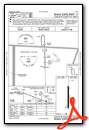
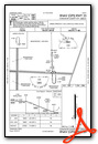
Instrument Approach Procedure (IAP) Charts
Nearby Airports with Instrument Procedures
| ID | Name | Heading / Distance | ||
|---|---|---|---|---|
 |
KBWD | Brownwood Regional Airport | 247° | 19.8 |
|
KMNZ | Hamilton Municipal Airport | 123° | 27.6 |
|
KSEP | Stephenville Clark Regional Airport | 050° | 27.8 |
|
KETN | Eastland Municipal Airport | 340° | 31.5 |
|
KGZN | Gregory M Simmons Memorial Airport | 321° | 34.3 |
|
KCOM | Coleman Municipal Airport | 263° | 41.4 |
|
81R | San Saba County Municipal Airport | 188° | 41.4 |
|
KBKD | Stephens County Airport | 342° | 50.1 |
|
KGDJ | Granbury Regional Airport | 051° | 50.5 |
|
KLZZ | Lampasas Airport | 156° | 52.9 |
|
KBBD | Curtis Field Airport | 220° | 57.9 |
|
KMWL | Mineral Wells Regional Airport | 027° | 58.4 |
Airport Images
Do you have a recent image of this airport? Upload it here!


