Login
Register


BKD
Stephens County Airport
Official FAA Data Effective 2026-02-19 0901Z
Chart Supplement

VFR Chart of KBKD
Sectional Charts at SkyVector.com
IFR Chart of KBKD
Enroute Charts at SkyVector.com
Location Information for KBKD
Coordinates: N32°43.13' / W98°53.50'Located 02 miles S of Breckenridge, Texas on 144 acres of land. View all Airports in Texas.
Surveyed Elevation is 1284 feet MSL.
Operations Data
|
|
Airport Communications
| AWOS-3: | 120.175 Tel. 254-559-5525 |
|---|---|
| UNICOM: | 122.800 |
| CTAF: | 122.800 |
| AWOS-3PT at ETN (18.6 S): | 118.45 254-631-0493 |
| AWOS-4 at GZN (22.1 S): | 118.0 254-442-1185 |
| AWOS-3PT at 6P9 (22.9 SE): | 118.8 254-647-3618 |
- APCH/DEP CTL SVC PRVDD BY FORT WORTH ARTCC (ZFW) ON FREQS 127.0/360.6 (MINERAL WELLS RCAG).
Nearby Navigation Aids
|
| ||||||||||||||||||||||||||||||||||||||||||||||||||||||


Runway 17/35
| Dimensions: | 5002 x 100 feet / 1525 x 30 meters | |
|---|---|---|
| Surface: | Asphalt in Good Condition | |
| Weight Limits: | S-19 | |
| Edge Lighting: | Medium Intensity | |
| Runway 17 | Runway 35 | |
| Coordinates: | N32°43.54' / W98°53.46' | N32°42.72' / W98°53.45' |
| Elevation: | 1255.0 | 1284.0 |
| Traffic Pattern: | Left | Left |
| Runway Heading: | 180° True | 360° True |
| Markings: | Non-Precision Instrument in good condition. | Non-Precision Instrument in good condition. |
| Glide Slope Indicator | P2L (3.00° Glide Path Angle) | P2L (3.00° Glide Path Angle) |
| Obstacles: | 22 ft Trees 528 ft from runway, 275 ft right of center APCH SLOPE 8:1 TO DSPLCD THR OVR 25 FT TREE, 218 FT DSTC. |
17 ft Trees 201 ft from runway, 170 ft right of center 21 FT TREES 89 DSTC, 130 FT R. |
Runway 13/31
| Dimensions: | 2401 x 50 feet / 732 x 15 meters | |
|---|---|---|
| Surface: | Asphalt in Fair Condition | |
| Weight Limits: | S-4 | |
| Runway 13 | Runway 31 | |
| Coordinates: | N32°43.24' / W98°53.73' | N32°42.96' / W98°53.40' |
| Elevation: | 1246.9 | 1272.4 |
| Traffic Pattern: | Left | Left |
| Runway Heading: | 135° True | 315° True |
| Displaced Threshold: | 120 Feet | |
| Markings: | Basic in good condition. | Basic in good condition. |
| Obstacles: | 25 ft Trees 305 ft from runway, 250 ft left of center 4 FT FENCE 39-141 FT DSTC; 125 FT R. |
20 ft Trees 200 ft from runway 5 FT FENCE 150 FT DSTC ACRS APCH; 20 FT TREES AND BRUSH 150 FT DSTC. |
Runway 04/22
| Dimensions: | 2398 x 50 feet / 731 x 15 meters | |
|---|---|---|
| Surface: | Asphalt in Fair Condition | |
| Weight Limits: | S-4 | |
| Runway 04 | Runway 22 | |
| Coordinates: | N32°43.00' / W98°53.67' | N32°43.28' / W98°53.35' |
| Elevation: | 1263.0 | 1254.3 |
| Traffic Pattern: | Left | Left |
| Runway Heading: | 45° True | 225° True |
| Markings: | Basic in good condition. | Basic in good condition. |
| Obstacles: | 20 ft Tree 250 ft from runway, 85 ft right of center 4 FT FENCE 150 FT DSTC ACRS APCH; 18 FT TREES 150 FT - 200 FT DSTC. |
25 ft Trees 400 ft from runway 10 FT BRUSH, FT 0-199 FT DSTC, 85 FT L. |
Services Available
| Fuel: | 100LL (blue), Jet-A |
|---|---|
| Transient Storage: | Tiedowns |
| Airframe Repair: | MAJOR |
| Engine Repair: | MAJOR |
| Bottled Oxygen: | NONE |
| Bulk Oxygen: | NOT AVAILABLE |
Ownership Information
| Ownership: | Publicly owned | |
|---|---|---|
| Owner: | STEPHENS COUNTY | |
| STEPHENS COUNTY COURTHOUSE, 200 WEST WALKER | ||
| BRECKENRIDGE, TX 76424 | ||
| 254-559-2190 | ||
| Manager: | MICHAEL ROACH | |
| STEPHENS COUNTY COURTHOUSE, 200 WEST WALKER | ||
| BRECKENRIDGE, TX 76424 | ||
| 254-559-2190 | ||
Other Remarks
- MIRL RWY 17/35 PRESET LOW INTST; TO INCR INTST & ACTVT PAPI RWYS 17 & 35 - CTAF.
Weather Minimums


Instrument Approach Procedure (IAP) Charts


Nearby Airports with Instrument Procedures
| ID | Name | Heading / Distance | ||
|---|---|---|---|---|
 |
KETN | Eastland Municipal Airport | 167° | 18.7 |
|
T23 | Albany Municipal Airport | 270° | 19.0 |
|
KGZN | Gregory M Simmons Memorial Airport | 197° | 22.2 |
|
F35 | Possum Kingdom Airport | 061° | 26.1 |
|
KRPH | Graham Municipal Airport | 035° | 29.0 |
|
KONY | Olney Municipal Airport | 005° | 38.0 |
|
KMWL | Mineral Wells Regional Airport | 084° | 42.2 |
|
KABI | Abilene Regional Airport | 245° | 44.1 |
|
F56 | Arledge Field Airport | 285° | 44.1 |
|
KSEP | Stephenville Clark Regional Airport | 129° | 47.1 |
|
KMKN | Comanche County-City Airport | 162° | 50.1 |
|
15F | Haskell Municipal Airport | 304° | 50.4 |
Airport Images
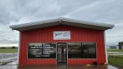
By: sfarris5735@icl...


