


Login
Register
MTO
Coles County Memorial Airport
Official FAA Data Effective 2026-10-01 0901Z
Chart Supplement

KMTO Airport Diagram

VFR Chart of KMTO
Sectional Charts at SkyVector.com
IFR Chart of KMTO
Enroute Charts at SkyVector.com
Location Information for KMTO
Coordinates: N39°28.67' / W88°16.80'Located 04 miles E of Mattoon/Charleston, Illinois on 1225 acres of land. View all Airports in Illinois.
Surveyed Elevation is 722 feet MSL.
Operations Data
|
|
Airport Communications
| ASOS: | 118.475 Tel. 217-234-8442 |
|---|---|
| CHAMPAIGN APPROACH: | 132.85 290.225 |
| CHAMPAIGN DEPARTURE: | 132.85 290.225 |
| CTAF: | 122.700 |
| UNICOM: | 122.700 |
| AWOS-3PT at 1H2 (27.2 SW): | 118.375 217-536-5976 |
| AWOS-3 at PRG (31.2 NE): | 124.175 217-465-4304 |
| ASOS at CMI (33.3 N): | 217-355-4072 |
- APCH/DEP SVC PRVDD BY CHICAGO ARTCC ON REMOTED CHAMPAIGN APCH CTL FREQS 121.35 & 353.95 (DANVILLE RCAG) WHEN CHAMPAIGN APCH CTL CLSD.
Nearby Navigation Aids
|
| ||||||||||||||||||||||||||||||||||||||||||||||||||||||||||||


Runway 11/29
| Dimensions: | 6501 x 150 feet / 1982 x 46 meters | |
|---|---|---|
| Surface: | Asphalt / Grooved in Good Condition | |
| Weight Limits: | PCR/2110/F/D/X/T, S-120, D-250, ST-550, DT-1120 | |
| Edge Lighting: | High Intensity | |
| Runway 11 | Runway 29 | |
| Coordinates: | N39°28.88' / W88°17.38' | N39°28.46' / W88°16.11' |
| Elevation: | 714.4 | 714.3 |
| Traffic Pattern: | Right | Left |
| Runway Heading: | 113° True | 293° True |
| Declared Distances: | TORA:6501 TODA:6501 ASDA:6501 LDA:6501 | TORA:6501 TODA:6501 ASDA:6501 LDA:6501 |
| Markings: | Precision Instrument in fair condition. | Precision Instrument in fair condition. |
| Glide Slope Indicator | P4L (3.00° Glide Path Angle) | |
| Approach Lights: | MALSR 1,400 Foot Medium-intensity Approach Lighting System with runway alignment indicator lights. | |
| REIL: | Yes | |
| Obstacles: | 56 ft Tree 2592 ft from runway, 780 ft right of center | |
Runway 06/24
| Dimensions: | 5799 x 100 feet / 1768 x 30 meters | |
|---|---|---|
| Surface: | Asphalt / Grooved in Good Condition | |
| Weight Limits: | PCR/680 /F/D/X/T, S-120, D-218, ST-289, DT-768 | |
| Edge Lighting: | Medium Intensity | |
| Runway 06 | Runway 24 | |
| Coordinates: | N39°28.45' / W88°17.30' | N39°28.92' / W88°16.23' |
| Elevation: | 718.8 | 712.1 |
| Traffic Pattern: | Right | Left |
| Runway Heading: | 60° True | 240° True |
| Declared Distances: | TORA:5799 TODA:5799 ASDA:5799 LDA:5799 | TORA:5799 TODA:5799 ASDA:5799 LDA:5799 |
| Markings: | Non-Precision Instrument in good condition. | Non-Precision Instrument in good condition. |
| Glide Slope Indicator | V4L (3.00° Glide Path Angle) | V4L (3.00° Glide Path Angle) |
| REIL: | Yes | Yes |
| Obstacles: | 52 ft Tree 2139 ft from runway, 103 ft left of center | |
Runway 18/36
RWY 18/36 NOT AVBL FOR PART 121/PART 380 OPS WITH SKED PAX CARRYING OPS MORE THAN 9 PAX SEATS AND NON-SKED PAX CARRYING OPS MORE THAN 30 PAX SEATS. | ||
| Dimensions: | 1098 x 250 feet / 335 x 76 meters | |
|---|---|---|
| Surface: | Turf | |
| Runway 18 | Runway 36 | |
| Coordinates: | N39°28.74' / W88°17.30' | N39°28.56' / W88°17.29' |
| Elevation: | 714.7 | 718.9 |
| Traffic Pattern: | Right | |
| Runway Heading: | 175° True | 355° True |
| Declared Distances: | TORA:1080 TODA:1080 ASDA:1080 LDA:1080 | TORA:1080 TODA:1080 ASDA:1080 LDA:1080 |
Services Available
| Fuel: | 100LL (blue), Jet-A |
|---|---|
| Transient Storage: | Hangars,Tiedowns |
| Airframe Repair: | MAJOR |
| Engine Repair: | MAJOR |
| Bottled Oxygen: | HIGH/LOW |
| Bulk Oxygen: | NONE |
| Other Services: | AIR FREIGHT SERVICES,CROP DUSTING SERVICES,AIR AMBULANCE SERVICES,CARGO HANDLING SERVICES,CHARTER SERVICE,PILOT INSTRUCTION,AIRCRAFT RENTAL,AIRCRAFT SALES |
Ownership Information
| Ownership: | Publicly owned | |
|---|---|---|
| Owner: | COLES COUNTY AIRPORT AUTHORITY | |
| 432 AIRPORT ROAD | ||
| MATTOON, IL 61938 | ||
| 217-234-7120 | ||
| Manager: | ANDREW FEARN | |
| 432 AIRPORT ROAD | ||
| MATTOON, IL 61938 | ||
| 217-234-7120 | ||
Other Remarks
- BIRDS ON & INVOF ARPT.
- ARPT SFC COND NOT MONITORED BTN 2300Z-1300Z.
- FOR CD CTC CHAMPAIGN APCH AT 217-355-4071, WHEN APCH CLSD CTC CHICAGO ARTCC AT 630-906-8921
- CORNER STONE MARKERS; LENGTH & WIDTH.
- ACTVT MALSR RWY 29; REIL RWY 06, 11 & 24; MIRL RWY 06/24 - CTAF. ACTVT HIRL RWY 11/29 & INCR INTST - CTAF.
Weather Minimums


Instrument Approach Procedure (IAP) Charts


Nearby Airports with Instrument Procedures
| ID | Name | Heading / Distance | ||
|---|---|---|---|---|
 |
1H8 | Casey Municipal Airport | 129° | 16.6 |
|
2H0 | Shelby County Airport | 261° | 26.6 |
|
1H2 | Effingham County Regional Airport | 205° | 27.1 |
|
KPRG | Edgar County Airport | 064° | 31.2 |
|
KCMI | University of Illinois/Willard Airport | 000° | 33.6 |
|
KDEC | Decatur Airport | 308° | 34.6 |
|
C16 | Frasca Field Airport | 005° | 40.3 |
|
KRSV | Crawford County Airport | 133° | 40.4 |
|
3I3 | Sky King Airport | 084° | 42.1 |
|
KSIV | Sullivan County Airport | 119° | 44.4 |
|
KHUF | Terre Haute Regional Airport | 091° | 45.2 |
|
KOLY | Olney-Noble Airport | 173° | 45.6 |
Airport Images
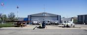
By: mto@aeromanagem...
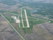
By: anonymous



