Login
Register
NRA
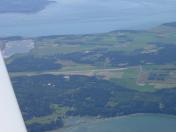
Coupeville NOLF Airport
Official FAA Data Effective 2025-11-27 0901Z
VFR Chart of KNRA
Sectional Charts at SkyVector.com
IFR Chart of KNRA
Enroute Charts at SkyVector.com
Location Information for KNRA
Coordinates: N48°11.00' / W122°38.00'Located 03 miles SE of Coupeville, Washington. View all Airports in Washington.
Estimated Elevation is 199 feet MSL.
Operations Data
|
|
Airport Communications
| AWOS-3 at OKH (4.4 N): | 132.775 360-675-8431 |
|---|---|
| ATIS at NUW (10.2 N): | 134.15 |
| ASOS at NUW (10.2 N): | 360-257-8813 |
Nearby Navigation Aids
|
| ||||||||||||||||||||||||||||||||||||||||||||||||||||||||||||
Runway 14/32
| Dimensions: | 5400 x 200 feet / 1646 x 61 meters | |
|---|---|---|
| Surface: | Concrete | |
| Edge Lighting: | Medium Intensity | |
| Runway 14 | Runway 32 | |
| Traffic Pattern: | Right | Right |
Ownership Information
| Ownership: | Owned by the Navy | |
|---|---|---|
| Owner: | US NAVY | |
| COMMANDING OFFICER ATTN: CODE AOT, 3730 NORTH CHARLES | ||
| OAK HARBOR, WA 98278 | ||
| 360-257-2681/2 | ||
| Manager: | US NAVY | |
| COMMANDING OFFICER ATTN: CODE AOT, 3730 NORTH CHARLES | ||
| OAK HARBOR, WA 98278 | ||
| 360-257-2681/2 | ||
Other Remarks
- FULL STOP LNDG NOT AUZD UNLESS EMERGENCY.
- WHIDBEY ISLAND NAS (AULT FLD) ATIS AVBL ON FREQ 134.15/280.3.
- FOR CD CTC WHIDBEY APCH AT 360-257-3310.
- ASOS C360-678-2934.
- PRIOR REQ. MIRL RY 14/32 OPRS AS RQRD FOR MIL OPNL REQUIREMENTS.
Nearby Airports with Instrument Procedures
| ID | Name | Heading / Distance | ||
|---|---|---|---|---|
 |
KOKH | Delaurentis Airport | 338° | 4.4 |
 |
KNUW | Whidbey Island NAS (Ault Field) Airport | 354° | 10.2 |
 |
0S9 | Jefferson County International Airport | 222° | 10.5 |
 |
KAWO | Arlington Municipal Airport | 093° | 19.1 |
 |
KBVS | Skagit Regional Airport | 026° | 19.2 |
 |
KPAE | Seattle Paine Field International Airport | 139° | 21.8 |
 |
KFHR | Friday Harbor Airport | 322° | 25.7 |
 |
S43 | Harvey Field Airport | 127° | 27.1 |
 |
KNOW | Port Angeles CGAS Airport | 265° | 31.5 |
 |
KORS | Orcas Island Airport | 340° | 33.4 |
 |
KCLM | William R Fairchild International Airport | 264° | 35.0 |
 |
KBLI | Bellingham International Airport | 005° | 36.8 |


