Login
Register


O20
Kingdon Airpark Airport
Official FAA Data Effective 2025-12-25 0901Z
Chart Supplement

VFR Chart of O20
Sectional Charts at SkyVector.com
IFR Chart of O20
Enroute Charts at SkyVector.com
Location Information for O20
Coordinates: N38°5.51' / W121°21.50'Located 04 miles SW of Lodi, California on 41 acres of land. View all Airports in California.
Estimated Elevation is 18 feet MSL.
Operations Data
|
|
Airport Communications
| CTAF: | 122.800 |
|---|---|
| UNICOM: | 122.800 |
| ATIS at SCK (13.1 SE): | 118.25 |
| ASOS at SCK (13.6 SE): | 209-625-0001 |
| AWOS-AV at O88 (17.5 W): | 127.075 707-374-5396 |
Nearby Navigation Aids
|
| ||||||||||||||||||||||||||||||||||||


Runway 12/30
| Dimensions: | 3851 x 60 feet / 1174 x 18 meters | |
|---|---|---|
| Surface: | Asphalt in Poor Condition RWY 30 CRACKED AND SPALLING WITH EXCESSIVE RUBBER BUILD-UP IN TDZ. | |
| Edge Lighting: | Non-Standard NSTD EDGE LGTS 40 FT FROM EDGE OF RWY; RWY 12 LGTD THLD RELCTD 105 FT; RWY 30 LGTD THLD RELCTD 385 FT FOR NGT OPNS. 3360 FT OF RWY 12/30 USBL AT NGT. | |
| Runway 12 | Runway 30 | |
| Coordinates: | N38°5.74' / W121°21.78' | N38°5.29' / W121°21.22' |
| Elevation: | 18.1 | 18.1 |
| Traffic Pattern: | Left | Left |
| Displaced Threshold: | 105 Feet | 385 Feet |
| Markings: | Basic in poor condition. | Basic in poor condition. |
| Glide Slope Indicator | TRIL (4.50° Glide Path Angle) RY 30 VASI OTS INDEFLY. | |
| Obstacles: | 3 ft Fence 200 ft from runway, 5 ft left of center APCH RATIO 50:1 FROM DSPLCD THR +3 FT FENCE 135 FT LEFT. 3 FT FENCE 0-200 FT FM RY END; +2 FT DIRT PILES 0 FT FM RY END 50 FT L & 40 FT FM RY END 100 FT R. |
15 ft Road 300 ft from runway, 135 ft right of center RWY 30 APCH RATIO TO DSPLCD THR 50:1; +15' LGT POLE 130' FM RY END 100' R; AUTO PARKING LOT IN E CORNER OF PRIMARY SURFACE. |
Services Available
| Fuel: | 100LL (blue) |
|---|---|
| Transient Storage: | Tiedowns |
| Airframe Repair: | NONE |
| Engine Repair: | NONE |
| Bottled Oxygen: | NONE |
| Bulk Oxygen: | NONE |
Ownership Information
| Ownership: | Privately Owned | |
|---|---|---|
| Owner: | AG PROJECT MNG. LLC. | |
| 4100 EAST FREMONT STREET | ||
| STOCKTON, CA 95215 | ||
| 209-986-0797 | ||
| Manager: | AMRITPAL (RICK) GREWAL | EMAIL: AGPROJECT@SBCGLOBAL.NET |
| 4100 EAST FREMONT STREET | ||
| STOCKTON, CA 95215 | ||
| 209-986-0797 | ||
Other Remarks
- TWY CLSD INDEFLY.
- ACFT PARKED 115 FT LEFT OF RWY 30 CNTRLN SE END OF RWY PRIOR TO DSPLCD THLD.
- FOR CD CTC NORCAL APCH AT 916-361-0516.
- NW 1000 FT ROUGH SFC.
- RWY MRKGS POOR DUE TO CRACKED AND SPALLING ASPH.
- RWY MRKGS POOR DUE TO CRACKED AND SPALLING ASPH WITH EXCESSIVE RUBBER BUILD-UP IN THE TDZ.
- 0LL SELF-FUELING FAC AVBL 24/7.
- FOR LIRL RWY 12/30 KEY 122.8 5 TIMES.
Nearby Airports with Instrument Procedures
| ID | Name | Heading / Distance | ||
|---|---|---|---|---|
 |
1O3 | Lodi Airport | 032° | 7.9 |
|
KSCK | Stockton Metro Airport | 154° | 13.1 |
|
O88 | Rio Vista Municipal Airport | 290° | 17.4 |
|
C83 | Byron Airport | 218° | 20.3 |
|
KTCY | Tracy Municipal Airport | 189° | 24.5 |
|
KSAC | Sacramento Exec Airport | 345° | 26.0 |
|
KMHR | Sacramento Mather Airport | 005° | 27.9 |
|
KSUU | Travis AFB Airport | 291° | 28.7 |
|
KJAQ | Westover Field Amador County Airport | 057° | 31.7 |
|
KLVK | Livermore Municipal Airport | 222° | 32.4 |
|
KEDU | University Airport | 322° | 33.2 |
|
KVCB | Nut Tree Airport | 301° | 33.3 |
Airport Images
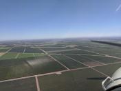
By: mhebbar@gmail.com


