Login
Register


SYF
Cheyenne County Municipal Airport
Official FAA Data Effective 2026-02-19 0901Z
Chart Supplement

VFR Chart of KSYF
Sectional Charts at SkyVector.com
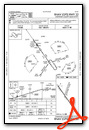
IFR Chart of KSYF
Enroute Charts at SkyVector.com
Location Information for KSYF
Coordinates: N39°45.55' / W101°47.68'Located 01 miles S of St Francis, Kansas on 307 acres of land. View all Airports in Kansas.
Estimated Elevation is 3429 feet MSL.
Operations Data
|
|
Airport Communications
| AWOS-3P: | 118.925 Tel. 785-306-1050 |
|---|---|
| CTAF: | 122.800 |
| UNICOM: | 122.800 |
| ASOS at GLD (24.0 S): | 121.025 785-576-2383 |
| AWOS-3 at 2V5 (29.0 NW): | 118.250 970-332-5930 |
| AWOS-3 at ADT (34.9 E): | 118.675 785-626-3572 |
- APCH/DEP CTL SVC PRVDD BY DENVER ARTCC (ZDV) ON FREQS 132.7/226.675 (GOODLAND RCAG).
Nearby Navigation Aids
|
| ||||||||||||||||||||||||||||||||||||||||||||||||||||||||||||


Runway 14/32
| Dimensions: | 5200 x 75 feet / 1585 x 23 meters | |
|---|---|---|
| Surface: | Concrete in Excellent Condition | |
| Weight Limits: | S-30, D-30 | |
| Edge Lighting: | Medium Intensity | |
| Runway 14 | Runway 32 | |
| Coordinates: | N39°45.83' / W101°48.02' | N39°45.13' / W101°47.38' |
| Elevation: | 3389.4 | 3429.5 |
| Traffic Pattern: | Left | Left |
| Runway Heading: | 145° True | 325° True |
| Displaced Threshold: | 200 Feet | |
| Declared Distances: | TORA:5200 TODA:5200 ASDA:5200 LDA:5000 | TORA:5200 TODA:5200 ASDA:5200 LDA:5200 |
| Markings: | Non-Precision Instrument in good condition. | Non-Precision Instrument in good condition. |
| Obstacles: | 36 ft Trees 662 ft from runway, 214 ft right of center | |
Runway 18/36
| Dimensions: | 2313 x 280 feet / 705 x 85 meters | |
|---|---|---|
| Surface: | Turf in Good Condition | |
| Runway 18 | Runway 36 | |
| Coordinates: | N39°45.89' / W101°47.55' | N39°45.53' / W101°47.71' |
| Elevation: | 3379.9 | 3407.4 |
| Traffic Pattern: | Left | Left |
| Runway Heading: | 199° True | 19° True |
| Obstacles: | 15 ft Road 55 ft from runway 35 FT PLINE AT 450 FT 0B. |
|
Services Available
| Fuel: | 100LL (blue) |
|---|---|
| Transient Storage: | Tiedowns |
| Airframe Repair: | NOT AVAILABLE |
| Engine Repair: | NOT AVAILABLE |
| Bottled Oxygen: | NOT AVAILABLE |
| Bulk Oxygen: | NOT AVAILABLE |
| Other Services: | AIR FREIGHT SERVICES,CROP DUSTING SERVICES,CHARTER SERVICE,PILOT INSTRUCTION,AIRCRAFT RENTAL |
Ownership Information
| Ownership: | Publicly owned | |
|---|---|---|
| Owner: | CHEYENNE COUNTY | |
| 212 E. WASHINGTON ST, PO BOX 985 | ||
| ST. FRANCIS, KS 67756 | ||
| 785-772-7079 | ||
| Manager: | MICHAEL HANSON | |
| 212 E. WASHINGTON ST, PO BOX 517 | ||
| ST. FRANCIS, KS 67756 | ||
| 785-332-8844 | ||
Other Remarks
- FOR CD CTC DENVER ARTCC AT 303-651-4257.
- ACTVT MIRL RWY 14/32 - CTAF.
Weather Minimums


Instrument Approach Procedure (IAP) Charts

Nearby Airports with Instrument Procedures
| ID | Name | Heading / Distance | ||
|---|---|---|---|---|
 |
KGLD | Renner Field/Goodland Municipal Airport | 169° | 23.7 |
|
2V5 | Wray Municipal Airport | 314° | 29.0 |
|
KADT | Atwood-Rawlins County City-County Airport | 081° | 35.1 |
|
KITR | Kit Carson County Airport | 216° | 38.5 |
|
KCBK | Shalz Field Airport | 119° | 40.0 |
|
KIML | Imperial Municipal Airport | 010° | 45.7 |
|
2V6 | Yuma Municipal Airport | 296° | 47.3 |
|
KHEQ | Holyoke Airport | 335° | 53.3 |
|
KOIN | Oberlin Municipal Airport | 085° | 58.2 |
|
KOEL | Oakley Municipal Airport | 130° | 59.8 |
|
KMCK | Mc Cook Ben Nelson Regional Airport | 063° | 61.6 |
|
KGGF | Grant Municipal Airport | 002° | 66.7 |
Airport Images
Do you have a recent image of this airport? Upload it here!


Comments
No facilities, crew car that won't start
Landed there for fuel on 5/13/22. There is no public bathroom on the field. Not even a porta-potty. Sign on fuel pump says to use the crew car to drive two miles to a bathroom. Crew car battery dead. Co-pilot (wife) non-plussed.