Login
Register


PRZ
Portales Municipal Airport
Official FAA Data Effective 2026-02-19 0901Z
Chart Supplement

VFR Chart of KPRZ
Sectional Charts at SkyVector.com
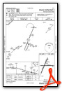
IFR Chart of KPRZ
Enroute Charts at SkyVector.com
Location Information for KPRZ
Coordinates: N34°8.73' / W103°24.62'Located 04 miles SW of Portales, New Mexico on 502 acres of land. View all Airports in New Mexico.
Surveyed Elevation is 4077 feet MSL.
Operations Data
|
|
Airport Communications
| AWOS-3PT: | 118.175 Tel. 575-478-2864 |
|---|---|
| CANNON APPROACH: | 118.425 352.1 |
| CANNON DEPARTURE: | 118.425 307.175 |
| CLEARANCE DELIVERY: | 119.0 |
| CTAF: | 122.800 |
| UNICOM: | 122.800 |
| ATIS at CVS (14.9 N): | 269.9 |
| AWOS-3PT at CVN (23.6 NE): | 135.375 575-389-1056 |
| ASOS at 4MR (28.4 NW): | 135.375 575-784-2748 |
Nearby Navigation Aids
|
| ||||||||||||||||||||||||||||||||||||||||||||||||||||||


Runway 01/19
| Dimensions: | 5700 x 60 feet / 1737 x 18 meters | |
|---|---|---|
| Surface: | Asphalt in Fair Condition | |
| Weight Limits: | 4 /F/C/Y/T | |
| Edge Lighting: | Medium Intensity | |
| Runway 01 | Runway 19 | |
| Coordinates: | N34°8.29' / W103°24.93' | N34°9.15' / W103°24.49' |
| Elevation: | 4077.8 | 4044.0 |
| Runway Heading: | 23° True | 203° True |
| Markings: | Non-Precision Instrument in good condition. | Non-Precision Instrument in good condition. |
| Glide Slope Indicator | PSIL (3.50° Glide Path Angle) PVASI OTS INDEFLY. | |
Runway 08/26
| Dimensions: | 4560 x 60 feet / 1390 x 18 meters | |
|---|---|---|
| Surface: | Asphalt in Good Condition | |
| Weight Limits: | 4 /F/C/Y/T | |
| Edge Lighting: | Medium Intensity | |
| Runway 08 | Runway 26 | |
| Coordinates: | N34°8.74' / W103°24.96' | N34°8.74' / W103°24.06' |
| Elevation: | 4066.3 | 4058.2 |
| Runway Heading: | 90° True | 270° True |
| Markings: | Non-Precision Instrument in fair condition. | Non-Precision Instrument in fair condition. |
| Glide Slope Indicator | PSIL (3.00° Glide Path Angle) PVASI OTS INDEFLY. | |
| Obstacles: | 30 ft Power Line 1200 ft from runway | |
Services Available
| Fuel: | 100LL (blue), Jet-A |
|---|---|
| Transient Storage: | Hangars,Tiedowns CALL AHD FOR HNGR. |
| Airframe Repair: | MAJOR |
| Engine Repair: | MAJOR |
| Bottled Oxygen: | NOT AVAILABLE |
| Bulk Oxygen: | NOT AVAILABLE |
| Other Services: | CROP DUSTING SERVICES,PILOT INSTRUCTION |
Ownership Information
| Ownership: | Publicly owned | |
|---|---|---|
| Owner: | CITY OF PORTALES | |
| 100 W 1ST ST | ||
| PORTALES, NM 88130-5902 | ||
| 575-356-6662 | ||
| Manager: | KELLY MCCLELLAN | |
| 181 AIRPORT RD | ||
| PORTALES, NM 88130-9108 | ||
| 575-478-2863 | ||
Other Remarks
- FOR CD CTC ALBUQUERQUE ARTCC AT 505-856-4861.
- 0LL FUEL AVBL H24 SELF SVC VIA CREDIT CARD.
- ACTVT OR INCR INTST MIRL RWY 01/19 & 08/26 - CTAF. MIRL RWY 01/19 & 08/26 PRESET LOW INTST.
Weather Minimums
Instrument Approach Procedure (IAP) Charts
Nearby Airports with Instrument Procedures
| ID | Name | Heading / Distance | ||
|---|---|---|---|---|
 |
KCVS | Cannon AFB Airport | 017° | 14.9 |
|
KCVN | Clovis Regional Airport | 044° | 23.6 |
|
2T1 | Muleshoe Municipal Airport | 086° | 38.4 |
|
KLIU | Littlefield Taylor Brown Municipal Airport | 104° | 52.7 |
|
KLLN | Levelland Municipal Airport | 124° | 62.9 |
|
F98 | Yoakum County Airport | 152° | 62.7 |
|
KTCC | Tucumcari Municipal Airport | 351° | 62.9 |
|
KHRX | Hereford Municipal Airport | 051° | 68.8 |
|
E06 | Lea County/Zip Franklin Memorial Airport | 179° | 71.4 |
|
KROW | Roswell Air Center Airport | 228° | 75.5 |
|
KPVW | Hale County Airport | 088° | 84.3 |
|
KBFE | Terry County Airport | 133° | 84.3 |
Airport Images
Do you have a recent image of this airport? Upload it here!


